| Locality | Latitude | Longitude | Distance | Bearing |
|---|
| Upadowa Grodziec Cu-mine, Grodziec, Gmina Zagrodno, Złotoryja County, Lower Silesian Voivodeship, Poland | 51° 10' 21" N | 15° 46' 40" E | 4.1km (2.6 miles) | |
| Radziechów sand/gravel pit, Radziechów, Gmina Zagrodno, Złotoryja County, Lower Silesian Voivodeship, Poland | 51° 14' 34" N | 15° 49' 21" E | 4.3km (2.7 miles) | |
| Grodziec limestone quarry I, Grodziec, Gmina Zagrodno, Złotoryja County, Lower Silesian Voivodeship, Poland | 51° 10' 11" N | 15° 46' 35" E | 4.4km (2.7 miles) | |
| Mnisza Górka basalt quarry, Grodziec, Gmina Zagrodno, Złotoryja County, Lower Silesian Voivodeship, Poland | 51° 10' 2" N | 15° 48' 42" E | 4.5km (2.8 miles) | |
| Grodziec basalt, Grodziec, Gmina Zagrodno, Złotoryja County, Lower Silesian Voivodeship, Poland | 51° 10' 30" N | 15° 45' 40" E | 4.5km (2.8 miles) | |
| Konrad Cu-mine, Iwiny, Gmina Warta Bolesławiecka, Bolesławiec County, Lower Silesian Voivodeship, Poland | 51° 12' 54" N | 15° 44' 2" E | 4.7km (2.9 miles) | |
| Grodziec limestone quarry II, Grodziec, Gmina Zagrodno, Złotoryja County, Lower Silesian Voivodeship, Poland | 51° 9' 41" N | 15° 46' 10" E | 5.5km (3.4 miles) | |
| Wojcieszyn melaphyre quarry, Wojcieszyn, Gmina Pielgrzymka, Złotoryja County, Lower Silesian Voivodeship, Poland | 51° 8' 52" N | 15° 49' 8" E | 6.7km (4.1 miles) | |
| Nowa Wieś Grodziska basalt quarry, Nowa Wieś Grodziska, Gmina Pielgrzymka, Złotoryja County, Lower Silesian Voivodeship, Poland | 51° 8' 46" N | 15° 45' 36" E | 7.3km (4.5 miles) | |
| Nowa Wieś Grodziska sandstone quarry, Nowa Wieś Grodziska, Gmina Pielgrzymka, Złotoryja County, Lower Silesian Voivodeship, Poland | 51° 8' 32" N | 15° 45' 40" E | 7.6km (4.8 miles) | |
| Nowa Wieś Złotoryjska basalt quarry, Gmina Zagrodno, Złotoryja County, Lower Silesian Voivodeship, Poland | 51° 10' 5" N | 15° 53' 37" E | 7.8km (4.8 miles) | |
| Czaple sandstone quarry, Czaple, Gmina Pielgrzymka, Złotoryja County, Lower Silesian Voivodeship, Poland | 51° 8' 31" N | 15° 45' 10" E | 7.9km (4.9 miles) | |
| Czaple gravel pit, Czaple, Gmina Pielgrzymka, Złotoryja County, Lower Silesian Voivodeship, Poland | 51° 8' 1" N | 15° 44' 8" E | 9.3km (5.8 miles) | |
| Pielgrzymka sandstone quarry, Pielgrzymka, Gmina Pielgrzymka, Złotoryja County, Lower Silesian Voivodeship, Poland | 51° 6' 54" N | 15° 49' 5" E | 10.3km (6.4 miles) | |
| Posadów quarry, Złotoryja, Złotoryja County, Lower Silesian Voivodeship, Poland | 51° 8' 0" N | 15° 53' 31" E | 10.4km (6.4 miles) | |
| Zbylutów III sandstone quarry, Zbylutów, Gmina Lwówek Śląski, Lwówek Śląski County, Lower Silesian Voivodeship, Poland | 51° 9' 5" N | 15° 40' 6" E | 11.0km (6.9 miles) | |
| Pielgrzymka basalt quarry, Pielgrzymka, Gmina Pielgrzymka, Złotoryja County, Lower Silesian Voivodeship, Poland | 51° 6' 23" N | 15° 49' 54" E | 11.3km (7.0 miles) | |
| Zbylutów II sandstone quarry, Zbylutów, Gmina Lwówek Śląski, Lwówek Śląski County, Lower Silesian Voivodeship, Poland | 51° 8' 57" N | 15° 39' 27" E | 11.8km (7.3 miles) | |
| Zbylutów sandstone quarry, Zbylutów, Gmina Lwówek Śląski, Lwówek Śląski County, Lower Silesian Voivodeship, Poland | 51° 8' 37" N | 15° 39' 30" E | 12.1km (7.5 miles) | |
| Świątek basalt quarry, Czaple, Gmina Pielgrzymka, Złotoryja County, Lower Silesian Voivodeship, Poland | 51° 6' 6" N | 15° 44' 9" E | 12.5km (7.8 miles) | |
| Mieszczańska Mtn., Złotoryja, Złotoryja County, Lower Silesian Voivodeship, Poland | 51° 7' 44" N | 15° 56' 4" E | 12.7km (7.9 miles) | |
| Jeziorna quarry, Nowy Kościół, Gmina Świerzawa, Złotoryja County, Lower Silesian Voivodeship, Poland | 51° 5' 38" N | 15° 51' 59" E | 13.4km (8.3 miles) | |
| Wilcza Góra quarry, Wilków, Gmina Złotoryja, Złotoryja County, Lower Silesian Voivodeship, Poland | 51° 6' 21" N | 15° 54' 48" E | 13.7km (8.5 miles) | |
| Nowy Kościół septaria occurrence 2, Nowy Kościół, Gmina Świerzawa, Złotoryja County, Lower Silesian Voivodeship, Poland | 51° 5' 30" N | 15° 52' 34" E | 13.8km (8.6 miles) | |
| Kozów bazalt quarry, Gmina Złotoryja, Złotoryja County, Lower Silesian Voivodeship, Poland | 51° 8' 1" N | 15° 57' 49" E | 14.0km (8.7 miles) | |
| Czerwony Kamień quarry, Nowy Kościół, Gmina Świerzawa, Złotoryja County, Lower Silesian Voivodeship, Poland | 51° 5' 26" N | 15° 52' 48" E | 14.0km (8.7 miles) | |
| Nowy Kościół septaria occurrence 1, Nowy Kościół, Gmina Świerzawa, Złotoryja County, Lower Silesian Voivodeship, Poland | 51° 4' 37" N | 15° 51' 56" E | 15.1km (9.4 miles) | |
| Skała II sandstone mine, Skała, Gmina Lwówek Śląski, Lwówek Śląski County, Lower Silesian Voivodeship, Poland | 51° 9' 35" N | 15° 35' 44" E | 15.2km (9.4 miles) | |
| Nowy Kościół copper mine (Lena mine), Nowy Kościół, Gmina Świerzawa, Złotoryja County, Lower Silesian Voivodeship, Poland | 51° 4' 31" N | 15° 52' 22" E | 15.5km (9.6 miles) | |
| Wilków sandstone quarry, Wilków, Gmina Złotoryja, Złotoryja County, Lower Silesian Voivodeship, Poland | 51° 5' 36" N | 15° 55' 47" E | 15.5km (9.6 miles) | |

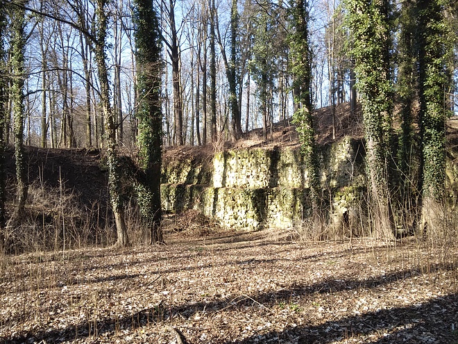


Grodziec limestone quarry I, Grodziec, Gmina Zagrodno, Złotoryja County, Lower Silesian Voivodeship, Poland