| Locality | Latitude | Longitude | Distance | Bearing |
|---|
| N-30 borehole, Bolesławice, Gmina Jaworzyna Śląska, Świdnica County, Lower Silesian Voivodeship, Poland | 50° 53' 42" N | 16° 27' 47" E | 3.0km (1.8 miles) | |
| Wierzbna granite quarry, Wierzbna, Gmina Żarów, Świdnica County, Lower Silesian Voivodeship, Poland | 50° 53' 53" N | 16° 29' 33" E | 4.6km (2.8 miles) | |
| Unnamed granite quarry, Wierzbna, Gmina Żarów, Świdnica County, Lower Silesian Voivodeship, Poland | 50° 53' 33" N | 16° 29' 59" E | 5.3km (3.3 miles) | |
| Wiśniowa granite quarry, Wiśniowa, Gmina Świdnica, Świdnica County, Lower Silesian Voivodeship, Poland | 50° 53' 4" N | 16° 29' 48" E | 5.5km (3.4 miles) | |
| Andrzej kaolin pit, Gmina Żarów, Świdnica County, Lower Silesian Voivodeship, Poland | 50° 56' 21" N | 16° 30' 29" E | 6.0km (3.7 miles) | |
| Lisiec Hill, Strzegom, Gmina Strzegom, Świdnica County, Lower Silesian Voivodeship, Poland | 50° 56' 29" N | 16° 21' 10" E | 6.4km (4.0 miles) | |
| Panków granite quarry II, Panków, Gmina Świdnica, Świdnica County, Lower Silesian Voivodeship, Poland | 50° 53' 1" N | 16° 30' 45" E | 6.5km (4.1 miles) | |
| Panków granite quarry I, Panków, Gmina Świdnica, Świdnica County, Lower Silesian Voivodeship, Poland | 50° 53' 6" N | 16° 30' 53" E | 6.6km (4.1 miles) | |
| Niegoszów granite quarry I, Niegoszów, Gmina Świdnica, Świdnica County, Lower Silesian Voivodeship, Poland | 50° 52' 43" N | 16° 30' 37" E | 6.7km (4.2 miles) | |
| Łażany granodiorite quarry, Gmina Żarów, Świdnica County, Lower Silesian Voivodeship, Poland | 50° 58' 1" N | 16° 29' 35" E | 7.3km (4.6 miles) | |
| Morów quarry, Jaroszów, Gmina Strzegom, Świdnica County, Lower Silesian Voivodeship, Poland | 50° 58' 36" N | 16° 23' 43" E | 7.5km (4.7 miles) | |
| Niegoszów granite quarry II, Niegoszów, Gmina Świdnica, Świdnica County, Lower Silesian Voivodeship, Poland | 50° 52' 32" N | 16° 31' 34" E | 7.8km (4.8 miles) | |
| Mokrzeszów sand pit, Mokrzeszów, Gmina Świdnica, Świdnica County, Lower Silesian Voivodeship, Poland | 50° 51' 4" N | 16° 22' 27" E | 8.0km (5.0 miles) | |
| Mount Krukowska, Żarów, Gmina Żarów, Świdnica County, Lower Silesian Voivodeship, Poland | 50° 57' 45" N | 16° 31' 3" E | 8.1km (5.0 miles) | |
| Quartz vein, Jaroszów, Gmina Strzegom, Świdnica County, Lower Silesian Voivodeship, Poland | 50° 58' 55" N | 16° 23' 34" E | 8.1km (5.1 miles) | |
| Grabina, Strzegom, Gmina Strzegom, Świdnica County, Lower Silesian Voivodeship, Poland | 50° 57' 10" N | 16° 20' 3" E | 8.2km (5.1 miles) | |
| Calc-silicate rocks outcrop, Jaroszów, Gmina Strzegom, Świdnica County, Lower Silesian Voivodeship, Poland | 50° 59' 11" N | 16° 24' 58" E | 8.2km (5.1 miles) | |
| Siedlimowice granite quarry, Siedlimowice, Gmina Żarów, Świdnica County, Lower Silesian Voivodeship, Poland | 50° 55' 49" N | 16° 32' 52" E | 8.3km (5.2 miles) | |
| Morawa III granite quarry, Jaroszów, Gmina Strzegom, Świdnica County, Lower Silesian Voivodeship, Poland | 50° 58' 59" N | 16° 23' 11" E | 8.4km (5.2 miles) | |
| North Stanisław sand-pit, Rusko, Gmina Strzegom, Świdnica County, Lower Silesian Voivodeship, Poland | 50° 59' 23" N | 16° 27' 23" E | 8.7km (5.4 miles) | |
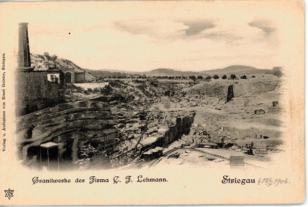
| Strzegom I quarry, Strzegom, Gmina Strzegom, Świdnica County, Lower Silesian Voivodeship, Poland | 50° 57' 29" N | 16° 19' 41" E | 8.8km (5.5 miles) | |
| Strzegom III quarry, Strzegom, Gmina Strzegom, Świdnica County, Lower Silesian Voivodeship, Poland | 50° 57' 55" N | 16° 20' 12" E | 8.8km (5.5 miles) | |
| Rusko moldavite occurrence 2, Rusko, Gmina Strzegom, Świdnica County, Lower Silesian Voivodeship, Poland | 50° 59' 17" N | 16° 28' 47" E | 9.0km (5.6 miles) | |
| Grabina II quarry, Strzegom, Gmina Strzegom, Świdnica County, Lower Silesian Voivodeship, Poland | 50° 57' 6" N | 16° 19' 4" E | 9.1km (5.6 miles) | |
| Strzegom II quarry, Strzegom, Gmina Strzegom, Świdnica County, Lower Silesian Voivodeship, Poland | 50° 57' 29" N | 16° 19' 24" E | 9.1km (5.7 miles) | |
| Granit-Wiatrak quarry, Strzegom, Gmina Strzegom, Świdnica County, Lower Silesian Voivodeship, Poland | 50° 59' 12" N | 16° 22' 20" E | 9.2km (5.7 miles) | |
| Kowal quarry, Gmina Strzegom, Świdnica County, Lower Silesian Voivodeship, Poland | 50° 57' 18" N | 16° 19' 8" E | 9.2km (5.7 miles) | |
| Graniczna quarry, Strzegom, Gmina Strzegom, Świdnica County, Lower Silesian Voivodeship, Poland | 50° 57' 43" N | 16° 19' 26" E | 9.3km (5.8 miles) | |
| Wiatrak, Żółkiewka, Gmina Strzegom, Świdnica County, Lower Silesian Voivodeship, Poland | 50° 57' 52" N | 16° 19' 29" E | 9.4km (5.9 miles) | |
| Mokrzeszów conglomerate quarry, Mokrzeszów, Gmina Świdnica, Świdnica County, Lower Silesian Voivodeship, Poland | 50° 50' 35" N | 16° 21' 13" E | 9.6km (5.9 miles) | |


Strzegom III quarry, Strzegom, Gmina Strzegom, Świdnica County, Lower Silesian Voivodeship, Poland