| Locality | Latitude | Longitude | Distance | Bearing |
|---|
| Carnaíba mining district, Pindobaçu, Bahia, Brazil | 10° 43' 15" S | 40° 26' 56" W | 8.1km (5.0 miles) | |
| Canavieiras mine, Mirangaba, Bahia, Brazil | 10° 55' 0" S | 40° 38' 59" W | 35.8km (22.2 miles) | |
| Jaguarari, Curaçá river valley, Bahia, Brazil | 10° 15' 28" S | 40° 11' 39" W | 52.8km (32.8 miles) | |
| Canavieiras North Mine, Jacobina, Bahia, Brazil | 11° 13' 37" S | 40° 30' 41" W | 64.4km (40.0 miles) | |
| Canavieiras Central Mine, Jacobina, Bahia, Brazil | 11° 14' 15" S | 40° 30' 32" W | 65.5km (40.7 miles) | |
| Canavieiras Sul Mine, Jacobina, Bahia, Brazil | 11° 14' 34" S | 40° 30' 33" W | 66.1km (41.1 miles) | |
| Itapicuru mine, Jacobina, Bahia, Brazil | 11° 15' 3" S | 40° 31' 24" W | 67.1km (41.7 miles) | |
| Morro do Cuscuz Mine, Jacobina, Bahia, Brazil | 11° 15' 27" S | 40° 30' 56" W | 67.8km (42.1 miles) | |
| Morro do Vento Central Mine, Jacobina, Bahia, Brazil | 11° 16' 1" S | 40° 30' 53" W | 68.8km (42.8 miles) | |
| Morro do Vento Sul Mine, Jacobina, Bahia, Brazil | 11° 16' 46" S | 40° 31' 2" W | 70.2km (43.6 miles) | |
| João Belo Waste Dump, João Belo Mine, Jacobina, Bahia, Brazil | 11° 17' 6" S | 40° 31' 18" W | 70.9km (44.0 miles) | |
| João Belo Mine, Jacobina, Bahia, Brazil | 11° 17' 25" S | 40° 31' 3" W | 71.4km (44.4 miles) | |
| Ipueira-Medrado sill, Andorinha, Bahia, Brazil | 10° 24' 0" S | 39° 46' 59" W | 79.7km (49.5 miles) | |
| Caraíba mine, Jaguarari, Curaçá river valley, Bahia, Brazil | 9° 49' 59" S | 39° 52' 0" W | 112.1km (69.6 miles) | |
| Barra do Corda pegmatite, Juazeiro, Bahia, Brazil | 9° 30' 0" S | 40° 30' 0" W | 127.9km (79.5 miles) | |
| Maria Preta mine, Santaluz, Bahia, Brazil | 11° 0' 24" S | 39° 18' 15" W | 133.0km (82.7 miles) | |
| C1-Santaluz deposit, Quijingue, Bahia, Brazil | 10° 45' 0" S | 39° 15' 0" W | 133.4km (82.9 miles) | |
| Quijingue meteorite, Quijingue, Bahia, Brazil | 10° 45' 0" S | 39° 13' 0" W | 137.0km (85.1 miles) | |
| Salobro, Canudos, Bahia, Brazil | 10° 5' 31" S | 39° 11' 24" W | 152.8km (94.9 miles) | |
| Serra da Quixaba, Sento Sé, Bahia, Brazil | 9° 57' 59" S | 41° 48' 11" W | 164.8km (102.4 miles) | |
| Salininha mine, Pilão Arcado, Bahia, Brazil | 9° 31' 0" S | 41° 33' 46" W | 174.0km (108.1 miles) | |
| Fazenda Brasileiro mine, Barrocas, Bahia, Brazil | 11° 27' 16" S | 39° 4' 50" W | 175.7km (109.2 miles) | |
| Fazenda Canto Au deposit, Barrocas, Bahia, Brazil | 11° 26' 59" S | 39° 4' 19" W | 176.3km (109.5 miles) | |
| Curaçá, Curaçá river valley, Bahia, Brazil | 8° 59' 29" S | 39° 54' 21" W | 194.4km (120.8 miles) | |
| Riacho do Pontal prospect, Curaçá, Bahia, Brazil | 8° 54' 0" S | 39° 34' 59" W | 217.3km (135.0 miles) | |
| São José river, Igatu, Andaraí, Bahia, Brazil | 12° 21' 27" S | 41° 32' 11" W | 222.8km (138.5 miles) | |
| Serra da Mangabeira, Ibitiara, Bahia, Brazil | 12° 36' 22" S | 42° 18' 10" W | 295.5km (183.6 miles) | |


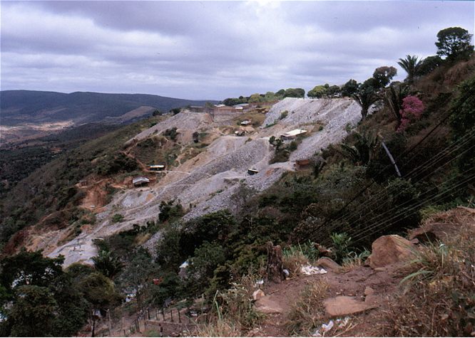


Carnaíba mining district, Pindobaçu, Bahia, Brazil