| Locality | Latitude | Longitude | Distance | Bearing |
|---|
| Epworth, Fannin County, Georgia, USA | 34° 57' 1" N | 84° 23' 6" W | 0.3km (0.2 miles) | |
| Mobile Copper Mine (Shaffer Mine), Fannin County, Georgia, USA | 34° 57' 51" N | 84° 25' 4" W | 3.2km (2.0 miles) | |
| Sally Jane Prospect, Fannin County, Georgia, USA | 34° 58' 39" N | 84° 24' 15" W | 3.6km (2.2 miles) | |
| Jeptha Patterson Prospect, Fannin County, Georgia, USA | 34° 57' 29" N | 84° 25' 48" W | 4.0km (2.5 miles) | |
| Number Twenty Copper Mine, Mineral Bluff, Fannin County, Georgia, USA | 34° 59' 17" N | 84° 22' 17" W | 4.7km (2.9 miles) | |
| Central Services, Polk County, Tennessee, USA | 34° 59' 20" N | 84° 22' 12" W | 4.8km (3.0 miles) | |
| Lebanon School, Fannin County, Georgia, USA | 34° 54' 32" N | 84° 25' 13" W | 5.3km (3.3 miles) | |
| Meek Prospect (United States Prospect), Polk County, Tennessee, USA | 35° 0' 6" N | 84° 22' 42" W | 6.0km (3.7 miles) | |
| Bryant Prospect, Fannin County, Georgia, USA | 34° 55' 39" N | 84° 27' 3" W | 6.2km (3.9 miles) | |
| Union, Fannin County, Georgia, USA | 34° 57' 11" N | 84° 19' 3" W | 6.4km (4.0 miles) | |
| Polk County Mine (Mary-Polk County ore body; Tennessee Copper Company; Old Polk County; Cities Service Company), Polk County, Tennessee, USA | 35° 0' 27" N | 84° 22' 55" W | 6.6km (4.1 miles) | |
| Cherokee Mine (School property; Old Tennessee Mine), Copperhill, Polk County, Tennessee, USA | 35° 0' 31" N | 84° 23' 40" W | 6.8km (4.2 miles) | |
| South pit, Cherokee Open pit, Polk County, Tennessee, USA | 35° 0' 31" N | 84° 23' 48" W | 6.8km (4.2 miles) | |
| Mary Mine (Mary-Polk County Ore Body; Cities Service Company), Polk County, Tennessee, USA | 35° 0' 41" N | 84° 22' 47" W | 7.0km (4.4 miles) | |
| North pit, Cherokee open pit, Polk County, Tennessee, USA | 35° 0' 41" N | 84° 23' 40" W | 7.1km (4.4 miles) | |
| Calloway Mine, Polk County, Tennessee, USA | 35° 0' 41" N | 84° 22' 20" W | 7.2km (4.5 miles) | |
| Kellogg Prospect, Fannin County, Georgia, USA | 34° 55' 8" N | 84° 27' 38" W | 7.4km (4.6 miles) | |
| Old Tennessee Mine (School Property Mine), Polk County, Tennessee, USA | 35° 0' 57" N | 84° 23' 30" W | 7.5km (4.7 miles) | |
| London Mine (McPherson Mine; Tennessee Copper Company), Polk County, Tennessee, USA | 35° 0' 59" N | 84° 22' 59" W | 7.6km (4.7 miles) | |
| Hothouse Creek Valley, Blue Ridge, Fannin County, Georgia, USA | 34° 56' 54" N | 84° 18' 8" W | 7.8km (4.8 miles) | |
| Boyd Mine (Culchote vein), Ducktown, Polk County, Tennessee, USA | 35° 1' 34" N | 84° 22' 44" W | 8.7km (5.4 miles) | |
| Mount Pisgah prospect (Higdon prospect), Pisgah Mountain, Fannin County, Georgia, USA | 34° 53' 4" N | 84° 26' 50" W | 8.9km (5.5 miles) | |
| Hiwassee Mine (Tennessee Copper Company), Ducktown, Polk County, Tennessee, USA | 35° 1' 57" N | 84° 22' 52" W | 9.4km (5.8 miles) | |
| Paul Campbell Isabella Pit No. 393, Polk County, Tennessee, USA | 35° 1' 53" N | 84° 21' 53" W | 9.5km (5.9 miles) | |
| Hackney Placer, Fannin County, Georgia, USA | 34° 51' 59" N | 84° 21' 19" W | 9.6km (5.9 miles) | |
| Burra Burra Mine (Tennessee Copper Company; Copperhill Operations), Polk County, Tennessee, USA | 35° 2' 5" N | 84° 22' 46" W | 9.7km (6.0 miles) | |
| Copperhill Mine (Eureka Mine; Isabella Mine), Copperhill, Polk County, Tennessee, USA | 35° 2' 1" N | 84° 21' 46" W | 9.7km (6.1 miles) | |
| Isabella Mine, Isabella, Polk County, Tennessee, USA | 35° 2' 1" N | 84° 21' 46" W | 9.8km (6.1 miles) | |
| Pisgah Mountain, Fannin County, Georgia, USA | 34° 52' 31" N | 84° 26' 55" W | 9.8km (6.1 miles) | |
| J. Y. Allen Property, Fannin County, Georgia, USA | 34° 52' 10" N | 84° 19' 55" W | 10.1km (6.3 miles) | |


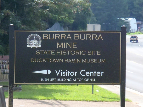

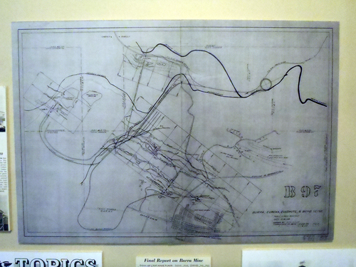


Burra Burra Mine, Polk County, Tennessee, USA