| Locality | Latitude | Longitude | Distance | Bearing |
|---|
| Spake Prospect, Burke County, North Carolina, USA | 35° 46' 14" N | 81° 34' 31" W | 3.0km (1.9 miles) | |
| Grill Prospect, Burke County, North Carolina, USA | 35° 43' 49" N | 81° 36' 33" W | 4.2km (2.6 miles) | |
| Hudson Prospect, Burke County, North Carolina, USA | 35° 42' 22" N | 81° 33' 45" W | 4.3km (2.7 miles) | |
| Hossfeld Prospect, Burke County, North Carolina, USA | 35° 43' 19" N | 81° 36' 31" W | 4.5km (2.8 miles) | |
| Unnamed Mica Prospect (MRDS - 10127171), Burke County, North Carolina, USA | 35° 41' 56" N | 81° 37' 35" W | 7.4km (4.6 miles) | |
| Morganton Quarry (Vulcan Materials Co. Quarry), Morganton, Burke County, North Carolina, USA | 35° 45' 43" N | 81° 39' 11" W | 8.0km (5.0 miles) | |
| Unnamed Gneiss Quarry GI-022 (MRDS - 10106098), Morganton, Burke County, North Carolina, USA | 35° 45' 56" N | 81° 39' 22" W | 8.4km (5.2 miles) | |
| Causby Quarry, Morganton, Burke County, North Carolina, USA | 35° 46' 14" N | 81° 39' 27" W | 8.7km (5.4 miles) | |
| Smith Cliff Sillimanite deposit, Burke County, North Carolina, USA | 35° 40' 6" N | 81° 35' 50" W | 8.9km (5.5 miles) | |
| Hunting Creek Tributary Placer, Morganton, Burke County, North Carolina, USA | 35° 45' 46" N | 81° 39' 52" W | 9.1km (5.6 miles) | |
| Cages Mountain Sillimanite Deposit, Caldwell County, North Carolina, USA | 35° 49' 39" N | 81° 32' 12" W | 9.6km (6.0 miles) | |
| Saw Mills Sillimanite Deposit, Caldwell County, North Carolina, USA | 35° 48' 4" N | 81° 29' 3" W | 9.7km (6.1 miles) | |
| Morganton, Burke County, North Carolina, USA | 35° 44' 43" N | 81° 41' 4" W | 10.6km (6.6 miles) | |
| Unnamed Gold Placer (MRDS - 10089503), Morganton, Burke County, North Carolina, USA | 35° 45' 52" N | 81° 41' 12" W | 11.0km (6.9 miles) | |
| Floyd Brittan Mine, Burke County, North Carolina, USA | 35° 38' 49" N | 81° 30' 34" W | 12.0km (7.5 miles) | |
| Yancey Prospect, Burke County, North Carolina, USA | 35° 38' 44" N | 81° 30' 31" W | 12.2km (7.6 miles) | |
| George P. Young Mine, Catawba County, North Carolina, USA | 35° 39' 10" N | 81° 29' 28" W | 12.3km (7.6 miles) | |
| Reed Mine, Burke County, North Carolina, USA | 35° 38' 39" N | 81° 30' 24" W | 12.4km (7.7 miles) | |
| Miller prospect, Caldwell County, North Carolina, USA | 35° 49' 38" N | 81° 28' 7" W | 12.8km (7.9 miles) | |
| Noah Young Mine, Burke County, North Carolina, USA | 35° 39' 21" N | 81° 28' 22" W | 13.0km (8.1 miles) | |
| Puette Mine, Morganton, Burke County, North Carolina, USA | 35° 49' 37" N | 81° 40' 18" W | 13.2km (8.2 miles) | |
| Paul Oliver prospect, Caldwell County, North Carolina, USA | 35° 51' 10" N | 81° 38' 48" W | 14.0km (8.7 miles) | |
| Baileys Creek (Bailey Fork), Glen Alpine, Burke County, North Carolina, USA | 35° 43' 41" N | 81° 43' 17" W | 14.1km (8.7 miles) | |
| Long Prospect, Caldwell County, North Carolina, USA | 35° 52' 39" N | 81° 32' 29" W | 15.0km (9.3 miles) | |
| Causby Gneiss Quarry, Morganton, Caldwell County, North Carolina, USA | 35° 52' 42" N | 81° 32' 57" W | 15.0km (9.3 miles) | |
| Caldwell Quarry (Martin Marietta Quarry), Lenoir, Caldwell County, North Carolina, USA | 35° 52' 47" N | 81° 33' 22" W | 15.0km (9.3 miles) | |
| Quarry (MRDS - 10074568), Burke County, North Carolina, USA | 35° 41' 2" N | 81° 43' 2" W | 15.2km (9.4 miles) | |
| Haywood Hoyle Prospect, Burke County, North Carolina, USA | 35° 36' 41" N | 81° 36' 9" W | 15.2km (9.4 miles) | |
| Bailey Fork Placer, Burke County, North Carolina, USA | 35° 40' 32" N | 81° 42' 50" W | 15.4km (9.5 miles) | |
| Newton Prospect, Burke County, North Carolina, USA | 35° 38' 40" N | 81° 41' 24" W | 15.8km (9.8 miles) | |
Minerals recorded nearby (within 15.8 km)
Rock types recorded nearby (within 15.8 km)
Entries shown in red are rocks recorded for this region.

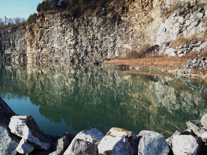
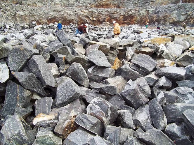


Morganton Quarry, Morganton, Burke County, North Carolina, USA