| Locality | Latitude | Longitude | Distance | Bearing |
|---|
| White Quarry, Leesburg, Loudoun County, Virginia, USA | 39° 6' 34" N | 77° 33' 40" W | 0.6km (0.4 miles) | |
| Quarry (MRDS - 10227917), Leesburg, Loudoun County, Virginia, USA | 39° 6' 5" N | 77° 34' 9" W | 1.5km (1.0 miles) | |
| Potomac Mine, Leesburg, Loudoun County, Virginia, USA | 39° 5' 59" N | 77° 33' 0" W | 2.0km (1.2 miles) | |
| Goose Creek Mine (Eagle Mine), Culpeper Basin, Loudoun County, Virginia, USA | 39° 5' 37" N | 77° 30' 21" W | 5.5km (3.4 miles) | |
| Leesburg Quarry, Leesburg, Loudoun County, Virginia, USA | 39° 4' 59" N | 77° 30' 46" W | 5.6km (3.5 miles) | |
| Unnamed Copper Prospect (MRDS - 10276962), Loudoun County, Virginia, USA | 39° 5' 48" N | 77° 30' 4" W | 5.7km (3.6 miles) | |
| Old Goose Creek Quarry, Leesburg, Loudoun County, Virginia, USA | 39° 4' 6" N | 77° 30' 57" W | 6.6km (4.1 miles) | |
| New Goose Creek Quarry, Leesburg, Loudoun County, Virginia, USA | 39° 4' 6" N | 77° 30' 57" W | 6.6km (4.1 miles) | |
| Luck Stone Quarry, Loudoun County, Virginia, USA | 39° 3' 18" N | 77° 32' 0" W | 7.1km (4.4 miles) | |
| Goose Creek, Leesburg, Loudoun County, Virginia, USA | 39° 6' 4" N | 77° 28' 37" W | 7.6km (4.7 miles) | |
| Unnamed Iron Prospect (MRDS - 10251960), Loudoun County, Virginia, USA | 39° 2' 14" N | 77° 37' 7" W | 9.8km (6.1 miles) | |
| Gneiss Quarry, Loudoun County, Virginia, USA | 39° 5' 53" N | 77° 40' 35" W | 10.0km (6.2 miles) | |
| Veasco Quarry (MRDS - 10276445), Oatlands, Loudoun County, Virginia, USA | 39° 2' 20" N | 77° 38' 21" W | 10.7km (6.6 miles) | |
| Unnamed PGE Occurrence (MRDS - 10048644), Loudoun County, Virginia, USA | 39° 1' 17" N | 77° 36' 11" W | 10.9km (6.8 miles) | |
| Graywacke Quarry, Loudoun County, Virginia, USA | 39° 1' 40" N | 77° 37' 34" W | 11.1km (6.9 miles) | |
| Loudon Marble Company Quarry, Loudoun County, Virginia, USA | 39° 1' 30" N | 77° 40' 55" W | 14.3km (8.9 miles) | |
| Furnace Mountain Mine, Loudoun County, Virginia, USA | 39° 15' 8" N | 77° 32' 14" W | 15.4km (9.6 miles) | |
| Dickerson Trap Rock Quarries, Dickerson, Montgomery County, Maryland, USA | 39° 13' 2" N | 77° 26' 3" W | 15.9km (9.9 miles) | |
| Sterling Copper Occurrence, Sterling, Loudoun County, Virginia, USA | 39° 0' 20" N | 77° 26' 4" W | 16.5km (10.2 miles) | |
| Dickerson, Montgomery County, Maryland, USA | 39° 13' 4" N | 77° 25' 27" W | 16.6km (10.3 miles) | |
| Shale Prospect, Arcola, Loudoun County, Virginia, USA | 38° 57' 56" N | 77° 32' 4" W | 16.8km (10.4 miles) | |
| Government Quarry, Seneca sandstone quarries, Seneca, Montgomery County, Maryland, USA | 39° 4' 37" N | 77° 21' 55" W | 17.6km (10.9 miles) | |
| Shale Prospect, Sterling, Loudoun County, Virginia, USA | 38° 58' 53" N | 77° 26' 51" W | 17.9km (11.1 miles) | |
| Peter's Quarry, Seneca sandstone quarries, Seneca, Montgomery County, Maryland, USA | 39° 4' 11" N | 77° 21' 50" W | 17.9km (11.1 miles) | |
| Point of Rocks bank, Frederick County, Maryland, USA | 39° 16' 39" N | 77° 32' 5" W | 18.3km (11.3 miles) | |
| College Quarry, Seneca sandstone quarries, Seneca, Montgomery County, Maryland, USA | 39° 4' 7" N | 77° 21' 23" W | 18.6km (11.5 miles) | |
| Seneca Quarry, Seneca sandstone quarries, Seneca, Montgomery County, Maryland, USA | 39° 4' 9" N | 77° 20' 55" W | 19.2km (11.9 miles) | |
| Seneca sandstone quarries, Seneca, Montgomery County, Maryland, USA | 39° 4' 8" N | 77° 20' 49" W | 19.3km (12.0 miles) | |
| Loudoun Quarries Inc. Quarry, Herndon, Loudoun County, Virginia, USA | 38° 58' 27" N | 77° 25' 26" W | 19.7km (12.3 miles) | |
| Seneca, Montgomery County, Maryland, USA | 39° 4' 42" N | 77° 20' 21" W | 19.8km (12.3 miles) | |
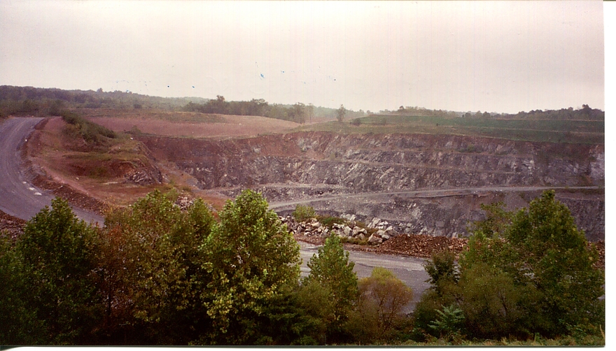


New Goose Creek Quarry, Leesburg, Loudoun County, Virginia, USA