| Locality | Latitude | Longitude | Distance | Bearing |
|---|
| New Haven, New Haven County, Connecticut, USA | 41° 18' 27" N | 72° 55' 34" W | 0.2km (0.1 miles) | |
| East Rock, New Haven, New Haven County, Connecticut, USA | 41° 19' 35" N | 72° 54' 14" W | 2.8km (1.8 miles) | |
| Mill Rock, Hamden, New Haven County, Connecticut, USA | 41° 20' 16" N | 72° 54' 51" W | 3.4km (2.1 miles) | |
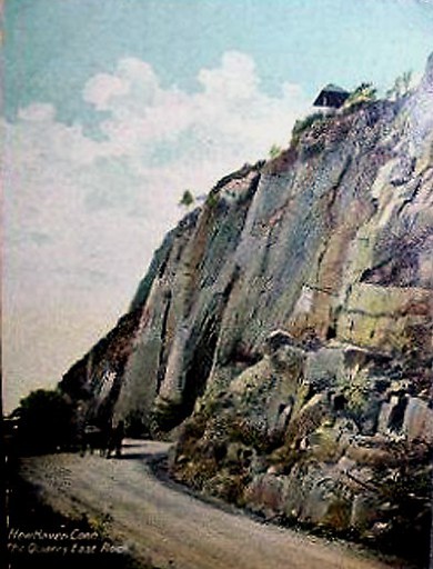
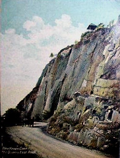
| Pine Rock Quarry (Farnham Quarry), Hamden, New Haven County, Connecticut, USA | 41° 20' 17" N | 72° 57' 3" W | 3.8km (2.4 miles) | |
| Fair Haven, New Haven, New Haven County, Connecticut, USA | 41° 18' 14" N | 72° 52' 44" W | 4.2km (2.6 miles) | |
| Silliman's Verd Antique Quarry, West Haven, New Haven County, Connecticut, USA | 41° 18' 43" N | 72° 58' 41" W | 4.2km (2.6 miles) | |
| Lambert's Mine (Maltby Lakes Mine), West Haven, New Haven County, Connecticut, USA | 41° 18' 22" N | 72° 58' 57" W | 4.6km (2.8 miles) | |
| Foxon quarry, Foxon, East Haven, New Haven County, Connecticut, USA | 41° 18' 56" N | 72° 52' 1" W | 5.1km (3.2 miles) | |
| Cinque Quarry, East Haven, New Haven County, Connecticut, USA | 41° 18' 3" N | 72° 51' 55" W | 5.3km (3.3 miles) | |
| McLay Avenue, East Haven, New Haven County, Connecticut, USA | 41° 18' 6" N | 72° 51' 53" W | 5.3km (3.3 miles) | |
| Woodbridge Mall (Amity Shopping Center), Woodbridge, New Haven County, Connecticut, USA | 41° 20' 11" N | 72° 58' 58" W | 5.5km (3.4 miles) | |
| High Street and Interstate 95 interchange, East Haven, New Haven County, Connecticut, USA | 41° 16' 59" N | 72° 52' 14" W | 5.6km (3.5 miles) | |
| East Haven, New Haven County, Connecticut, USA | 41° 16' 37" N | 72° 52' 22" W | 5.8km (3.6 miles) | |
| Barcla Quarry (Clark-Barrone Quarry), Woodbridge, New Haven County, Connecticut, USA | 41° 21' 2" N | 72° 58' 28" W | 6.1km (3.8 miles) | |
| Foxon, East Haven, New Haven County, Connecticut, USA | 41° 19' 28" N | 72° 50' 9" W | 7.9km (4.9 miles) | |
| Lambert Road serpentinite, Orange, New Haven County, Connecticut, USA | 41° 15' 39" N | 73° 0' 16" W | 8.3km (5.2 miles) | |
| Hamden, New Haven County, Connecticut, USA | 41° 22' 59" N | 72° 54' 6" W | 8.6km (5.3 miles) | |
| Woodbridge, New Haven County, Connecticut, USA | 41° 21' 13" N | 73° 0' 44" W | 8.6km (5.4 miles) | |
| Orange, New Haven County, Connecticut, USA | 41° 16' 41" N | 73° 1' 32" W | 8.8km (5.5 miles) | |
| Farm River Rock Quarry, East Haven, New Haven County, Connecticut, USA | 41° 20' 30" N | 72° 49' 6" W | 9.9km (6.1 miles) | |
| Branford, New Haven County, Connecticut, USA | 41° 16' 45" N | 72° 48' 53" W | 10.0km (6.2 miles) | |
| Quarry Road, Milford, New Haven County, Connecticut, USA | 41° 14' 27" N | 73° 0' 48" W | 10.4km (6.4 miles) | |
| North Haven, New Haven County, Connecticut, USA | 41° 23' 19" N | 72° 51' 39" W | 10.5km (6.5 miles) | |
| Baldwin Quarry (Milford Quarry), Milford, New Haven County, Connecticut, USA | 41° 14' 21" N | 73° 1' 55" W | 11.6km (7.2 miles) | |
| North Branford Quarry, North Branford, New Haven County, Connecticut, USA | 41° 20' 26" N | 72° 47' 38" W | 11.8km (7.3 miles) | |
| York Hill, Hamden, New Haven County, Connecticut, USA | 41° 24' 51" N | 72° 54' 38" W | 11.8km (7.3 miles) | |
| Herbert Street - Wheelers Farms Road intersection, Orange, New Haven County, Connecticut, USA | 41° 16' 23" N | 73° 4' 13" W | 12.5km (7.8 miles) | |
| Holbrook Quarry, Seymour, New Haven County, Connecticut, USA | 41° 21' 49" N | 73° 4' 16" W | 13.4km (8.3 miles) | |
| North Branford, New Haven County, Connecticut, USA | 41° 19' 36" N | 72° 46' 9" W | 13.4km (8.3 miles) | |
| Derby, New Haven County, Connecticut, USA | 41° 19' 15" N | 73° 5' 20" W | 13.5km (8.4 miles) | |
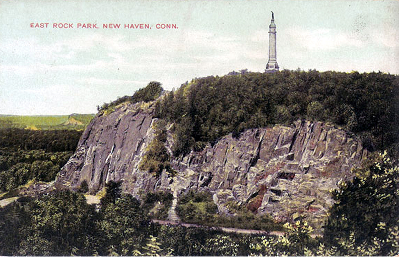


East Rock, New Haven, New Haven County, Connecticut, USA