| Locality | Latitude | Longitude | Distance | Bearing |
|---|
| Boardman's Bridge, New Milford, Litchfield County, Connecticut, USA | 41° 35' 37" N | 73° 26' 53" W | 3.8km (2.4 miles) | |
| Advance Stone Quarry, Boardman's Bridge, New Milford, Litchfield County, Connecticut, USA | 41° 35' 57" N | 73° 26' 52" W | 4.1km (2.6 miles) | |
| Mine Hill (Ore Hill), Roxbury, Litchfield County, Connecticut, USA | 41° 34' 43" N | 73° 21' 3" W | 4.8km (3.0 miles) | |
| Bridgewater, Litchfield County, Connecticut, USA | 41° 32' 44" N | 73° 22' 6" W | 4.8km (3.0 miles) | |
| Roxbury Iron Mine (Shepaug Iron Company Mine; Shepaug Spathic Iron and Steel Company Mine), Mine Hill (Ore Hill), Roxbury, Litchfield County, Connecticut, USA | 41° 34' 9" N | 73° 20' 29" W | 5.6km (3.5 miles) | |
| Roxbury Granite Quarry (upper quarry), Mine Hill (Ore Hill), Roxbury, Litchfield County, Connecticut, USA | 41° 33' 45" N | 73° 20' 26" W | 5.9km (3.6 miles) | |
| Unnamed quartz quarries, Bridgewater, Litchfield County, Connecticut, USA | 41° 33' 26" N | 73° 20' 34" W | 5.9km (3.7 miles) | |
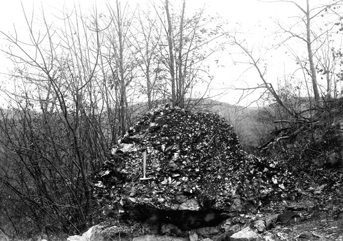
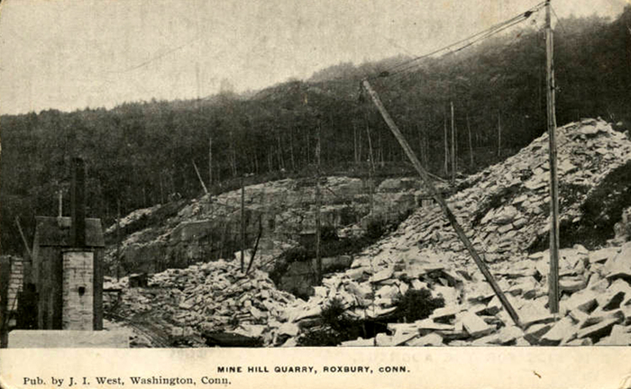
| Rockside Quarry (Mine Hill Quarry), Mine Hill (Ore Hill), Roxbury, Litchfield County, Connecticut, USA | 41° 34' 14" N | 73° 20' 16" W | 5.9km (3.7 miles) | |
| Quartz quarry, Mine Hill (Ore Hill), Roxbury, Litchfield County, Connecticut, USA | 41° 34' 0" N | 73° 20' 15" W | 6.0km (3.7 miles) | |
| Unnamed quartz quarries, Roxbury, Litchfield County, Connecticut, USA | 41° 33' 30" N | 73° 20' 21" W | 6.1km (3.8 miles) | |
| Unnamed quartz mine (Judd's Bridge kyanite locality), Washington, Litchfield County, Connecticut, USA | 41° 35' 56" N | 73° 20' 11" W | 6.5km (4.0 miles) | |
| Unnamed quartz prospects, Washington, Litchfield County, Connecticut, USA | 41° 35' 59" N | 73° 20' 5" W | 6.6km (4.1 miles) | |
| Rocky Mountain Road garnet prospect, Roxbury, Litchfield County, Connecticut, USA | 41° 32' 27" N | 73° 18' 46" W | 8.9km (5.5 miles) | |
| New England Mining Company Quarry (Roebling Mine; Hewitt's Mine), Upper Merryall, New Milford, Litchfield County, Connecticut, USA | 41° 39' 22" N | 73° 26' 5" W | 9.1km (5.6 miles) | |
| Upper Merryall, New Milford, Litchfield County, Connecticut, USA | 41° 39' 44" N | 73° 25' 19" W | 9.5km (5.9 miles) | |
| Washington, Litchfield County, Connecticut, USA | 41° 37' 44" N | 73° 18' 36" W | 10.0km (6.2 miles) | |
| Berry Road kyanite locality, Roxbury, Litchfield County, Connecticut, USA | 41° 30' 24" N | 73° 19' 47" W | 10.2km (6.3 miles) | |
| U. S. Route 7 Expressway (Brookfield Bypass), Brookfield, Fairfield County, Connecticut, USA | 41° 29' 2" N | 73° 25' 2" W | 10.4km (6.4 miles) | |
| Brookfield, Fairfield County, Connecticut, USA | 41° 28' 57" N | 73° 24' 33" W | 10.5km (6.5 miles) | |
| Ilmenite locality, Bridgewater, Litchfield County, Connecticut, USA | 41° 29' 3" N | 73° 21' 28" W | 11.1km (6.9 miles) | |
| Green's Farm locality (Roxbury garnet mine; Roxbury Falls garnet mine; Garnet Hill), Roxbury, Litchfield County, Connecticut, USA | 41° 30' 24" N | 73° 18' 11" W | 11.7km (7.3 miles) | |
| New Preston, Washington, Litchfield County, Connecticut, USA | 41° 40' 31" N | 73° 21' 16" W | 11.8km (7.4 miles) | |
| Old lead mine, Brookfield, Fairfield County, Connecticut, USA | 41° 28' 0" N | 73° 24' 21" W | 12.2km (7.6 miles) | |
| Sachem Road area, Southbury, New Haven County, Connecticut, USA | 41° 29' 10" N | 73° 19' 14" W | 12.5km (7.7 miles) | |
| Unnamed quartz quarry, Southbury, New Haven County, Connecticut, USA | 41° 29' 26" N | 73° 18' 37" W | 12.6km (7.8 miles) | |
| Kent Iron Mine (Limonite mine), Kent, Litchfield County, Connecticut, USA | 41° 41' 15" N | 73° 26' 51" W | 12.7km (7.9 miles) | |
| Unnamed quartz quarry, Washington, Litchfield County, Connecticut, USA | 41° 39' 58" N | 73° 18' 46" W | 12.7km (7.9 miles) | |
| U. S. Route 7 Expressway (Danbury line to Iron Works District), Brookfield, Fairfield County, Connecticut, USA | 41° 27' 3" N | 73° 23' 41" W | 14.0km (8.7 miles) | |
| Pawling Mine, Town of Pawling, Dutchess County, New York, USA | 41° 34' 0" N | 73° 35' 59" W | 16.0km (9.9 miles) | |
| Danbury beryl prospect, Brookfield, Fairfield County, Connecticut, USA | 41° 25' 55" N | 73° 22' 59" W | 16.2km (10.1 miles) | |


New England Mining Company Quarry, Upper Merryall, New Milford, Litchfield County, Connecticut, USA