| Locality | Latitude | Longitude | Distance | Bearing |
|---|
| Hedgehog Hill Quarry (Gem Mica Quarry), Peru, Oxford County, Maine, USA | 44° 28' 6" N | 70° 27' 6" W | 5.6km (3.5 miles) | |
| Lobikis Quarry, Peru, Oxford County, Maine, USA | 44° 29' 24" N | 70° 29' 34" W | 7.2km (4.5 miles) | |
| Ragged Ass Jack Mountain locality (Ragged Jack Mountain locality), Hartford, Oxford County, Maine, USA | 44° 25' 20" N | 70° 24' 33" W | 9.4km (5.8 miles) | |
| Paper Mill Excavation, Jay, Franklin County, Maine, USA | 44° 30' 17" N | 70° 14' 13" W | 13.4km (8.3 miles) | |
| Lone Star Silver Mine, Woodstock, Oxford County, Maine, USA | 44° 25' 12" N | 70° 34' 9" W | 16.2km (10.1 miles) | |
| Riley Paper Mill excavation, Livermore Falls, Androscoggin County, Maine, USA | 44° 28' 48" N | 70° 11' 55" W | 16.7km (10.3 miles) | |
| Biron Quarry, Sumner, Oxford County, Maine, USA | 44° 22' 28" N | 70° 30' 19" W | 16.7km (10.4 miles) | |
| Livermore, Androscoggin County, Maine, USA | 44° 23' 2" N | 70° 14' 57" W | 18.4km (11.5 miles) | |
| Woodstock Gold and Silver Mine, Woodstock, Oxford County, Maine, USA | 44° 23' 59" N | 70° 35' 50" W | 19.3km (12.0 miles) | |
| Black Mountain Quarry, Rumford, Oxford County, Maine, USA | 44° 35' 7" N | 70° 38' 47" W | 21.0km (13.1 miles) | |
| State Route 4 road cut, Livermore, Androscoggin County, Maine, USA | 44° 20' 18" N | 70° 15' 19" W | 22.2km (13.8 miles) | |
| Bessey Quarry, Buckfield, Oxford County, Maine, USA | 44° 18' 2" N | 70° 26' 40" W | 23.1km (14.4 miles) | |
| Orchard Quarry, Buckfield, Oxford County, Maine, USA | 44° 17' 39" N | 70° 25' 40" W | 23.7km (14.7 miles) | |
| Bennett Quarry, Buckfield, Oxford County, Maine, USA | 44° 17' 35" N | 70° 25' 35" W | 23.8km (14.8 miles) | |
| Basin Falls locality, Buckfield, Oxford County, Maine, USA | 44° 17' 27" N | 70° 24' 6" W | 24.0km (14.9 miles) | |
| Ryerson Hill Quarries, Paris, Oxford County, Maine, USA | 44° 17' 44" N | 70° 28' 0" W | 24.0km (14.9 miles) | |
| Cummings Quarry, Buckfield, Oxford County, Maine, USA | 44° 17' 26" N | 70° 26' 57" W | 24.3km (15.1 miles) | |
| Snow Falls, West Paris, Oxford County, Maine, USA | 44° 18' 7" N | 70° 32' 2" W | 24.9km (15.5 miles) | |
| Lower prospects, Rumford, Oxford County, Maine, USA | 44° 32' 48" N | 70° 43' 11" W | 25.3km (15.7 miles) | |
| Bell pit, Newry, Oxford County, Maine, USA | 44° 32' 39" N | 70° 43' 15" W | 25.4km (15.8 miles) | |
| Frank Perham prospect, Rumford, Oxford County, Maine, USA | 44° 32' 47" N | 70° 43' 15" W | 25.4km (15.8 miles) | |
| Nevel Quarry (Twin tunnels; United Feldspar Quarry), Newry, Oxford County, Maine, USA | 44° 32' 42" N | 70° 43' 19" W | 25.5km (15.8 miles) | |
| Dunton Gem Quarry, Newry, Oxford County, Maine, USA | 44° 32' 34" N | 70° 43' 23" W | 25.5km (15.8 miles) | |
| Kinglet Prospect, Newry, Oxford County, Maine, USA | 44° 32' 31" N | 70° 43' 26" W | 25.6km (15.9 miles) | |
| A.C. Perham Quarry, West Paris, Oxford County, Maine, USA | 44° 18' 47" N | 70° 34' 44" W | 25.6km (15.9 miles) | |
| Crooker Gem Pegmatite Quarries, Newry, Oxford County, Maine, USA | 44° 32' 39" N | 70° 43' 24" W | 25.6km (15.9 miles) | |
| Scotty Quarry, Newry, Oxford County, Maine, USA | 44° 32' 35" N | 70° 43' 37" W | 25.8km (16.1 miles) | |
| Irish Quarry, Buckfield, Oxford County, Maine, USA | 44° 16' 26" N | 70° 23' 39" W | 25.9km (16.1 miles) | |
| Fletcher Quarry, Buckfield, Oxford County, Maine, USA | 44° 16' 24" N | 70° 24' 10" W | 25.9km (16.1 miles) | |
| Broome Prospect, Newry, Oxford County, Maine, USA | 44° 32' 44" N | 70° 43' 45" W | 26.1km (16.2 miles) | |

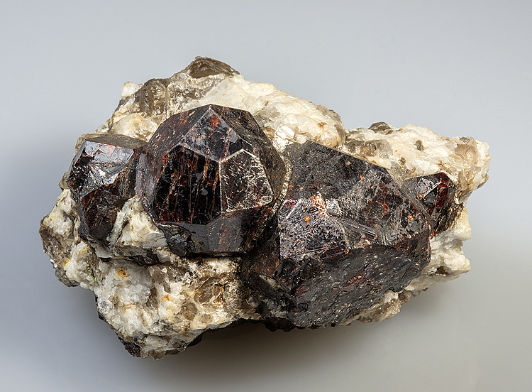
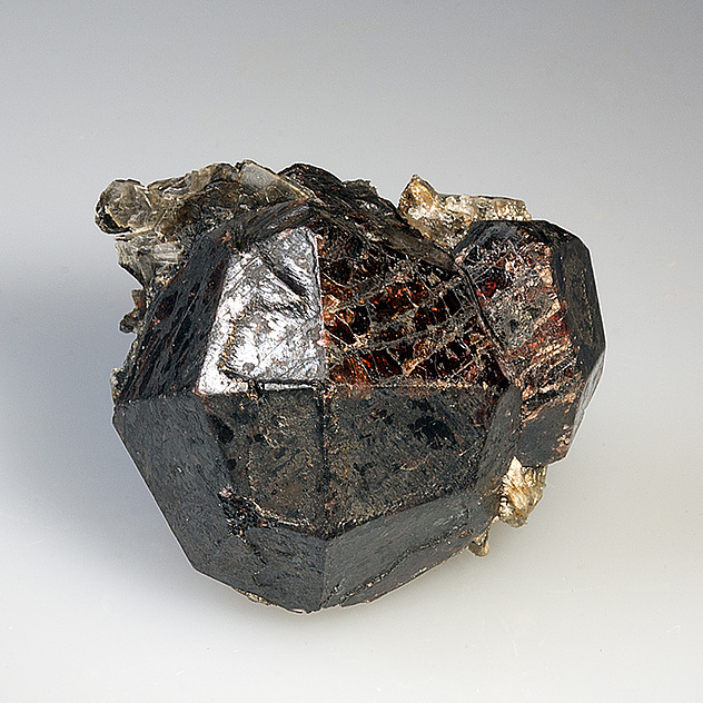

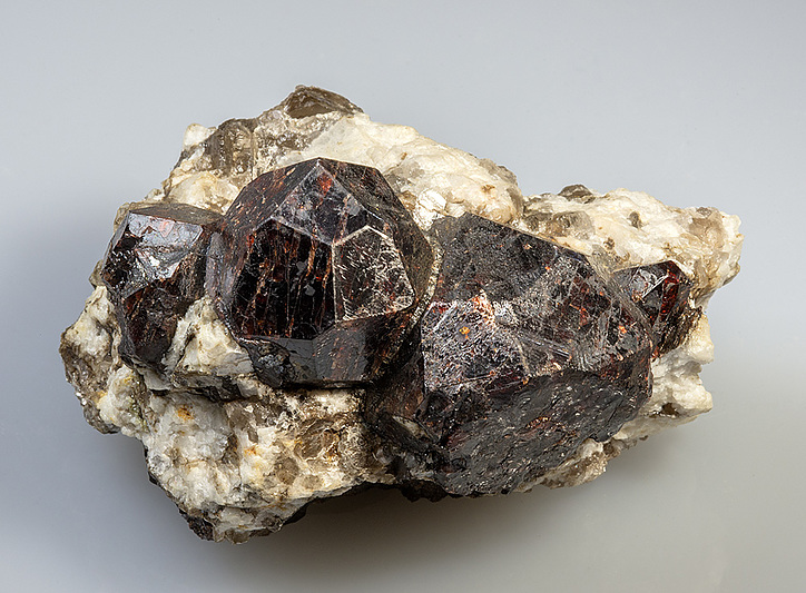


Ragged Ass Jack Mountain locality, Hartford, Oxford County, Maine, USA