| Locality | Latitude | Longitude | Distance | Bearing |
|---|
| Brewster Mines, Brewster, Town of Southeast, Putnam County, New York, USA | 41° 23' 49" N | 73° 37' 3" W | 0.0km (0.0 miles) | |
| Interstate 84 road cuts, Town of Southeast, Putnam County, New York, USA | 41° 24' 54" N | 73° 37' 9" W | 2.0km (1.2 miles) | |
| Tilly Foster Iron Mine, Town of Southeast, Putnam County, New York, USA | 41° 24' 46" N | 73° 38' 31" W | 2.7km (1.7 miles) | |
| Theall Mine, Town of Southeast, Putnam County, New York, USA | 41° 22' 0" N | 73° 34' 59" W | 4.4km (2.7 miles) | |
| Mc Collum Mine, North Salem, Westchester County, New York, USA | 41° 21' 0" N | 73° 39' 0" W | 5.9km (3.7 miles) | |
| Camarco Quarry, Town of Carmel, Putnam County, New York, USA | 41° 26' 0" N | 73° 41' 0" W | 6.8km (4.2 miles) | |
| Clover Hill Mine, Croton Falls, Somers Township, Westchester County, New York, USA | 41° 19' 59" N | 73° 40' 0" W | 8.2km (5.1 miles) | |
| Interstate 84 and US Route 202 interchange, Danbury, Fairfield County, Connecticut, USA | 41° 23' 34" N | 73° 31' 6" W | 8.2km (5.1 miles) | |
| Western Connecticut State College, Danbury, Fairfield County, Connecticut, USA | 41° 23' 42" N | 73° 29' 39" W | 10.2km (6.4 miles) | |
| Brown's Quarry, Town of Kent, Putnam County, New York, USA | 41° 28' 59" N | 73° 40' 0" W | 10.4km (6.5 miles) | |
| Putnam County Mining Corp. Mine, Pine Pond, Town of Kent, Putnam County, New York, USA | 41° 27' 52" N | 73° 42' 33" W | 10.7km (6.7 miles) | |
| Mahopac Mines, Town of Carmel, Putnam County, New York, USA | 41° 23' 48" N | 73° 45' 38" W | 12.0km (7.4 miles) | |
| Oil Mill Pond, Danbury, Fairfield County, Connecticut, USA | 41° 23' 18" N | 73° 27' 54" W | 12.7km (7.9 miles) | |
| Tuckahoe and Patterson Marble Company Quarry, Town of Patterson, Putnam County, New York, USA | 41° 30' 48" N | 73° 36' 23" W | 13.0km (8.1 miles) | |
| Knapp's Quarry, Town of Patterson, Putnam County, New York, USA | 41° 30' 59" N | 73° 35' 59" W | 13.3km (8.3 miles) | |
| North Street mall, Danbury, Fairfield County, Connecticut, USA | 41° 24' 42" N | 73° 27' 20" W | 13.5km (8.4 miles) | |
| Danbury, Fairfield County, Connecticut, USA | 41° 23' 47" N | 73° 27' 15" W | 13.6km (8.4 miles) | |
| Danburite type locality, Danbury, Fairfield County, Connecticut, USA | 41° 23' 45" N | 73° 27' 15" W | 13.6km (8.4 miles) | |
| Titicus Mica Quarry, Ridgefield, Fairfield County, Connecticut, USA | 41° 18' 8" N | 73° 30' 29" W | 13.9km (8.7 miles) | |
| Casey Quarry (Ridgefield pegmatite), Ridgefield, Fairfield County, Connecticut, USA | 41° 17' 40" N | 73° 31' 1" W | 14.1km (8.8 miles) | |
| Bradley Mine, Town of Putnam Valley, Putnam County, New York, USA | 41° 24' 28" N | 73° 47' 24" W | 14.5km (9.0 miles) | |
| Old Quarry Nature Center, Danbury, Fairfield County, Connecticut, USA | 41° 22' 36" N | 73° 26' 2" W | 15.4km (9.6 miles) | |
| Ridgefield, Fairfield County, Connecticut, USA | 41° 16' 53" N | 73° 29' 54" W | 16.2km (10.1 miles) | |
| Ridgefield Silver Mine, Ridgefield, Fairfield County, Connecticut, USA | 41° 17' 54" N | 73° 28' 18" W | 16.3km (10.2 miles) | |
| Shelter Rock Road/Plumtrees Road intersection, Danbury, Fairfield County, Connecticut, USA | 41° 23' 45" N | 73° 24' 44" W | 17.1km (10.6 miles) | |
| West Redding grossular locality, Redding (Reading), Fairfield County, Connecticut, USA | 41° 19' 20" N | 73° 26' 16" W | 17.1km (10.6 miles) | |
| Bethel, Fairfield County, Connecticut, USA | 41° 22' 16" N | 73° 24' 41" W | 17.4km (10.8 miles) | |
| Agstone Company Limestone Quarry, Danbury, Fairfield County, Connecticut, USA | 41° 25' 40" N | 73° 24' 43" W | 17.4km (10.8 miles) | |
| Pawling Mine, Town of Pawling, Dutchess County, New York, USA | 41° 34' 0" N | 73° 35' 59" W | 18.9km (11.7 miles) | |
| Old lead mine, Brookfield, Fairfield County, Connecticut, USA | 41° 28' 0" N | 73° 24' 21" W | 19.2km (11.9 miles) | |
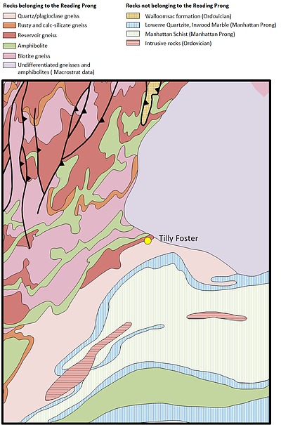
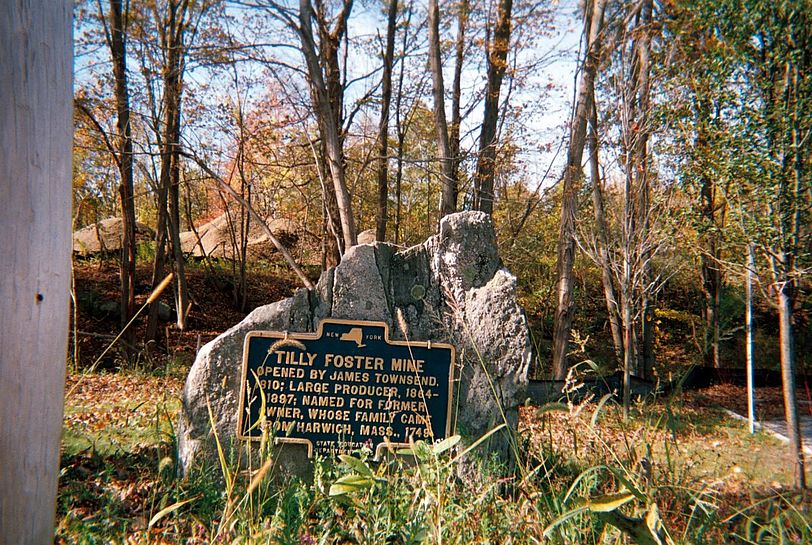

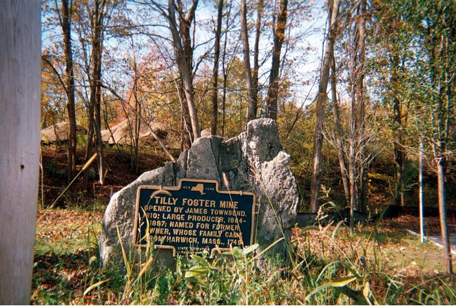


Tilly Foster Iron Mine, Town of Southeast, Putnam County, New York, USA