| Locality | Latitude | Longitude | Distance | Bearing |
|---|
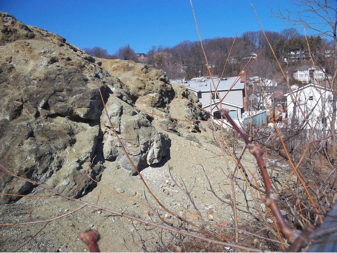
| Spring Street Artinite occurrence, Staten Island (Richmond County), New York City, New York, USA | 40° 36' 6" N | 74° 5' 58" W | 0.8km (0.5 miles) | |
| Reeds Basket Willow Swamp Park, Staten Island (Richmond County), New York City, New York, USA | 40° 36' 6" N | 74° 6' 22" W | 1.2km (0.7 miles) | |
| Grymes Hill, Staten Island (Richmond County), New York City, New York, USA | 40° 37' 9" N | 74° 5' 14" W | 1.4km (0.9 miles) | |
| Victory Diner locality, Staten Island (Richmond County), New York City, New York, USA | 40° 35' 13" N | 74° 6' 15" W | 2.5km (1.6 miles) | |
| Tyson's Mine, Four Corners on the Richmond Turnpike, Staten Island (Richmond County), New York City, New York, USA | 40° 36' 37" N | 74° 7' 49" W | 2.9km (1.8 miles) | |
| Lincoln Avenue, Staten Island (Richmond County), New York City, New York, USA | 40° 34' 54" N | 74° 6' 43" W | 3.3km (2.0 miles) | |
| Cooper and Hewitt Mine, Ocean Terrace, Staten Island (Richmond County), New York City, New York, USA | 40° 37' 59" N | 74° 4' 0" W | 3.7km (2.3 miles) | |
| New Dorp Mine, New Dorp Station, Staten Island (Richmond County), New York City, New York, USA | 40° 38' 0" N | 74° 3' 59" W | 3.7km (2.3 miles) | |
| Graniteville Quarry, Staten Island (Richmond County), New York City, New York, USA | 40° 37' 29" N | 74° 9' 14" W | 5.2km (3.2 miles) | |
| 55th Street & 7th Avenue, Brooklyn (Kings County), New York City, New York, USA | 40° 38' 22" N | 74° 0' 31" W | 8.1km (5.0 miles) | |
| Newark Bay, Newark, Essex County, New Jersey, USA | 40° 40' 38" N | 74° 7' 47" W | 8.1km (5.1 miles) | |
| 40th Street between 5th and 6th Avenues, Brooklyn (Kings County), New York City, New York, USA | 40° 38' 59" N | 74° 0' 13" W | 9.0km (5.6 miles) | |
| Pavonia Avenue and Chestnut Avenue sewer excavation, Jersey City, Hudson County, New Jersey, USA | 40° 43' 0" N | 74° 4' 0" W | 12.3km (7.6 miles) | |
| Marion Place, Jersey City, Hudson County, New Jersey, USA | 40° 43' 0" N | 74° 4' 0" W | 12.3km (7.6 miles) | |
| O'Neill & Hopkins Quarry, Jersey City, Hudson County, New Jersey, USA | 40° 43' 0" N | 74° 4' 0" W | 12.3km (7.6 miles) | |
| New Jersey Railroad cut, Bergen Hill, Jersey City, Hudson County, New Jersey, USA | 40° 43' 0" N | 74° 4' 0" W | 12.3km (7.6 miles) | |
| World Trade Center Site, Manhattan (New York County), New York City, New York, USA | 40° 42' 42" N | 74° 0' 45" W | 13.4km (8.4 miles) | |
| Pennsylvania Railroad cut, Mt Pleasant, Bergen Hill, Jersey City, Hudson County, New Jersey, USA | 40° 43' 53" N | 74° 3' 45" W | 13.9km (8.7 miles) | |
| Erie Railroad tunnel, Bergen Hill, Jersey City, Hudson County, New Jersey, USA | 40° 43' 51" N | 74° 3' 8" W | 14.1km (8.8 miles) | |
| Erie Railroad cut (Bergen archways), Bergen Hill, Jersey City, Hudson County, New Jersey, USA | 40° 44' 5" N | 74° 3' 25" W | 14.4km (9.0 miles) | |
| Eastern portal, Delaware - Lackawanna & Western Railroad tunnels, Bergen Hill, Jersey City, Hudson County, New Jersey, USA | 40° 44' 12" N | 74° 2' 53" W | 14.8km (9.2 miles) | |
| Delaware - Lackawanna & Western Railroad tunnels, Bergen Hill, Jersey City, Hudson County, New Jersey, USA | 40° 44' 24" N | 74° 3' 46" W | 14.9km (9.2 miles) | |
| Stevens Bluffs, Hoboken, Hudson County, New Jersey, USA | 40° 44' 35" N | 74° 1' 30" W | 16.1km (10.0 miles) | |
| Castle Point, Hoboken, Hudson County, New Jersey, USA | 40° 44' 41" N | 74° 1' 23" W | 16.3km (10.2 miles) | |
| Laurel Hill, Secaucus, Hudson County, New Jersey, USA | 40° 45' 35" N | 74° 5' 5" W | 16.8km (10.5 miles) | |
| Penn Station, 34th Street between 7th and 8th Avenues, Manhattan (New York County), New York City, New York, USA | 40° 45' 2" N | 73° 59' 36" W | 18.0km (11.2 miles) | |
| 34th Street between 7th and 8th Avenues, Manhattan (New York County), New York City, New York, USA | 40° 45' 5" N | 73° 59' 31" W | 18.1km (11.3 miles) | |
| 35th Street & Broadway, Manhattan (New York County), New York City, New York, USA | 40° 45' 0" N | 73° 59' 17" W | 18.2km (11.3 miles) | |
| New York - West Shore & Buffalo RR tunnel, Weehawken, Bergen Hill, Hudson County, New Jersey, USA | 40° 46' 0" N | 74° 1' 0" W | 18.8km (11.7 miles) | |
| Shady Side, Weehawken, Bergen Hill, Hudson County, New Jersey, USA | 40° 46' 0" N | 74° 1' 0" W | 18.8km (11.7 miles) | |
Minerals recorded nearby (within 18.8 km)
Rock types recorded nearby (within 18.8 km)
Entries shown in red are rocks recorded for this region.


Spring Street Artinite occurrence, Staten Island, New York City, New York, USA