| Locality | Latitude | Longitude | Distance | Bearing |
|---|
| Hammond, St. Lawrence County, New York, USA | 44° 26' 56" N | 75° 41' 39" W | 0.0km (0.0 miles) | |
| Mineral Point Lead Manufacturing Company Mine, Mineral Point, Black Lake, Hammond, Macomb Township, St. Lawrence County, New York, USA | 44° 28' 30" N | 75° 37' 59" W | 5.6km (3.5 miles) | |
| Rock Island road cut, Richville, St. Lawrence County, New York, USA | 44° 23' 39" N | 75° 40' 10" W | 6.4km (4.0 miles) | |
| Graphite deposit, Indian River, Rossie, St. Lawrence County, New York, USA | 44° 23' 59" N | 75° 39' 0" W | 6.5km (4.0 miles) | |
| West Bigelow mine, Bigelow, De Kalb Township, St. Lawrence County, New York, USA | 44° 27' 6" N | 75° 36' 39" W | 6.6km (4.1 miles) | |
| Agars Ledge, Rossie, St. Lawrence County, New York, USA | 44° 23' 29" N | 75° 40' 10" W | 6.7km (4.2 miles) | |
| Macomb Graphite Company Mine (Popes Mills Graphite Company Mine), Pope Mills, Macomb Township, St. Lawrence County, New York, USA | 44° 28' 0" N | 75° 35' 59" W | 7.7km (4.8 miles) | |
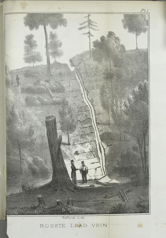
| Rossie Lead Mines, Rossie, St. Lawrence County, New York, USA | 44° 22' 59" N | 75° 39' 0" W | 8.1km (5.0 miles) | |
| Nelson Corners roadcut, Rossie, St. Lawrence County, New York, USA | 44° 22' 28" N | 75° 41' 43" W | 8.3km (5.1 miles) | |
| Rossie, St. Lawrence County, New York, USA | 44° 22' 45" N | 75° 39' 15" W | 8.4km (5.2 miles) | |
| H.D. Tann Mine, Brasie Corners, Macomb Township, St. Lawrence County, New York, USA | 44° 27' 0" N | 75° 34' 59" W | 8.8km (5.5 miles) | |
| Rossie Galena Company Mine, Rossie, St. Lawrence County, New York, USA | 44° 22' 0" N | 75° 39' 0" W | 9.8km (6.1 miles) | |
| Rossie Lead Mining Company Mine, Rossie, St. Lawrence County, New York, USA | 44° 22' 0" N | 75° 39' 0" W | 9.8km (6.1 miles) | |
| Macomb Township, St. Lawrence County, New York, USA | 44° 27' 51" N | 75° 33' 19" W | 11.2km (6.9 miles) | |
| Vrooman's Lake, Rossie, St. Lawrence County, New York, USA | 44° 21' 0" N | 75° 39' 0" W | 11.5km (7.2 miles) | |
| Victoria Mine (Pardee Mine), Rossie, St. Lawrence County, New York, USA | 44° 21' 0" N | 75° 39' 0" W | 11.5km (7.2 miles) | |
| Grass Lake, Rossie, St. Lawrence County, New York, USA | 44° 20' 33" N | 75° 43' 15" W | 12.0km (7.5 miles) | |
| Washburn farm chrome tremolite occurrence, Macomb, Macomb Township, St. Lawrence County, New York, USA | 44° 24' 45" N | 75° 32' 30" W | 12.8km (7.9 miles) | |
| Shipman Mine, Elizabethtown Township, Leeds and Grenville Counties, Ontario, Canada | 44° 32' 15" N | 75° 47' 48" W | 12.8km (7.9 miles) | |
| Pennock Farm Mine, Pierces Corners, St. Lawrence County, New York, USA | 44° 25' 0" N | 75° 31' 59" W | 13.3km (8.2 miles) | |
| Macomb fluorite mine (Rastley Road fluorite locality), Macomb, Macomb Township, St. Lawrence County, New York, USA | 44° 23' 26" N | 75° 32' 44" W | 13.4km (8.4 miles) | |
| Washburn farm copper mine, Macomb, Macomb Township, St. Lawrence County, New York, USA | 44° 24' 41" N | 75° 31' 54" W | 13.6km (8.4 miles) | |
| Yellow Lake North roadcut, Yellow Lake, Macomb Township, St. Lawrence County, New York, USA | 44° 20' 21" N | 75° 36' 14" W | 14.1km (8.8 miles) | |
| Yellow Lake South roadcut, Yellow Lake, Macomb Township, St. Lawrence County, New York, USA | 44° 20' 21" N | 75° 36' 14" W | 14.1km (8.8 miles) | |
| Ellis farm, Macomb, Macomb Township, St. Lawrence County, New York, USA | 44° 26' 44" N | 75° 30' 36" W | 14.6km (9.1 miles) | |
| Clarks Hill, Rossie, St. Lawrence County, New York, USA | 44° 19' 14" N | 75° 38' 25" W | 14.9km (9.2 miles) | |
| Hicks farm (Agar spinel locality), Rossie, St. Lawrence County, New York, USA | 44° 18' 51" N | 75° 39' 24" W | 15.2km (9.5 miles) | |
| Route 3 Roadcut, Oxbow, St. Lawrence County, New York, USA | 44° 19' 5" N | 75° 37' 54" W | 15.4km (9.6 miles) | |
| Hanson Bridge Road spinel locality, Oxbow, Antwerp, Jefferson County, New York, USA | 44° 18' 37" N | 75° 39' 54" W | 15.6km (9.7 miles) | |
| Yellow Lake, Macomb Township, St. Lawrence County, New York, USA | 44° 19' 24" N | 75° 35' 59" W | 15.8km (9.8 miles) | |


Rossie Lead Mines, Rossie, St. Lawrence County, New York, USA