| Locality | Latitude | Longitude | Distance | Bearing |
|---|
| Brunswick Mine, Stevens Mines Group (Stevens group of claims), Garfield Gulch, Greenlee County, Arizona, USA | 33° 7' 59" N | 109° 21' 53" W | 0.2km (0.1 miles) | |
| Morenci Quarry, Morenci, Greenlee County, Arizona, USA | 33° 8' 7" N | 109° 22' 3" W | 0.4km (0.2 miles) | |
| Molinar Alaska Mine (Brunswick; Alaska; Stevens Mine; Stevens Molinar; Stevens lease; Stella Mine), Stevens Mines Group (Stevens group of claims), Garfield Gulch, Greenlee County, Arizona, USA | 33° 8' 5" N | 109° 21' 51" W | 0.4km (0.2 miles) | |
| Clifton No. 1 Silica pit, Clifton, Greenlee County, Arizona, USA | 33° 8' 3" N | 109° 22' 23" W | 0.7km (0.4 miles) | |
| Stevens Mines Group (Stevens group of claims), Garfield Gulch, Greenlee County, Arizona, USA | 33° 7' 23" N | 109° 22' 0" W | 1.0km (0.6 miles) | |
| Santa Lucia Mine (Jupiter claim), Greenlee County, Arizona, USA | 33° 7' 44" N | 109° 22' 36" W | 1.0km (0.6 miles) | |
| Mammoth Mine (Arizona Copper Co. group), Garfield Gulch, Greenlee County, Arizona, USA | 33° 8' 17" N | 109° 21' 29" W | 1.0km (0.6 miles) | |
| Monte Cristo Mine, Greenlee County, Arizona, USA | 33° 7' 38" N | 109° 22' 36" W | 1.1km (0.7 miles) | |
| Shannon Mountain, Clifton, Greenlee County, Arizona, USA | 33° 6' 59" N | 109° 21' 41" W | 1.8km (1.1 miles) | |
| Shannon Mine (Shannon Mountain Mine), King Gulch, Greenlee County, Arizona, USA | 33° 7' 59" N | 109° 20' 48" W | 1.8km (1.1 miles) | |
| Anderson property, Greenlee County, Arizona, USA | 33° 7' 57" N | 109° 23' 13" W | 1.9km (1.2 miles) | |
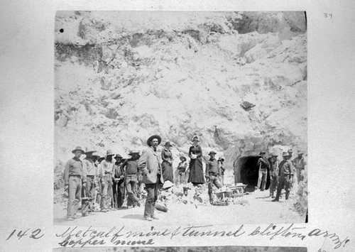
| Metcalf Mines (Arizona Copper Co. group; Metcalf Open pit), Clifton, Greenlee County, Arizona, USA | 33° 6' 47" N | 109° 21' 38" W | 2.1km (1.3 miles) | |
| Metcalf, Greenlee County, Arizona, USA | 33° 6' 41" N | 109° 21' 56" W | 2.3km (1.4 miles) | |
| Iolanthe prospect (Dead Pine prospect; El Moro prospect), King Gulch, Greenlee County, Arizona, USA | 33° 8' 8" N | 109° 20' 30" W | 2.3km (1.5 miles) | |
| Cuprite group, Santa Rosa Gulch, Greenlee County, Arizona, USA | 33° 7' 58" N | 109° 23' 30" W | 2.3km (1.5 miles) | |
| Miza Mine (Arizona Copper Co. property [in part]), Greenlee County, Arizona, USA | 33° 7' 5" N | 109° 23' 17" W | 2.5km (1.6 miles) | |
| La Palma group (La Palma claim; Venus claim; San Francisco claim; Laura group), Greenlee County, Arizona, USA | 33° 9' 11" N | 109° 23' 8" W | 3.0km (1.9 miles) | |
| Emerald Mine (Arizona Copper Co. property [in part]), Greenlee County, Arizona, USA | 33° 6' 33" N | 109° 23' 3" W | 3.0km (1.9 miles) | |
| Unnamed Silica pit, Greenlee County, Arizona, USA | 33° 6' 15" N | 109° 21' 56" W | 3.1km (1.9 miles) | |
| Clifton Copper Mines (San Jose; Copper Centre; Clifton gp; Standard gp; Standard Consolidated Copper Co.; Standard Mine; Standard Copper), Standard Gulch, Greenlee County, Arizona, USA | 33° 6' 11" N | 109° 21' 14" W | 3.4km (2.1 miles) | |
| Mansfield claim (Expectation group), Greenlee County, Arizona, USA | 33° 7' 32" N | 109° 19' 47" W | 3.5km (2.2 miles) | |
| Eleven and Celtic group (Celtic group; Veiled Prophet group), Placer Gulch, Greenlee County, Arizona, USA | 33° 7' 53" N | 109° 19' 45" W | 3.5km (2.2 miles) | |
| Copper Cliff Mine, Greenlee County, Arizona, USA | 33° 6' 24" N | 109° 23' 22" W | 3.5km (2.2 miles) | |
| Copper King Mountain, Greenlee County, Arizona, USA | 33° 7' 11" N | 109° 19' 51" W | 3.6km (2.2 miles) | |
| Parrot group (Kay Pat group; Essex; Ern), Greenlee County, Arizona, USA | 33° 6' 38" N | 109° 19' 59" W | 3.9km (2.4 miles) | |
| Copper King Mine (Copper Bullion Mine; Solid Copper Mine), Copper King Mountain, Greenlee County, Arizona, USA | 33° 6' 51" N | 109° 19' 45" W | 4.0km (2.5 miles) | |
| AMAX Exploration Inc. leases, Greenlee County, Arizona, USA | 33° 7' 58" N | 109° 19' 17" W | 4.2km (2.6 miles) | |
| Morenci Mordenite occurrence, Morenci, Greenlee County, Arizona, USA | 33° 10' 12" N | 109° 22' 18" W | 4.3km (2.6 miles) | |
| OBW Fry claim, Greenlee County, Arizona, USA | 33° 10' 12" N | 109° 22' 18" W | 4.3km (2.6 miles) | |
| Las Trajas Mine (Arizona Copper Co. property [in part]), Pinkaro Gulch, Greenlee County, Arizona, USA | 33° 6' 2" N | 109° 23' 39" W | 4.3km (2.7 miles) | |


Metcalf Mines, Clifton, Greenlee County, Arizona, USA