| Locality | Latitude | Longitude | Distance | Bearing |
|---|
| Marble Islands, Glacier Bay National Park, Glacier Bay Mining District, Alaska, USA | 58° 38' 36" N | 136° 2' 36" W | 1.6km (1.0 miles) | |
| Unnamed Prospect (ARDF - MF061; North Marble Island), Hoonah-Angoon Census Area, Alaska, USA | 58° 40' 18" N | 136° 3' 38" W | 1.7km (1.1 miles) | |
| Unnamed Prospect (ARDF - MF069; northeast side of Willoughby Island), Hoonah-Angoon Census Area, Alaska, USA | 58° 36' 0" N | 136° 7' 47" W | 7.7km (4.8 miles) | |
| Unnamed Mine (ARDF - MF067; Francis Island), Hoonah-Angoon Census Area, Alaska, USA | 58° 37' 32" N | 136° 10' 36" W | 7.8km (4.9 miles) | |
| Unnamed Prospect (ARDF - JU072; north of mouth of York Creek), Glacier Bay Mining District, Juneau Mining District, Alaska, USA | 58° 38' 51" N | 135° 55' 8" W | 8.0km (5.0 miles) | |
| Sandy Cove Prospect, Glacier Bay Mining District, Juneau Mining District, Alaska, USA | 58° 43' 15" N | 135° 58' 14" W | 8.7km (5.4 miles) | |
| Smith prospect; Treadwell Yukon Co.; Willoughby Island Mine, Hoonah-Angoon Census Area, Alaska, USA | 58° 35' 30" N | 136° 8' 26" W | 8.8km (5.4 miles) | |
| Miller Peak Occurrence, Glacier Bay Mining District, Juneau Mining District, Alaska, USA | 58° 43' 23" N | 135° 54' 14" W | 11.5km (7.1 miles) | |
| Mount Wright, Glacier Bay National Park, Glacier Bay Mining District, Alaska, USA | 58° 47' 52" N | 136° 1' 35" W | 15.8km (9.8 miles) | |
| Unnamed Occurrence (ARDF - JU056; near White Glacier), Glacier Bay Mining District, Juneau Mining District, Alaska, USA | 58° 49' 0" N | 135° 55' 8" W | 19.5km (12.1 miles) | |
| Unnamed Occurrence (ARDF - JU055; north of White Glacier), Glacier Bay Mining District, Juneau Mining District, Alaska, USA | 58° 49' 31" N | 135° 55' 30" W | 20.2km (12.5 miles) | |
| Unnamed Occurrence (ARDF - MF062; south of Tidal Inlet), Hoonah-Angoon Census Area, Alaska, USA | 58° 47' 34" N | 136° 20' 44" W | 22.6km (14.0 miles) | |
| Muir Inlet, Glacier Bay National Park, Glacier Bay Mining District, Alaska, USA | 58° 51' 59" N | 136° 5' 17" W | 23.4km (14.5 miles) | |
| Unnamed Occurrence (ARDF - JU024; northwest shore of outer Adams Inlet), Glacier Bay Mining District, Juneau Mining District, Alaska, USA | 58° 51' 55" N | 135° 58' 54" W | 23.6km (14.6 miles) | |
| Alaska Chief Prospect, Hoonah-Angoon Census Area, Alaska, USA | 58° 26' 40" N | 136° 6' 2" W | 23.7km (14.8 miles) | |
| Valley of Tears; Dundas River Mine, Hoonah-Angoon Census Area, Alaska, USA | 58° 30' 56" N | 136° 22' 4" W | 24.0km (14.9 miles) | |
| Barlett Cove, Glacier Bay National Park, Glacier Bay Mining District, Alaska, USA | 58° 27' 16" N | 135° 52' 57" W | 24.6km (15.3 miles) | |
| Unnamed Occurrence (ARDF - MF078; west of Alaska Chief), Hoonah-Angoon Census Area, Alaska, USA | 58° 26' 8" N | 136° 9' 10" W | 25.2km (15.7 miles) | |
| Unnamed Occurrence (ARDF - JU063; south tributary to Endicott River), Haines, Alaska, USA | 58° 43' 23" N | 135° 33' 52" W | 29.3km (18.2 miles) | |
| Unnamed Occurrence (ARDF - MF085; on Idaho Ridge), Hoonah-Angoon Census Area, Alaska, USA | 58° 54' 2" N | 136° 15' 28" W | 29.5km (18.3 miles) | |
| Unnamed Occurrence (ARDF - JU042; north of Endicott Lake), Glacier Bay Mining District, Juneau Mining District, Alaska, USA | 58° 50' 36" N | 135° 40' 32" W | 30.2km (18.8 miles) | |
| Unnamed Occurrence (ARDF - JU015; near terminus of Casement Glacier), Glacier Bay Mining District, Juneau Mining District, Alaska, USA | 58° 55' 27" N | 135° 57' 50" W | 30.2km (18.8 miles) | |
| Unnamed Occurrences (ARDF - MF057; southwest Gilbert Peninsula), Hoonah-Angoon Census Area, Alaska, USA | 58° 46' 28" N | 136° 33' 38" W | 32.0km (19.9 miles) | |
| Unnamed Prospect (ARDF - MF070; on Threesome Mountain), Hoonah-Angoon Census Area, Alaska, USA | 58° 31' 54" N | 136° 33' 56" W | 32.7km (20.3 miles) | |
| Endy Prospect, Haines, Alaska, USA | 58° 49' 19" N | 135° 34' 22" W | 33.4km (20.7 miles) | |
| Unnamed Occurrence (ARDF - MF075; east side of Dundas Bay), Hoonah-Angoon Census Area, Alaska, USA | 58° 22' 30" N | 136° 17' 16" W | 34.1km (21.2 miles) | |
| Unnamed Occurrence (ARDF - MF064; southwest of Red Mountain), Hoonah-Angoon Census Area, Alaska, USA | 58° 57' 56" N | 136° 2' 52" W | 34.4km (21.3 miles) | |
| Unnamed Occurrence (ARDF - MF083; east of Dundas Bay), Hoonah-Angoon Census Area, Alaska, USA | 58° 21' 0" N | 136° 10' 11" W | 34.8km (21.6 miles) | |
| Gustavus beach Prospect, Glacier Bay Mining District, Juneau Mining District, Alaska, USA | 58° 24' 38" N | 135° 41' 2" W | 34.8km (21.6 miles) | |
| Unnamed Occurrence (ARDF - JU025; on Mt. Young), Haines, Alaska, USA | 58° 51' 29" N | 135° 35' 20" W | 35.0km (21.7 miles) | |


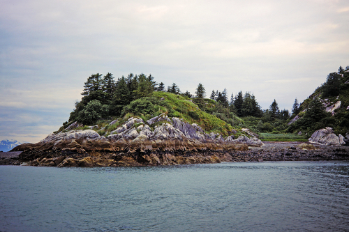


Marble Islands, Glacier Bay National Park, Glacier Bay Mining District, Alaska, USA