| Locality | Latitude | Longitude | Distance | Bearing |
|---|
| Summer Storm claim, Challis, Bay Horse Mining District, Custer County, Idaho, USA | 44° 19' 48" N | 114° 3' 58" W | 1.3km (0.8 miles) | |
| Rat's Nest claim (Rat's Nest mine), Challis, Bay Horse Mining District, Custer County, Idaho, USA | 44° 20' 50" N | 114° 4' 13" W | 2.1km (1.3 miles) | |
| Antelope Flat, Challis, Bay Horse Mining District, Custer County, Idaho, USA | 44° 18' 39" N | 114° 4' 10" W | 2.9km (1.8 miles) | |
| Devonian Dolomite (MRDS - 10289503), Custer County, Idaho, USA | 44° 21' 59" N | 114° 4' 26" W | 4.0km (2.5 miles) | |
| Grouse Creek Lake Prospect (Goose Lake Prospect), Custer County, Idaho, USA | 44° 23' 53" N | 113° 57' 35" W | 10.2km (6.3 miles) | |
| Benchmark Prospect (Unnamed Prospect), Custer County, Idaho, USA | 44° 25' 39" N | 113° 57' 4" W | 13.1km (8.1 miles) | |
| Mahogany Hill Prospect, Custer County, Idaho, USA | 44° 24' 44" N | 113° 54' 0" W | 14.8km (9.2 miles) | |
| Troxpar Prospect, Bay Horse Mining District, Custer County, Idaho, USA | 44° 28' 2" N | 114° 9' 0" W | 16.8km (10.4 miles) | |
| River View Mine, Bay Horse Mining District, Custer County, Idaho, USA | 44° 23' 10" N | 114° 17' 44" W | 20.3km (12.6 miles) | |
| Turtle Mine (No Name Mine; Turtleback), Bay Horse Mining District, Custer County, Idaho, USA | 44° 22' 5" N | 114° 18' 20" W | 20.6km (12.8 miles) | |
| Spar Canyon, Challis, Bay Horse Mining District, Custer County, Idaho, USA | 44° 13' 45" N | 114° 15' 57" W | 20.7km (12.9 miles) | |
| Excelsior Mine, Bay Horse Mining District, Custer County, Idaho, USA | 44° 23' 55" N | 114° 18' 0" W | 21.1km (13.1 miles) | |
| Kuna Prospect, Bay Horse Mining District, Custer County, Idaho, USA | 44° 23' 54" N | 114° 18' 0" W | 21.1km (13.1 miles) | |
| K-7 Tunnel, Challis, Bay Horse Mining District, Custer County, Idaho, USA | 44° 24' 9" N | 114° 18' 28" W | 21.8km (13.5 miles) | |
| Mammoth Prospect (Sheridan), Bay Horse Mining District, Custer County, Idaho, USA | 44° 18' 30" N | 114° 19' 23" W | 21.8km (13.6 miles) | |
| Henie Hinie Prospect (Nameless), Bay Horse Mining District, Custer County, Idaho, USA | 44° 23' 1" N | 114° 19' 9" W | 22.0km (13.7 miles) | |
| Hood Prospect, Bay Horse Mining District, Custer County, Idaho, USA | 44° 24' 11" N | 114° 18' 40" W | 22.1km (13.7 miles) | |
| Quartzite Occurrence (MRDS - 10168395), Bay Horse Mining District, Custer County, Idaho, USA | 44° 16' 1" N | 114° 19' 2" W | 22.5km (14.0 miles) | |
| Last Chance Mine, Bay Horse Mining District, Custer County, Idaho, USA | 44° 20' 59" N | 114° 19' 58" W | 22.5km (14.0 miles) | |
| McGregor Group, Bay Horse Mining District, Custer County, Idaho, USA | 44° 24' 29" N | 114° 18' 54" W | 22.6km (14.0 miles) | |
| Barton Mine, Bay Horse Mining District, Custer County, Idaho, USA | 44° 23' 44" N | 114° 19' 19" W | 22.6km (14.1 miles) | |
| Hoosier Mine, McGregor Group, Bay Horse Mining District, Custer County, Idaho, USA | 44° 23' 58" N | 114° 19' 24" W | 22.9km (14.2 miles) | |
| Pacific Mine (Silver Brick; Gleenland; Bayhorse; Little Fellow; Hoosier; Beardsley; Jefferson; Blain; Lincoln; Dave; Grant; Salmon River; Keno; Beardsley Ext.; Jackson; Democrat), McGregor Group, Bay Horse Mining District, Custer County, Idaho, USA | 44° 24' 39" N | 114° 19' 10" W | 23.0km (14.3 miles) | |
| Democrat (Vermont; Grizzly; Zodiac), Bay Horse Mining District, Custer County, Idaho, USA | 44° 24' 33" N | 114° 19' 21" W | 23.2km (14.4 miles) | |
| Bayhorse Lead (Bayhorse Mines Group), Custer County, Idaho, USA | 44° 22' 25" N | 114° 20' 13" W | 23.2km (14.4 miles) | |
| Silver Brick Mine, McGregor Group, Bay Horse Mining District, Custer County, Idaho, USA | 44° 24' 39" N | 114° 19' 19" W | 23.2km (14.4 miles) | |
| Thompson Creek Mine (Tungsten Jim Mine; Salmon River Scheelite Mine), Challis, Bay Horse Mining District, Custer County, Idaho, USA | 44° 30' 0" N | 114° 13' 59" W | 23.5km (14.6 miles) | |
| Cachelot Mine (Chalspar Mine; Marantha Mine; Holterman; Kraken Hill Mine), Challis, Bay Horse Mining District, Custer County, Idaho, USA | 44° 30' 0" N | 114° 13' 59" W | 23.5km (14.6 miles) | |
| Keno Mine, McGregor Group, Bay Horse Mining District, Custer County, Idaho, USA | 44° 24' 57" N | 114° 19' 24" W | 23.5km (14.6 miles) | |
| Hilltop Occurrence (Hilltop 1; 2; 3; 4), Custer County, Idaho, USA | 44° 10' 8" N | 113° 51' 45" W | 23.7km (14.7 miles) | |

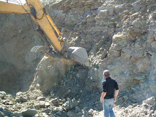


Rat's Nest claim, Challis, Bay Horse Mining District, Custer County, Idaho, USA