| Locality | Latitude | Longitude | Distance | Bearing |
|---|
| Bayard, Morrill County, Nebraska, USA | 41° 45' 18" N | 103° 19' 24" W | 0.0km (0.0 miles) | |
| Chimney Rock, Morrill County, Nebraska, USA | 41° 42' 13" N | 103° 20' 52" W | 6.0km (3.7 miles) | |
| Angora, Morrill County, Nebraska, USA | 41° 51' 7" N | 103° 7' 31" W | 19.7km (12.2 miles) | |
| Bridgeport, Morrill County, Nebraska, USA | 41° 39' 55" N | 103° 5' 54" W | 21.2km (13.2 miles) | |
| Broadwater, Morrill County, Nebraska, USA | 41° 35' 46" N | 102° 51' 7" W | 43.0km (26.7 miles) | |
| Mitchell, Scotts Bluff County, Nebraska, USA | 41° 56' 25" N | 103° 48' 29" W | 45.1km (28.0 miles) | |
| Potter meteorite, Cheyenne County, Nebraska, USA | 41° 13' 59" N | 103° 17' 59" W | 58.0km (36.1 miles) | |
| Lisco, Garden County, Nebraska, USA | 41° 29' 49" N | 102° 37' 12" W | 65.1km (40.5 miles) | |
| Henry, Scotts Bluff County, Nebraska, USA | 41° 59' 55" N | 104° 2' 48" W | 65.7km (40.8 miles) | |
| Albin (pallasite) meteorite, Laramie County, Wyoming, USA | 41° 30' 0" N | 104° 5' 59" W | 70.4km (43.8 miles) | |
| Goshen Hole Placers, Goshen County, Wyoming, USA | 41° 37' 30" N | 104° 10' 0" W | 71.4km (44.4 miles) | |
| Marsland meteorite, Dawes County, Nebraska, USA | 42° 27' 0" N | 103° 17' 59" W | 77.3km (48.0 miles) | |
| Agate Springs Fossil Quarries, Agate Fossil Beds National Monument, Sioux County, Nebraska, USA | 42° 25' 0" N | 103° 43' 39" W | 80.8km (50.2 miles) | |
| Agate, Sioux County, Nebraska, USA | 42° 25' 11" N | 103° 47' 36" W | 83.5km (51.9 miles) | |
| Goshen Hole, Platte County, Wyoming, USA | 41° 59' 34" N | 104° 19' 3" W | 86.4km (53.7 miles) | |
| Unknown Uranium Occurrence (MRDS - 10018885), Hartville Mining District, Goshen County, Wyoming, USA | 42° 18' 46" N | 104° 3' 34" W | 86.8km (53.9 miles) | |
| Spoon Buttes, Goshen County, Wyoming, USA | 42° 19' 30" N | 104° 4' 47" W | 89.0km (55.3 miles) | |
| Sioux County meteorite, Sioux County, Nebraska, USA | 42° 34' 59" N | 103° 40' 0" W | 96.3km (59.9 miles) | |
| Crow Butte uranium deposit, Dawes County, Nebraska, USA | 42° 38' 45" N | 103° 21' 9" W | 99.1km (61.6 miles) | |
| Crawford Dam, Crawford, Dawes County, Nebraska, USA | 42° 39' 56" N | 103° 25' 15" W | 101.6km (63.1 miles) | |
| Goshen Hole Rim, Goshen County, Wyoming, USA | 41° 49' 22" N | 104° 32' 59" W | 101.9km (63.3 miles) | |
| Chappell, Deuel County, Nebraska, USA | 41° 5' 33" N | 102° 28' 14" W | 102.4km (63.6 miles) | |
| Crawford, Dawes County, Nebraska, USA | 42° 40' 58" N | 103° 24' 45" W | 103.5km (64.3 miles) | |
| Phillip and Flanagan Claims, Sweetwater County, Wyoming, USA | 42° 27' 0" N | 104° 13' 59" W | 107.7km (66.9 miles) | |
| Lewellen, Garden County, Nebraska, USA | 41° 19' 53" N | 102° 8' 36" W | 109.0km (67.7 miles) | |
| Furney Manganese Prospect, Weld County, Colorado, USA | 40° 58' 25" N | 104° 9' 22" W | 111.2km (69.1 miles) | |
| Unnamed Uranium Occurrence (MRDS - 10011647), North Sterling Reservoir Area, Logan County, Colorado, USA | 40° 45' 0" N | 103° 16' 57" W | 111.8km (69.5 miles) | |
| Harrison, Sioux County, Nebraska, USA | 42° 41' 13" N | 103° 52' 56" W | 113.4km (70.5 miles) | |
| Unknown Uranium Occurrence (MRDS - 10091596), Goshen County, Wyoming, USA | 42° 23' 56" N | 104° 23' 32" W | 113.6km (70.6 miles) | |
| Unknown Graphite Occurrence (MRDS - 10157786), Hartville Mining District, Goshen County, Wyoming, USA | 42° 17' 20" N | 104° 30' 10" W | 114.0km (70.9 miles) | |
Minerals recorded nearby (within 20 km)
Rock types recorded nearby (within 20 km)
Entries shown in red are rocks recorded for this region.


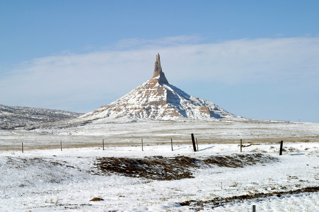


Chimney Rock, Morrill County, Nebraska, USA