| Locality | Latitude | Longitude | Distance | Bearing |
|---|
| Cap Diamant, Quebec City (Agglomération de Québec), Capitale-Nationale, Québec, Canada | 46° 48' 21" N | 71° 12' 24" W | 0.7km (0.4 miles) | |
| Tibbits Cove, Lévis TE, Chaudière-Appalaches, Québec, Canada | 46° 47' 49" N | 71° 11' 34" W | 1.5km (0.9 miles) | |
| Lévis TE, Chaudière-Appalaches, Québec, Canada | 46° 48' 41" N | 71° 10' 36" W | 1.8km (1.1 miles) | |
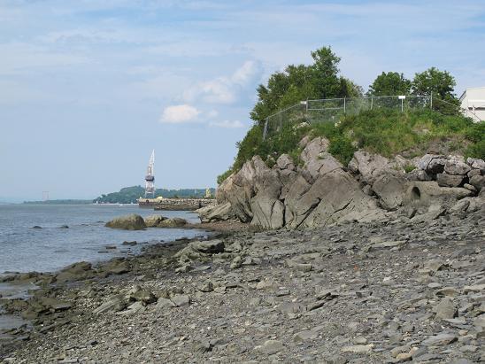
| De La Grève Jolliet, Lévis TE, Chaudière-Appalaches, Québec, Canada | 46° 49' 36" N | 71° 10' 18" W | 2.8km (1.8 miles) | |
| Rivière Linière, Robert-Cliche RCM, Chaudière-Appalaches, Québec, Canada | 46° 24' 59" N | 70° 59' 57" W | 46.4km (28.8 miles) | |
| Rivière-du-Loup, Robert-Cliche RCM, Chaudière-Appalaches, Québec, Canada | 46° 24' 59" N | 70° 59' 57" W | 46.4km (28.8 miles) | |
| Construction et Pavage Portneuf quarry, Portneuf RCM, Capitale-Nationale, Québec, Canada | 46° 43' 5" N | 71° 54' 32" W | 55.0km (34.1 miles) | |
| Harvey Hill mine, Saint-Pierre-de-Broughton (West Broughton), Les Appalaches RCM, Chaudière-Appalaches, Québec, Canada | 46° 16' 0" N | 71° 12' 28" W | 60.4km (37.5 miles) | |
| Broughton talc mine (Luzcan mine; Carrière rang XV), Saint-Pierre-de-Broughton (West Broughton), Les Appalaches RCM, Chaudière-Appalaches, Québec, Canada | 46° 15' 35" N | 71° 13' 8" W | 61.2km (38.0 miles) | |
| Tring-Jonction, Robert-Cliche RCM, Chaudière-Appalaches, Québec, Canada | 46° 16' 15" N | 70° 59' 42" W | 61.9km (38.5 miles) | |
| Bernstein deposit, Broughton, Chaudière-Appalaches, Québec, Canada | 46° 14' 54" N | 71° 5' 17" W | 63.0km (39.2 miles) | |
| Carey mine (Carey Canada Inc. mine), Tring-Jonction, Robert-Cliche RCM, Chaudière-Appalaches, Québec, Canada | 46° 15' 15" N | 71° 2' 11" W | 63.0km (39.2 miles) | |
| Boston Mine, Tring-Jonction, Robert-Cliche RCM, Chaudière-Appalaches, Québec, Canada | 46° 14' 53" N | 71° 3' 34" W | 63.4km (39.4 miles) | |
| Saint-Joseph-de-Beauce quarry (Calway Quarry), Saint-Joseph-de-Beauce, Robert-Cliche RCM, Chaudière-Appalaches, Québec, Canada | 46° 18' 46" N | 70° 46' 0" W | 64.5km (40.1 miles) | |
| Route 73 road cut, Saint-Joseph-de-Beauce, Robert-Cliche RCM, Chaudière-Appalaches, Québec, Canada | 46° 17' 25" N | 70° 48' 28" W | 65.1km (40.5 miles) | |
| Frontenac mine, East Broughton, Les Appalaches RCM, Chaudière-Appalaches, Québec, Canada | 46° 13' 44" N | 71° 5' 20" W | 65.2km (40.5 miles) | |
| 11e Rang, Saint-Pierre-de-Broughton (West Broughton), Les Appalaches RCM, Chaudière-Appalaches, Québec, Canada | 46° 13' 23" N | 71° 11' 2" W | 65.2km (40.5 miles) | |
| Fraser Mine, East Broughton, Les Appalaches RCM, Chaudière-Appalaches, Québec, Canada | 46° 13' 27" N | 71° 5' 17" W | 65.7km (40.8 miles) | |
| Montréal-Broughton mine, Sacré-Cœur-de-Jésus, Les Appalaches RCM, Chaudière-Appalaches, Québec, Canada | 46° 12' 24" N | 71° 7' 18" W | 67.3km (41.8 miles) | |
| Rivière des Plantes placer, Beauceville, Robert-Cliche RCM, Chaudière-Appalaches, Québec, Canada | 46° 15' 27" N | 70° 48' 12" W | 68.5km (42.6 miles) | |
| Beauceville Industrial park Quarry, Beauceville, Robert-Cliche RCM, Chaudière-Appalaches, Québec, Canada | 46° 13' 36" N | 70° 46' 55" W | 72.3km (44.9 miles) | |
| Federal Mine, Robertsonville, Thetford Mines, Les Appalaches RCM, Chaudière-Appalaches, Québec, Canada | 46° 9' 16" N | 71° 13' 0" W | 72.9km (45.3 miles) | |
| Federal Mine, Chaudière-Appalaches, Québec, Canada | 46° 9' 16" N | 71° 13' 0" W | 72.9km (45.3 miles) | |
| Pontbriand, Thetford Mines, Les Appalaches RCM, Chaudière-Appalaches, Québec, Canada | 46° 9' 12" N | 71° 15' 15" W | 73.1km (45.4 miles) | |
| Robertsonville, Thetford Mines, Les Appalaches RCM, Chaudière-Appalaches, Québec, Canada | 46° 8' 29" N | 71° 12' 53" W | 74.3km (46.2 miles) | |
| Pennington mine, Pontbriand, Thetford Mines, Les Appalaches RCM, Chaudière-Appalaches, Québec, Canada | 46° 8' 13" N | 71° 15' 10" W | 74.9km (46.6 miles) | |
| National mine, Pontbriand, Thetford Mines, Les Appalaches RCM, Chaudière-Appalaches, Québec, Canada | 46° 8' 7" N | 71° 15' 10" W | 75.1km (46.7 miles) | |
| Flintkote mine, Pontbriand, Thetford Mines, Les Appalaches RCM, Chaudière-Appalaches, Québec, Canada | 46° 7' 45" N | 71° 16' 19" W | 75.9km (47.2 miles) | |
| Rapides-du-Diable, Beauceville, Robert-Cliche RCM, Chaudière-Appalaches, Québec, Canada | 46° 11' 53" N | 70° 45' 2" W | 76.2km (47.4 miles) | |
| Tetreault Mine, Mékinac RCM, Mauricie, Québec, Canada | 46° 46' 45" N | 72° 13' 41" W | 78.4km (48.7 miles) | |
Minerals recorded nearby (within 20 km)
Rock types recorded nearby (within 20 km)
Entries shown in red are rocks recorded for this region.


De La Grève Jolliet, Lévis TE, Chaudière-Appalaches, Québec, Canada