| Locality | Latitude | Longitude | Distance | Bearing |
|---|
| Unnamed quarry, Waterworks Valley, St Lawrence, Jersey | 49° 12' 30" N | 2° 8' 9" W | 0.7km (0.4 miles) | |
| Waterworks Valley, St Lawrence, Jersey | 49° 12' 27" N | 2° 8' 3" W | 0.7km (0.4 miles) | |
| Jersey minette outcrops, St Helier, Jersey | 49° 12' 0" N | 2° 7' 0" W | 1.8km (1.1 miles) | |
| La Gigoulande Quarry, St Peter, Jersey | 49° 13' 29" N | 2° 10' 14" W | 3.2km (2.0 miles) | |
| Hermitage, St Helier, Jersey | 49° 10' 23" N | 2° 7' 31" W | 3.5km (2.2 miles) | |
| La Saline Quarry, St John, Jersey | 49° 15' 5" N | 2° 8' 13" W | 5.4km (3.3 miles) | |
| La Saline/Mont Mado Quarry, St John, Jersey | 49° 15' 5" N | 2° 8' 4" W | 5.4km (3.4 miles) | |
| Le Côtil Point, St John, Jersey | 49° 15' 12" N | 2° 8' 4" W | 5.6km (3.5 miles) | |
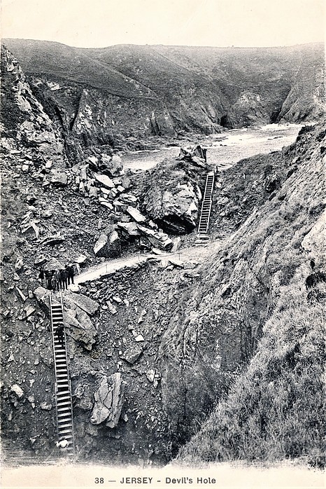
| Devil's Hole, St Mary, Jersey | 49° 15' 5" N | 2° 10' 24" W | 5.9km (3.7 miles) | |
| La Moye, St Brelade, Jersey | 49° 11' 4" N | 2° 13' 10" W | 6.1km (3.8 miles) | |
| Ronez quarry, St John, Jersey | 49° 15' 31" N | 2° 9' 13" W | 6.3km (3.9 miles) | |
| Sorel Point, St John, Jersey | 49° 15' 32" N | 2° 9' 32" W | 6.3km (3.9 miles) | |
| Le Nez Point, Le Hocq, St Clement, Jersey | 49° 10' 0" N | 2° 4' 0" W | 6.8km (4.2 miles) | |
| Le Hocq, St Clement, Jersey | 49° 10' 0" N | 2° 3' 42" W | 7.0km (4.4 miles) | |
| L'Etacq Quarry, St Ouen, Jersey | 49° 14' 8" N | 2° 13' 41" W | 7.3km (4.5 miles) | |
| Old L'Etacq Quarry, St Ouen, Jersey | 49° 14' 14" N | 2° 14' 1" W | 7.7km (4.8 miles) | |
| Le Pulec, St Ouen, Jersey | 49° 14' 33" N | 2° 14' 58" W | 9.0km (5.6 miles) | |
| No. 1 lode, Le Pulec, St Ouen, Jersey | 49° 14' 39" N | 2° 15' 0" W | 9.1km (5.7 miles) | |
| Sark's Hope Shaft, Sark's Hope Mine, Little Sark, Sark, Bailiwick of Guernsey | 49° 24' 34" N | 2° 22' 35" W | 28.6km (17.8 miles) | |
| Sark's Hope Mine, Little Sark, Sark, Bailiwick of Guernsey | 49° 24' 38" N | 2° 22' 26" W | 28.6km (17.8 miles) | |
| Le Pelley's Shaft, Sark's Hope Mine, Little Sark, Sark, Bailiwick of Guernsey | 49° 24' 38" N | 2° 22' 30" W | 28.6km (17.8 miles) | |
| Little Sark, Sark, Bailiwick of Guernsey | 49° 24' 49" N | 2° 22' 30" W | 28.9km (18.0 miles) | |
| Port-ès-Sées, Greater Sark, Sark, Bailiwick of Guernsey | 49° 25' 35" N | 2° 22' 10" W | 29.9km (18.6 miles) | |
| Greater Sark, Sark, Bailiwick of Guernsey | 49° 25' 48" N | 2° 21' 59" W | 30.1km (18.7 miles) | |
| Port du Moulin, Greater Sark, Sark, Bailiwick of Guernsey | 49° 26' 18" N | 2° 22' 8" W | 31.0km (19.2 miles) | |
| Lucy's shaft, Herm, St. Peter Port, Guernsey, Bailiwick of Guernsey | 49° 28' 1" N | 2° 26' 41" W | 36.7km (22.8 miles) | |
| Reading shaft, Herm, St. Peter Port, Guernsey, Bailiwick of Guernsey | 49° 28' 2" N | 2° 26' 43" W | 36.7km (22.8 miles) | |
| Fritot alluvium deposits, Le Rozel, Cherbourg, Manche, Normandy, France | 49° 29' 17" N | 1° 48' 41" W | 39.7km (24.7 miles) | |
| Barkers Quarry, St. Sampson's, Guernsey, Bailiwick of Guernsey | 49° 28' 26" N | 2° 31' 57" W | 41.4km (25.7 miles) | |
| Les Rocques Barrees Quarry, Vale, Guernsey, Bailiwick of Guernsey | 49° 29' 19" N | 2° 30' 36" W | 41.5km (25.8 miles) | |


Devil's Hole, St Mary, Jersey