| Locality | Latitude | Longitude | Distance | Bearing |
|---|
| Hungry Hill, Guilford, New Haven County, Connecticut, USA | 41° 18' 56" N | 72° 41' 40" W | 4.1km (2.5 miles) | |
| Hoadley Point Quarries, Branford, New Haven County, Connecticut, USA | 41° 15' 26" N | 72° 43' 58" W | 5.5km (3.4 miles) | |
| Stony Creek Quarry (Norcross Granite Gneiss Rock Quarries; Castellucci Quarry), Branford, New Haven County, Connecticut, USA | 41° 17' 12" N | 72° 44' 33" W | 5.6km (3.5 miles) | |
| Stony Creek Red Granite Company quarry, Branford, New Haven County, Connecticut, USA | 41° 17' 19" N | 72° 44' 44" W | 5.9km (3.6 miles) | |
| Leetes Quarry, Stony Creek, Branford, New Haven County, Connecticut, USA | 41° 16' 6" N | 72° 45' 8" W | 6.5km (4.1 miles) | |
| Stony Creek, Branford, New Haven County, Connecticut, USA | 41° 15' 57" N | 72° 45' 7" W | 6.6km (4.1 miles) | |
| North Branford, New Haven County, Connecticut, USA | 41° 19' 36" N | 72° 46' 9" W | 9.3km (5.8 miles) | |
| Hammonassett Beach, Madison, New Haven County, Connecticut, USA | 41° 16' 0" N | 72° 33' 32" W | 9.9km (6.2 miles) | |
| Branford, New Haven County, Connecticut, USA | 41° 16' 45" N | 72° 48' 53" W | 11.6km (7.2 miles) | |
| North Branford Quarry, North Branford, New Haven County, Connecticut, USA | 41° 20' 26" N | 72° 47' 38" W | 11.8km (7.4 miles) | |
| Farm River Rock Quarry, East Haven, New Haven County, Connecticut, USA | 41° 20' 30" N | 72° 49' 6" W | 13.6km (8.5 miles) | |
| Foxon, East Haven, New Haven County, Connecticut, USA | 41° 19' 28" N | 72° 50' 9" W | 14.2km (8.8 miles) | |
| Rockland Preserve, Madison, New Haven County, Connecticut, USA | 41° 25' 6" N | 72° 40' 15" W | 15.2km (9.5 miles) | |
| McLay Avenue, East Haven, New Haven County, Connecticut, USA | 41° 18' 6" N | 72° 51' 53" W | 15.9km (9.9 miles) | |
| Cinque Quarry, East Haven, New Haven County, Connecticut, USA | 41° 18' 3" N | 72° 51' 55" W | 15.9km (9.9 miles) | |
| High Street and Interstate 95 interchange, East Haven, New Haven County, Connecticut, USA | 41° 16' 59" N | 72° 52' 14" W | 16.2km (10.1 miles) | |
| Foxon quarry, Foxon, East Haven, New Haven County, Connecticut, USA | 41° 18' 56" N | 72° 52' 1" W | 16.4km (10.2 miles) | |
| East Haven, New Haven County, Connecticut, USA | 41° 16' 37" N | 72° 52' 22" W | 16.4km (10.2 miles) | |
| Fair Haven, New Haven, New Haven County, Connecticut, USA | 41° 18' 14" N | 72° 52' 44" W | 17.1km (10.6 miles) | |
| Mica Hills pegmatites and prospects, Durham, Middlesex County, Connecticut, USA | 41° 26' 40" N | 72° 40' 50" W | 18.1km (11.3 miles) | |
| North Haven, New Haven County, Connecticut, USA | 41° 23' 19" N | 72° 51' 39" W | 19.5km (12.1 miles) | |
| East Rock, New Haven, New Haven County, Connecticut, USA | 41° 19' 35" N | 72° 54' 14" W | 19.7km (12.2 miles) | |
| Mill Rock, Hamden, New Haven County, Connecticut, USA | 41° 20' 16" N | 72° 54' 51" W | 20.9km (13.0 miles) | |
| New Haven, New Haven County, Connecticut, USA | 41° 18' 27" N | 72° 55' 34" W | 21.1km (13.1 miles) | |
| Reed's Gap Quarry (New Haven Trap Rock quarry; Tilcon Durham quarry), Durham, Middlesex County, Connecticut, USA | 41° 28' 5" N | 72° 43' 54" W | 21.3km (13.2 miles) | |
| Hamden, New Haven County, Connecticut, USA | 41° 22' 59" N | 72° 54' 6" W | 22.0km (13.7 miles) | |
| Durham, Middlesex County, Connecticut, USA | 41° 28' 54" N | 72° 40' 51" W | 22.3km (13.8 miles) | |
| State Route 9 rock cuts, Haddam, Middlesex County, Connecticut, USA | 41° 26' 45" N | 72° 31' 14" W | 22.4km (13.9 miles) | |
| Ultramafic rock bodies, Haddam, Middlesex County, Connecticut, USA | 41° 26' 9" N | 72° 29' 33" W | 23.0km (14.3 miles) | |
| Wallingford, New Haven County, Connecticut, USA | 41° 27' 24" N | 72° 49' 23" W | 23.0km (14.3 miles) | |
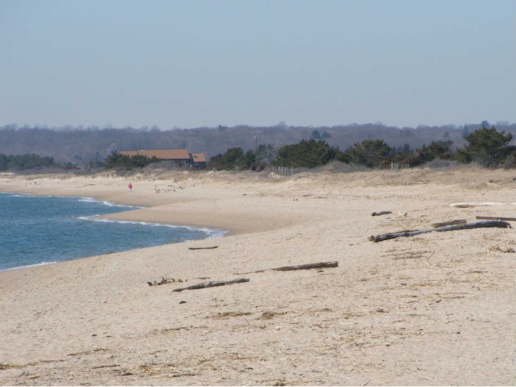


Hammonassett Beach, Madison, New Haven County, Connecticut, USA