| Locality | Latitude | Longitude | Distance | Bearing |
|---|
| Harvey Black Mine, Navajo County, Arizona, USA | 36° 59' 30" N | 110° 12' 27" W | 1.6km (1.0 miles) | |
| Spencer No. 1 (Spencer #1; Harvey Black #2), Navajo County, Arizona, USA | 36° 59' 27" N | 110° 13' 24" W | 2.9km (1.8 miles) | |
| Goulding, San Juan County, Utah, USA | 37° 0' 18" N | 110° 13' 4" W | 3.1km (1.9 miles) | |
| Unnamed U deposit [1], Navajo County, Arizona, USA | 36° 57' 45" N | 110° 13' 7" W | 3.7km (2.3 miles) | |
| Rock Door No. 1, San Juan County, Utah, USA | 37° 0' 52" N | 110° 12' 55" W | 3.8km (2.4 miles) | |
| Channel No. 32 (Paleochannel No. 32), Navajo County, Arizona, USA | 36° 59' 8" N | 110° 14' 1" W | 3.8km (2.4 miles) | |
| Channel No. 33 (Paleochannel No. 33), Navajo County, Arizona, USA | 36° 59' 8" N | 110° 14' 3" W | 3.8km (2.4 miles) | |
| Skyline Mine, San Juan County, Utah, USA | 37° 1' 12" N | 110° 13' 54" W | 5.2km (3.2 miles) | |
| Triangle Channel (Channel No. 34), Navajo County, Arizona, USA | 36° 59' 2" N | 110° 15' 0" W | 5.2km (3.3 miles) | |
| Mitten No. 2 Mine, Monument No. 1 channel (Channel No. 36), Mystery Valley, Mineral Mining District, Navajo County, Arizona, USA | 36° 57' 5" N | 110° 13' 55" W | 5.4km (3.3 miles) | |
| Monument No. 1 channel (Channel No. 36), Mystery Valley, Mineral Mining District, Navajo County, Arizona, USA | 36° 56' 54" N | 110° 13' 49" W | 5.5km (3.4 miles) | |
| Monument No. 1 Mine, Monument No. 1 channel (Channel No. 36), Mystery Valley, Mineral Mining District, Navajo County, Arizona, USA | 36° 56' 54" N | 110° 13' 49" W | 5.5km (3.4 miles) | |
| Channel No. 35 (Paleochannel No. 35), Navajo County, Arizona, USA | 36° 58' 8" N | 110° 15' 5" W | 5.7km (3.6 miles) | |
| Mitten No. 1 Mine, San Juan County, Utah, USA | 37° 1' 9" N | 110° 14' 38" W | 5.9km (3.7 miles) | |
| Gold Crown Mine, Mystery Valley, Mineral Mining District, Navajo County, Arizona, USA | 36° 56' 52" N | 110° 14' 29" W | 6.2km (3.9 miles) | |
| Skyline Road occurrence, San Juan County, Utah, USA | 37° 1' 6" N | 110° 15' 36" W | 7.1km (4.4 miles) | |
| Tom Holliday prospect, San Juan County, Utah, USA | 37° 1' 6" N | 110° 15' 36" W | 7.1km (4.4 miles) | |
| Channel No. 61 (Paleochannel No. 61), Navajo County, Arizona, USA | 36° 58' 8" N | 110° 16' 3" W | 7.1km (4.4 miles) | |
| Unnamed U deposit [10], Boot Mesa, Navajo County, Arizona, USA | 36° 56' 54" N | 110° 15' 19" W | 7.1km (4.4 miles) | |
| Mitchell Mesa, Mineral Mining District, Navajo County, Arizona, USA | 36° 58' 18" N | 110° 6' 37" W | 7.4km (4.6 miles) | |
| Mitchell Mesa No. 3 channel (Channel No. 52), Mitchell Mesa prospects, Mitchell Mesa, Mineral Mining District, Navajo County, Arizona, USA | 36° 57' 7" N | 110° 7' 7" W | 7.5km (4.6 miles) | |
| Mitchell Mesa prospects, Mitchell Mesa, Mineral Mining District, Navajo County, Arizona, USA | 36° 57' 50" N | 110° 6' 42" W | 7.5km (4.7 miles) | |
| H. Binoli claim (Mitchell Mesa No. 1; Channel No. 51), Mitchell Mesa prospects, Mitchell Mesa, Mineral Mining District, Navajo County, Arizona, USA | 36° 57' 19" N | 110° 6' 47" W | 7.8km (4.8 miles) | |
| Moonlight Mine, Navajo County, Arizona, USA | 36° 57' 37" N | 110° 16' 22" W | 7.8km (4.9 miles) | |
| Mystery Valley, Mineral Mining District, Navajo County, Arizona, USA | 36° 54' 31" N | 110° 11' 12" W | 8.7km (5.4 miles) | |
| Mitchell Mesa No. 2 channel (Channel No. 50), Mitchell Mesa prospects, Mitchell Mesa, Mineral Mining District, Navajo County, Arizona, USA | 36° 57' 8" N | 110° 6' 9" W | 8.7km (5.4 miles) | |
| Fern No. 4 Mine, Hoskinnini Mesa, Navajo County, Arizona, USA | 36° 59' 30" N | 110° 17' 27" W | 8.9km (5.5 miles) | |
| Daylight Mine, Boot Mesa, Navajo County, Arizona, USA | 36° 56' 48" N | 110° 16' 54" W | 9.2km (5.7 miles) | |
| Fern No. 1 Mine (Fern #1 Mine), Hoskinnini Mesa, Navajo County, Arizona, USA | 36° 59' 28" N | 110° 17' 46" W | 9.4km (5.8 miles) | |
| Big Chief Mine (Big Chief No. 3 & 4 claims), Boot Mesa, Navajo County, Arizona, USA | 36° 56' 26" N | 110° 17' 14" W | 10.0km (6.2 miles) | |


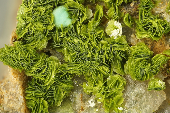


Monument No. 1 Mine, Monument No. 1 channel, Mystery Valley, Mineral Mining District, Navajo County, Arizona, USA