| Locality | Latitude | Longitude | Distance | Bearing |
|---|
| Rozello, Traves, Metropolitan City of Turin, Piedmont, Italy | 45° 16' 14" N | 7° 26' 29" E | 1.0km (0.6 miles) | |
| Ponte del Diavolo (Ponte del Roch), Lanzo Torinese, Metropolitan City of Turin, Piedmont, Italy | 45° 16' 6" N | 7° 28' 53" E | 2.4km (1.5 miles) | |
| Punta Serena, Traves, Metropolitan City of Turin, Piedmont, Italy | 45° 16' 2" N | 7° 25' 14" E | 2.4km (1.5 miles) | |
| Borna di Pugnetto (Grotta di Pugnetto), Pugnetto, Mezzenile, Metropolitan City of Turin, Piedmont, Italy | 45° 16' 21" N | 7° 24' 45" E | 3.1km (2.0 miles) | |
| Pugnetto, Mezzenile, Metropolitan City of Turin, Piedmont, Italy | 45° 16' 28" N | 7° 24' 43" E | 3.2km (2.0 miles) | |
| Pra Marella - I Bant, Mezzenile, Metropolitan City of Turin, Piedmont, Italy | 45° 16' 15" N | 7° 24' 27" E | 3.5km (2.2 miles) | |
| Chiaves, Monastero di Lanzo, Metropolitan City of Turin, Piedmont, Italy | 45° 17' 58" N | 7° 25' 33" E | 4.3km (2.7 miles) | |
| Fubina, Viù, Metropolitan City of Turin, Piedmont, Italy | 45° 14' 13" N | 7° 24' 8" E | 5.0km (3.1 miles) | |
| Croce di Chiaves, Chiaves, Monastero di Lanzo, Metropolitan City of Turin, Piedmont, Italy | 45° 18' 5" N | 7° 24' 33" E | 5.2km (3.2 miles) | |
| Colle Forcola, Corio, Metropolitan City of Turin, Piedmont, Italy | 45° 17' 44" N | 7° 30' 5" E | 5.2km (3.2 miles) | |
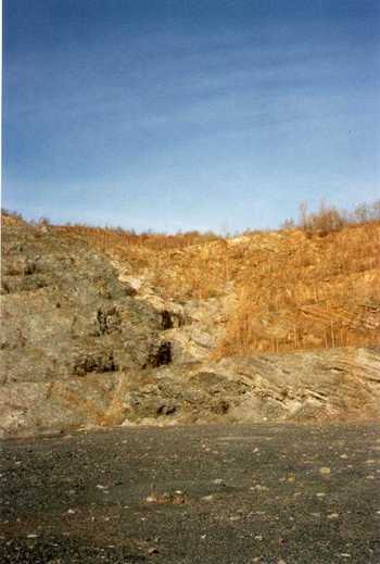
| Poggio San Vittore asbestos mine, Balangero, Metropolitan City of Turin, Piedmont, Italy | 45° 17' 32" N | 7° 30' 49" E | 5.7km (3.6 miles) | |
| Catelli, Mezzenile, Metropolitan City of Turin, Piedmont, Italy | 45° 17' 55" N | 7° 23' 33" E | 5.9km (3.7 miles) | |
| Punta Gensane, Col San Giovanni, Viù, Metropolitan City of Turin, Piedmont, Italy | 45° 13' 33" N | 7° 23' 39" E | 6.3km (3.9 miles) | |
| Case Baratonia, Varisella, Metropolitan City of Turin, Piedmont, Italy | 45° 12' 42" N | 7° 30' 5" E | 7.2km (4.4 miles) | |
| Santa Maria della Neve, Varisella, Metropolitan City of Turin, Piedmont, Italy | 45° 12' 13" N | 7° 28' 47" E | 7.2km (4.5 miles) | |
| Col San Giovanni, Viù, Metropolitan City of Turin, Piedmont, Italy | 45° 12' 55" N | 7° 22' 38" E | 8.0km (5.0 miles) | |
| Ladant, Voragno, Ceres, Metropolitan City of Turin, Piedmont, Italy | 45° 19' 12" N | 7° 22' 53" E | 8.2km (5.1 miles) | |
| Mount Crusat, Viù, Metropolitan City of Turin, Piedmont, Italy | 45° 12' 26" N | 7° 22' 57" E | 8.4km (5.2 miles) | |
| Voragno, Ceres, Metropolitan City of Turin, Piedmont, Italy | 45° 19' 7" N | 7° 22' 21" E | 8.5km (5.3 miles) | |
| Monte di Voragno talc mine (Monte di Voragno-Bellacosta Mine), Voragno, Ceres, Metropolitan City of Turin, Piedmont, Italy | 45° 19' 10" N | 7° 22' 16" E | 8.7km (5.4 miles) | |
| Colle Portia (Colle della Portia), Val della Torre, Metropolitan City of Turin, Piedmont, Italy | 45° 11' 15" N | 7° 24' 34" E | 9.3km (5.8 miles) | |
| Truc di Miola outcrop, La Cassa, Metropolitan City of Turin, Piedmont, Italy | 45° 11' 38" N | 7° 30' 47" E | 9.3km (5.8 miles) | |
| Testa Paian, Ala di Stura, Metropolitan City of Turin, Piedmont, Italy | 45° 18' 2" N | 7° 20' 20" E | 9.6km (6.0 miles) | |
| Bracchiello, Ceres, Metropolitan City of Turin, Piedmont, Italy | 45° 19' 22" N | 7° 21' 14" E | 9.9km (6.2 miles) | |
| Bracchiello Quarry, Bracchiello, Ceres, Metropolitan City of Turin, Piedmont, Italy | 45° 19' 27" N | 7° 21' 20" E | 9.9km (6.2 miles) | |
| Muande Castello, Val della Torre, Metropolitan City of Turin, Piedmont, Italy | 45° 10' 21" N | 7° 25' 33" E | 10.5km (6.5 miles) | |
| Chiampernotto, Ceres, Metropolitan City of Turin, Piedmont, Italy | 45° 19' 17" N | 7° 20' 32" E | 10.6km (6.6 miles) | |
| Arpone Mountain, Rubiana, Metropolitan City of Turin, Piedmont, Italy | 45° 10' 36" N | 7° 23' 47" E | 10.7km (6.7 miles) | |
| Cantoira quarry, Cantoira, Metropolitan City of Turin, Piedmont, Italy | 45° 20' 48" N | 7° 22' 5" E | 11.1km (6.9 miles) | |
| Colle Del Lys, Rubiana, Metropolitan City of Turin, Piedmont, Italy | 45° 10' 40" N | 7° 22' 57" E | 11.1km (6.9 miles) | |


Poggio San Vittore asbestos mine, Balangero, Metropolitan City of Turin, Piedmont, Italy