| Locality | Latitude | Longitude | Distance | Bearing |
|---|
| Bali Sn-polymetallic deposit, Dachang Sn-polymetallic ore field, Nandan County, Hechi, Guangxi, China | 24° 48' 0" N | 107° 32' 59" E | 1.4km (0.9 miles) | |
| Lamo-Longxianggai Cu-Zn deposit (Lame-Longxianggai Cu-Zn deposit), Dachang Sn-polymetallic ore field, Nandan County, Hechi, Guangxi, China | 24° 49' 29" N | 107° 34' 0" E | 3.0km (1.9 miles) | |
| Tongkeng-Changpo Mine, Dachang Sn-polymetallic ore field, Nandan County, Hechi, Guangxi, China | 24° 50' 14" N | 107° 34' 14" E | 4.2km (2.6 miles) | |
| Longtoushan Sn deposit (Gaofeng Mine), Dachang Sn-polymetallic ore field, Nandan County, Hechi, Guangxi, China | 24° 49' 59" N | 107° 37' 30" E | 8.8km (5.4 miles) | |
| Chashan Mine, Dachang Sn-polymetallic ore field, Nandan County, Hechi, Guangxi, China | 24° 49' 59" N | 107° 39' 0" E | 11.2km (7.0 miles) | |
| Huile Sn deposit, Dachang Sn-polymetallic ore field, Nandan County, Hechi, Guangxi, China | 24° 54' 11" N | 107° 39' 17" E | 15.4km (9.6 miles) | |
| Dafulou Sn deposit, Dachang Sn-polymetallic ore field, Nandan County, Hechi, Guangxi, China | 24° 55' 59" N | 107° 37' 59" E | 16.5km (10.3 miles) | |
| Kengma Sn deposit (Kenma Sn deposit; Kangma Sn deposit), Dachang Sn-polymetallic ore field, Nandan County, Hechi, Guangxi, China | 24° 55' 0" N | 107° 43' 59" E | 22.6km (14.1 miles) | |
| Yilan Mine, Nandan County, Hechi, Guangxi, China | 24° 58' 0" N | 107° 20' 59" E | 26.0km (16.2 miles) | |
| Beixiang Ag-polymetallic deposit (Hechi Ag-polymetallic deposit), Beixiang - Furongchang ore field, Jinchengjiang District, Hechi, Guangxi, China | 24° 46' 0" N | 107° 49' 24" E | 28.8km (17.9 miles) | |
| Bawang Pb-Zn deposit, Beixiang - Furongchang ore field, Jinchengjiang District, Hechi, Guangxi, China | 24° 39' 21" N | 107° 49' 40" E | 33.6km (20.9 miles) | |
| Nandan meteorite (Nantan meteorite), Lihu - Yaochai area, Nandan County, Hechi, Guangxi, China | 25° 6' 0" N | 107° 42' 0" E | 35.9km (22.3 miles) | |
| Furongchang Pb-Zn-Sb deposit, Beixiang - Furongchang ore field, Jinchengjiang District, Hechi, Guangxi, China | 24° 38' 24" N | 107° 51' 30" E | 37.1km (23.1 miles) | |
| Sanpaidong Pb-Zn-Sb deposit, Beixiang - Furongchang ore field, Jinchengjiang District, Hechi, Guangxi, China | 24° 37' 59" N | 107° 51' 29" E | 37.5km (23.3 miles) | |
| Ma'anshan Pb-Zn deposit, Mangchang ore field, Nandan County, Hechi, Guangxi, China | 25° 8' 59" N | 107° 28' 0" E | 38.5km (23.9 miles) | |
| Jianzhupo Pb-Zn-Sb-Mn deposit, Beixiang - Furongchang ore field, Jinchengjiang District, Hechi, Guangxi, China | 24° 37' 27" N | 107° 52' 12" E | 39.1km (24.3 miles) | |
| Shuiluo Mine (Wuxu Mine), Beixiang - Furongchang ore field, Jinchengjiang District, Hechi, Guangxi, China | 24° 34' 59" N | 107° 50' 59" E | 40.1km (24.9 miles) | |
| Datong Mine, Donglan County, Hechi, Guangxi, China | 24° 22' 59" N | 107° 36' 29" E | 47.9km (29.8 miles) | |
| Longtou Mine, Yizhou District, Hechi, Guangxi, China | 24° 30' 0" N | 108° 7' 0" E | 67.5km (42.0 miles) | |
| Wanbaoshan Hg deposit, Mayang, Nandan County, Hechi, Guangxi, China | 25° 23' 59" N | 107° 17' 59" E | 70.0km (43.5 miles) | |
| Yueli prospect, Fengshan County, Hechi, Guangxi, China | 24° 22' 41" N | 107° 1' 54" E | 70.5km (43.8 miles) | |
| Hangdong Mine, Tian'e County, Hechi, Guangxi, China | 24° 39' 55" N | 106° 51' 13" E | 71.4km (44.3 miles) | |
| Duchuan Pb-Zn deposit, Huanjiang Maonan Autonomous County, Hechi, Guangxi, China | 25° 6' 0" N | 108° 10' 59" E | 72.2km (44.9 miles) | |
| Jinya Au-polymetallic deposit (Jinyia Au-polymetallic deposit; Jingyia Au-polymetallic deposit), Fengshan County, Hechi, Guangxi, China | 24° 34' 0" N | 106° 52' 30" E | 72.6km (45.1 miles) | |
| Caijiaping Au deposit, Fengshan County, Hechi, Guangxi, China | 24° 30' 0" N | 106° 52' 59" E | 75.0km (46.6 miles) | |
| Jiaoman Au deposit, Tianyang Co., Baise, Guangxi, China | 24° 31' 59" N | 106° 49' 0" E | 79.5km (49.4 miles) | |
| Mingshan Au-(Tl) deposit, Lingyun Co., Baise, Guangxi, China | 24° 24' 29" N | 106° 51' 29" E | 82.3km (51.1 miles) | |
| Damingshan Au deposit, Lingyun Co., Baise, Guangxi, China | 24° 22' 59" N | 106° 52' 0" E | 83.2km (51.7 miles) | |
| Luolou Au deposit, Lingyun Co., Baise, Guangxi, China | 24° 22' 59" N | 106° 50' 59" E | 84.5km (52.5 miles) | |
| Beishan Mine, Huanjiang Maonan Autonomous County, Hechi, Guangxi, China | 25° 11' 58" N | 108° 16' 0" E | 84.9km (52.8 miles) | |

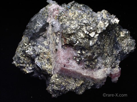


Longtoushan Sn deposit, Dachang Sn-polymetallic ore field, Nandan County, Hechi, Guangxi, China