Home PageAbout MindatThe Mindat ManualHistory of MindatCopyright StatusWho We AreContact UsAdvertise on Mindat
Donate to MindatCorporate SponsorshipSponsor a PageSponsored PagesMindat AdvertisersAdvertise on Mindat
Learning CenterWhat is a mineral?The most common minerals on earthInformation for EducatorsMindat ArticlesThe ElementsThe Rock H. Currier Digital LibraryGeologic Time
Minerals by PropertiesMinerals by ChemistryAdvanced Locality SearchRandom MineralRandom LocalitySearch by minIDLocalities Near MeSearch ArticlesSearch GlossaryMore Search Options
The Mindat ManualAdd a New PhotoRate PhotosLocality Edit ReportCoordinate Completion ReportAdd Glossary Item
Mining CompaniesStatisticsUsersMineral MuseumsClubs & OrganizationsMineral Shows & EventsThe Mindat DirectoryDevice SettingsThe Mineral Quiz
Photo SearchPhoto GalleriesSearch by ColorNew Photos TodayNew Photos YesterdayMembers' Photo GalleriesPast Photo of the Day GalleryPhotography
╳Discussions
💬 Home🔎 Search📅 LatestGroups
EducationOpen discussion area.Fakes & FraudsOpen discussion area.Field CollectingOpen discussion area.FossilsOpen discussion area.Gems and GemologyOpen discussion area.GeneralOpen discussion area.How to ContributeOpen discussion area.Identity HelpOpen discussion area.Improving Mindat.orgOpen discussion area.LocalitiesOpen discussion area.Lost and Stolen SpecimensOpen discussion area.MarketplaceOpen discussion area.MeteoritesOpen discussion area.Mindat ProductsOpen discussion area.Mineral ExchangesOpen discussion area.Mineral PhotographyOpen discussion area.Mineral ShowsOpen discussion area.Mineralogical ClassificationOpen discussion area.Mineralogy CourseOpen discussion area.MineralsOpen discussion area.Minerals and MuseumsOpen discussion area.PhotosOpen discussion area.Techniques for CollectorsOpen discussion area.The Rock H. Currier Digital LibraryOpen discussion area.UV MineralsOpen discussion area.Recent Images in Discussions


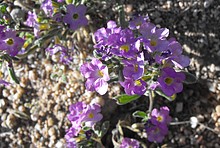

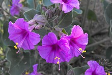
Field CollectingStrickland Quarry, Portland, Connecticut
15th Jun 2011 22:37 UTCMickey Marks

16th Jun 2011 04:53 UTCSam Cordero, Jr.

16th Jun 2011 13:36 UTCHarold Moritz 🌟 Expert
As stated in the text I wrote for each locality, there were two separate quarries/mines working the same pegmatite. The Strickland or Eureka quarry worked the southern part as an open quarry, and later as an underground mine. The much smaller and shorter-live Cramer or Schoonmaker mine worked the northern part of the pegmatite. Most specimens came from the Strickland quarry, but if they were collected from the northernmost dump, they came from the Schoonmaker mine. I have found that few collectors realized this and typically labeled everything "Strickland quarry". But they are different localities in the heirarchy of mindat databasing - Schoonmaker mine is not the same place as the Strickland Quarry. But they are combined under the next mindat level up - "Strickland pegmatite". If you select the "Strickland pegmatite" level, all minerals and specimen photos from both the Strickland quarry and the Schoonmaker mine will appear there, as well as specimen photos only posted at this level. So if your specimen label says "Strickland quarry", then enter it under the "Strickland quarry" locality page. If you are not sure if it came from the quarry or the more northern mine - or dont care - then enter it under the combined "Strickland pegmatite" locality page.
It may be worth stating that a photo can be posted to any heirarchical level in mindat, they do not have to be put in at the lowest, most specific level. You could just as easily enter a photo at the "Collins Hill" level, the "Portland" level, etc. on up, depending on the most specific level of information you have for a specimen. But it can only be posted to one level, so you should post it at the lowest level possible.
Hope that helps!
Harold
24th Jun 2011 01:07 UTCMIchael Sharpe
24th Jun 2011 05:23 UTCSam Cordero, Jr.
Oh well. Guess I'll just wait for that PowerBall ticket.
24th Jun 2011 13:23 UTCWayne Corwin
You may not win the golf game , , , but who cares ? ;)
Just remember to 'replace your divot'
KOR
Wayne

2nd Jul 2011 17:54 UTCRob (The Rock Hunter) Shepard
Rob
20th Jun 2012 14:42 UTCChester S. Lemanski, Jr.
20th Jun 2012 15:15 UTCHarold Moritz 🌟 Expert
"Located in the Middletown Pegmatite District comprising a swarm of Permian (~260 mya) pegmatite dikes; locally in a north-trending zone, mostly in the Ordovician Collins Hill Formation; but dikes are also present in eastward adjacent Ordovician Glastonbury Gneiss and westward adjacent Ordovician Middletown Formation."
This puts the place in greater context and is consistent with published map formation names and ages. Various references put the age of the pegmatites, based on several methods, at about 260 mya (mid Permian).
25th Jun 2012 02:24 UTCHarold Moritz 🌟 Expert
I just noticed you included the combined "Strickland-Cramer" name as synonyms for the Strickland Quarry. This is incorrect, the two always were separate physical and operational entities with different owners, too. USGS may want to lump them together in their database, but they are only related at the next level up - they both worked the Strickland pegmatite. So I included the combined "Strickland-Cramer" name as synonyms for the Strickland pegmatite. Personally I find the USGS-MRDS database (for Connecticut at least) to be rife with wrong positions, errors and duplications (in different places) that the only way to know any given place is correct is to go to the original source documents.
25th Jun 2012 14:30 UTCChester S. Lemanski, Jr.
Please change the geological setting paragraph as per your suggestion. It is much better.
Regarding the names, if the alternate is in the literature, it has to be listed among the alternate names in Mindat. We may not like it since it is then "impure" but that's the way it is. There are numerous examples of similar abberations in MRDS and elsewhere (e.g.: Mad Ox Mine = Maddock Mine). Many of these are due to misspellings from a time when few folks were truly literate.
MRDS is rife with errors of all types and significance. Believe me, it is often frustrating to unscramble what is presented!
Chet
25th Jun 2012 14:32 UTCChester S. Lemanski, Jr.
Please change the geological setting paragraph as per your suggestion. It is much better.
Regarding the names, if the alternate is in the literature, it has to be listed among the alternate names in Mindat. We may not like it since it is then "impure" but that's the way it is. There are numerous examples of similar abberations in MRDS and elsewhere (e.g.: Mad Ox Mine = Maddock Mine). Many of these are due to misspellings from a time when few folks were truly literate.
MRDS is rife with errors of all types and significance. Believe me, it is often frustrating to unscramble what is presented!
Chet
25th Jun 2012 15:00 UTCHarold Moritz 🌟 Expert
Understood, appreciate the feedback. No problem with including the names, at least at some level in the hierarchy.
I think the problem with MRDS is lack of quality control review of the product by someone knowledgeable. Now we have a database that has been overlayed onto Google maps, and thus taken as gospel by many because it is convenient, that is so full of garbage I have to tell club members not to use it lest they end up trespassing in search of a phantom locality (usually on the wrong geology), and wasting their time and mine, pissing off property owners, etc. I tell them to use mindat coordinates, at least for Conn., because I have "vetted" them (at least the ones I've edited so far) and mostly been to them and based my coordinates on topo maps and/or aerial photos so am positive they are correct. Much in MRDS is correct, but just as much is wrong and well, right or wrong there's no way to tell from the database, without going to the source references (which I use instead).
Fritz
25th Jun 2012 15:10 UTCChester S. Lemanski, Jr.
As I am doing California (and Arizona), I look at the topo map and position of the cursor for the stated coordinates. There should be a mine/shaft/adit symbol at/near the location. If not, checking the satellite photo may reveal mining scars or dumps. I do find many MRDS coordinates right on, but way too many more way off, or conflicting between 2 or 3 sets of coordinates provided in 2 or more MRDS files. I have a few other contributors working on California who are providing accurate coordinates which they or their acquaintances have acquired with modern GPS devices. Our little collecting group has done liewise in past years. It doesn't get any better than that! If you have any known accurate coordinates for Connecticut, or any other state, please feel free to substitute them for the coordinates of record, BUT, reference the old coordinates in the locality description block, as well an explanation of the new coordinates:
Coordinates obtained by Harold Moritz on 6/24/2012, using a Garmin model _______ device. Taken at the quarry entrance (mine adit portal, etc.). The coordinates of record presented in MRDS were: ____________________________. If you don't want your name used to link you to a location, don't use it.
25th Jun 2012 15:59 UTCHarold Moritz 🌟 Expert
5th Jul 2012 02:52 UTCleigh voytek


Mindat.org is an outreach project of the Hudson Institute of Mineralogy, a 501(c)(3) not-for-profit organization.
Copyright © mindat.org and the Hudson Institute of Mineralogy 1993-2024, except where stated. Most political location boundaries are © OpenStreetMap contributors. Mindat.org relies on the contributions of thousands of members and supporters. Founded in 2000 by Jolyon Ralph.
Privacy Policy - Terms & Conditions - Contact Us / DMCA issues - Report a bug/vulnerability Current server date and time: April 18, 2024 23:18:51