Home PageAbout MindatThe Mindat ManualHistory of MindatCopyright StatusWho We AreContact UsAdvertise on Mindat
Donate to MindatCorporate SponsorshipSponsor a PageSponsored PagesMindat AdvertisersAdvertise on Mindat
Learning CenterWhat is a mineral?The most common minerals on earthInformation for EducatorsMindat ArticlesThe ElementsThe Rock H. Currier Digital LibraryGeologic Time
Minerals by PropertiesMinerals by ChemistryAdvanced Locality SearchRandom MineralRandom LocalitySearch by minIDLocalities Near MeSearch ArticlesSearch GlossaryMore Search Options
The Mindat ManualAdd a New PhotoRate PhotosLocality Edit ReportCoordinate Completion ReportAdd Glossary Item
Mining CompaniesStatisticsUsersMineral MuseumsClubs & OrganizationsMineral Shows & EventsThe Mindat DirectoryDevice SettingsThe Mineral Quiz
Photo SearchPhoto GalleriesSearch by ColorNew Photos TodayNew Photos YesterdayMembers' Photo GalleriesPast Photo of the Day GalleryPhotography
╳Discussions
💬 Home🔎 Search📅 LatestGroups
EducationOpen discussion area.Fakes & FraudsOpen discussion area.Field CollectingOpen discussion area.FossilsOpen discussion area.Gems and GemologyOpen discussion area.GeneralOpen discussion area.How to ContributeOpen discussion area.Identity HelpOpen discussion area.Improving Mindat.orgOpen discussion area.LocalitiesOpen discussion area.Lost and Stolen SpecimensOpen discussion area.MarketplaceOpen discussion area.MeteoritesOpen discussion area.Mindat ProductsOpen discussion area.Mineral ExchangesOpen discussion area.Mineral PhotographyOpen discussion area.Mineral ShowsOpen discussion area.Mineralogical ClassificationOpen discussion area.Mineralogy CourseOpen discussion area.MineralsOpen discussion area.Minerals and MuseumsOpen discussion area.PhotosOpen discussion area.Techniques for CollectorsOpen discussion area.The Rock H. Currier Digital LibraryOpen discussion area.UV MineralsOpen discussion area.Recent Images in Discussions


Field CollectingManganese Mine, Keweenaw, Michigan

4th Sep 2018 05:18 UTCRobert Darabos
Mindat has a pretty looking loose location for it. Is its location precise?
One place I found states it is just North of the Clark Mine. More precisely on Mindat, it shows it is off of Golf Course Road just North of Red Trail. Will there be any signs near the locality? Or am I just looking for material that looks piled up?
Thanks in advance!
4th Sep 2018 15:34 UTCLarry Maltby Expert
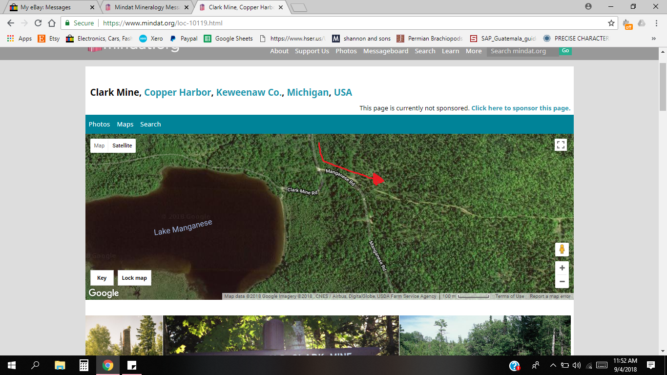
Go to the satellite view of the Clark Mine on Mindat. Start by clicking on the coordinates on the location page. Click the minus sign until you can see Manganese Lake, the Clark Mine and the connecting roads all in the same view. At Manganese Lake the road to the Clark Mine turns abruptly to the south. In that curve a two track forks to the left and proceeds uphill heading east. That is the road that you want. As you follow that an outcrop of conglomerate will appear on the left. At that point start looking to the right. There is no big rock pile, just some rubble about 50 yards into the woods that is difficult to see. The small mine opening was bulldozed shut a couple of years ago and I have not been there since that happened. It may be easier to see now in the thick foliage. If you get to the north /south road to the Clark Mine that intersects on the right, you have gone too far.
4th Sep 2018 15:57 UTCAlfredo Petrov Manager
4th Sep 2018 17:49 UTCLarry Maltby Expert

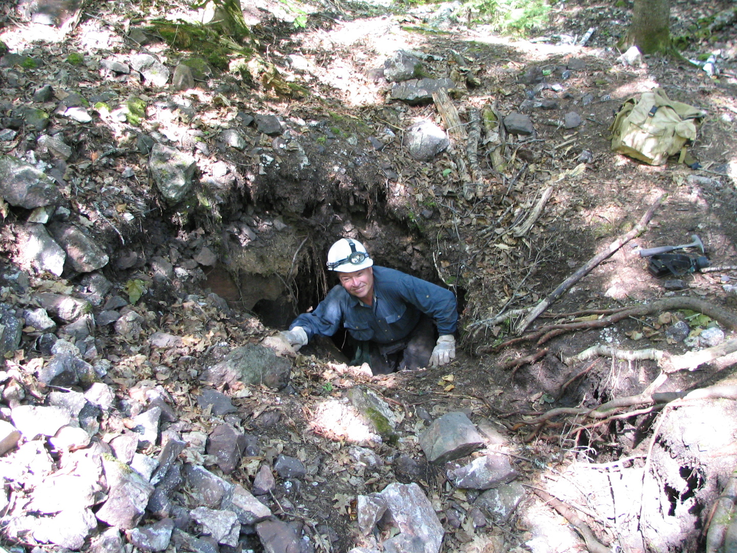
I have also heard that story. Below is a photo of the old mine opening and my son Ken. He and I made many trips to collect in May each year while the foliage was sparse. In June the black flies here will drive you crazy. There are a lot of black bears in Keweenaw County but good or bad depending how you look at it, they are hunted in season and have some fear of man. My son encountered a large black while collecting alone in the traps. H waved his arms and shouted and the bear bolted. In the summer we have sometimes seen what appears to be a jar of Smuckers berry preserves spilled in the trail. The bears do love their thimble berries.
4th Sep 2018 20:17 UTCLarry Maltby Expert
At this time of year you will have to look closely because of the foliage.
4th Sep 2018 20:19 UTCThomas Rosemeyer
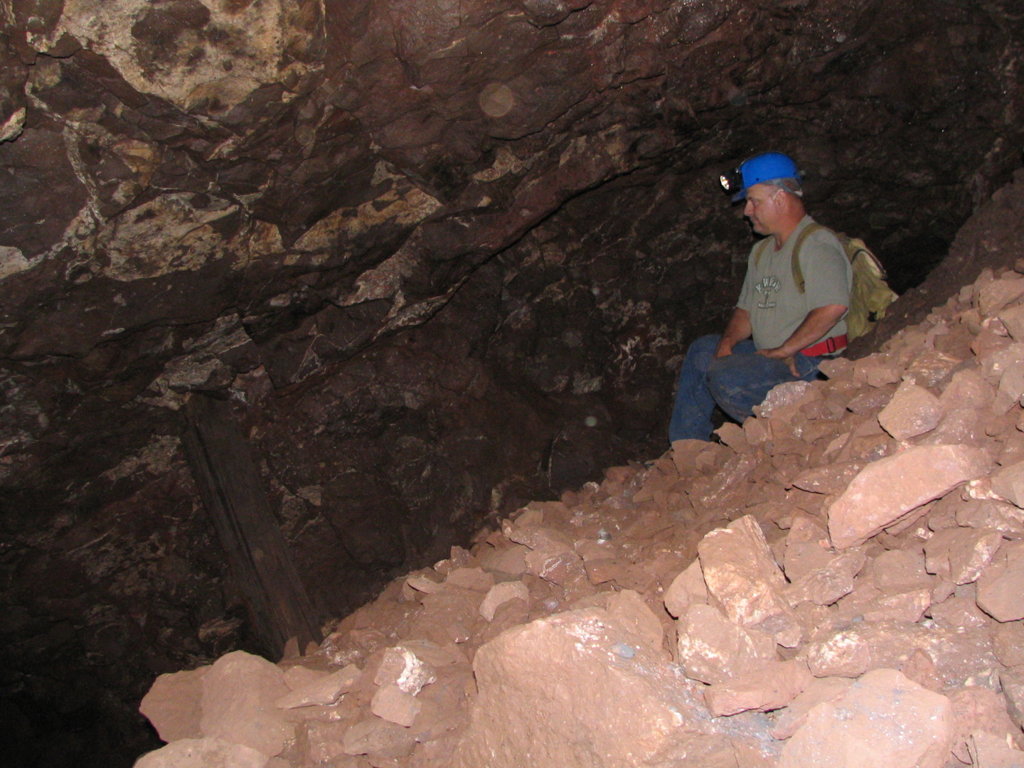
The last time I was underground at the mine (just before the land company bulldozed the opening shut) was the winter hibernation home for at least 2 bears and the mine had quite a "bear smell" to it.
I have also written a full length article on the locality that was in the Nov/Dec 2014 issue of Rocks & Minerals.
4th Sep 2018 20:26 UTCAllan Blaske
There was an article in Rocks and Minerals (Volume 89, No. 6, 2014) "History and Mineralogy of the Manganese Mine, Keweenaw County, Michigan" by Tom Rosemeyer. I may be the source of the bear story. I responded to Tom's article in R&M with a letter (volume 90, No.2, 2015) about my bear story. Long story short, way back in 1990 there was an opening at the bottom of the trench at location. I jumped down into the trench and looked into the opening into the old mine, to see a fuzzy black face looking back at me! It wasn't more than 10 feet to the bear! Luckily, I didn't toss a rock into the hole beforehand (like I generally to, to see how far the hole was open). If I had, it would have hit the bear and alerted him to my presence. I got out of there as fast as I could.
From the Rosemeyer article, it sounds like anything left of the pile was dozed and spread around for logging road fill. Probably not much there anymore.
If you can get a copy of Tom's article, it has some maps which show the location. It also includes a map which I included in a senior research project at MTU. (see the references at the bottom of the Mindat page for the reference). If you would like a copy of my paper, I can send you one. Just PM me.
The Macfallite from there is pretty cool. If you can still find some. Good luck.
4th Sep 2018 20:27 UTCAllan Blaske
5th Sep 2018 04:04 UTCJim Gawura

5th Sep 2018 15:52 UTCLarry Maltby Expert

Thanks for posting the photos. You mentioned the calcite. Here are some clusters of Macfallite crystals emerging from the calcite during leaching. Specimens like this can still be found in the rubble. FOV 5.0 mm
5th Sep 2018 16:25 UTCRobert Darabos
MacFallite is the main thing I am after. Does it usually appear on Calcite?
5th Sep 2018 17:44 UTCLarry Maltby Expert

5th Sep 2018 20:48 UTCPaul Brandes 🌟 Manager


Mindat.org is an outreach project of the Hudson Institute of Mineralogy, a 501(c)(3) not-for-profit organization.
Copyright © mindat.org and the Hudson Institute of Mineralogy 1993-2024, except where stated. Most political location boundaries are © OpenStreetMap contributors. Mindat.org relies on the contributions of thousands of members and supporters. Founded in 2000 by Jolyon Ralph.
Privacy Policy - Terms & Conditions - Contact Us / DMCA issues - Report a bug/vulnerability Current server date and time: April 25, 2024 12:49:04