Home PageAbout MindatThe Mindat ManualHistory of MindatCopyright StatusWho We AreContact UsAdvertise on Mindat
Donate to MindatCorporate SponsorshipSponsor a PageSponsored PagesMindat AdvertisersAdvertise on Mindat
Learning CenterWhat is a mineral?The most common minerals on earthInformation for EducatorsMindat ArticlesThe ElementsThe Rock H. Currier Digital LibraryGeologic Time
Minerals by PropertiesMinerals by ChemistryAdvanced Locality SearchRandom MineralRandom LocalitySearch by minIDLocalities Near MeSearch ArticlesSearch GlossaryMore Search Options
The Mindat ManualAdd a New PhotoRate PhotosLocality Edit ReportCoordinate Completion ReportAdd Glossary Item
Mining CompaniesStatisticsUsersMineral MuseumsClubs & OrganizationsMineral Shows & EventsThe Mindat DirectoryDevice SettingsThe Mineral Quiz
Photo SearchPhoto GalleriesSearch by ColorNew Photos TodayNew Photos YesterdayMembers' Photo GalleriesPast Photo of the Day GalleryPhotography
╳Discussions
💬 Home🔎 Search📅 LatestGroups
EducationOpen discussion area.Fakes & FraudsOpen discussion area.Field CollectingOpen discussion area.FossilsOpen discussion area.Gems and GemologyOpen discussion area.GeneralOpen discussion area.How to ContributeOpen discussion area.Identity HelpOpen discussion area.Improving Mindat.orgOpen discussion area.LocalitiesOpen discussion area.Lost and Stolen SpecimensOpen discussion area.MarketplaceOpen discussion area.MeteoritesOpen discussion area.Mindat ProductsOpen discussion area.Mineral ExchangesOpen discussion area.Mineral PhotographyOpen discussion area.Mineral ShowsOpen discussion area.Mineralogical ClassificationOpen discussion area.Mineralogy CourseOpen discussion area.MineralsOpen discussion area.Minerals and MuseumsOpen discussion area.PhotosOpen discussion area.Techniques for CollectorsOpen discussion area.The Rock H. Currier Digital LibraryOpen discussion area.UV MineralsOpen discussion area.Recent Images in Discussions


GeneralEagles Nest Occurrence

10th Dec 2016 05:29 UTCFrank Festa

From Sabina " to reach the occurrence, proceed along the Eagles Nest park road for a distance of 4.8 to the junction of a wagon road".
That wagon road is at approx. 45 4.539N and 77 51.237W using Google Earth 2009 view.
"the deposit is was explored by numerous pits and trenches for radioactive mineralization" "The openings are on north side of a ridge that extends northward from Eagles Nest".
The pits and trenches begin approx. at 45 4.556N and 77 51.210W along the ridge to approx. 45 4.587N and 77 51.162W.
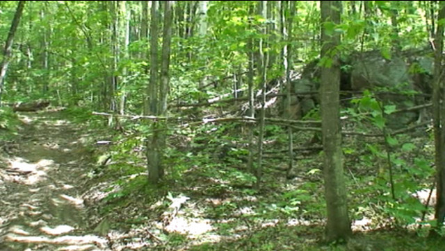
I explored these pits and trenches a number of years ago, have photos on film, not digital.
Do have later digital photos of pits


10th Dec 2016 12:43 UTCReiner Mielke Expert
I don't understand your coordinates, Could you please give them to me in standard notation, either decimal degress or d/m/s and I will correct it. Thanks
10th Dec 2016 16:36 UTCD. Peck
10th Dec 2016 17:08 UTCReiner Mielke Expert

10th Dec 2016 17:39 UTCMatt Neuzil Expert
"Mineral location : uraninite. 1956-7 : stripping, trenching and 17 DDH by Eagle Nest Mines Ltd. 7 radioactive zones outlined :' Mountain' - 1 working in lot 69, HRW (Faraday) and 6 workings in lots 69 and 70, HRE (Dungannon). 'Tower Line' - 3 small pits on lot 71, HRE (Dungannon). 'Pinnacle' - several workings aver 500 ft on lots 70 and 71, HRE (Dungannon). 'Gossan' - 80 ft of stripping and 2 trenches on lot 71, HRE (Dungannon). 'Mica' - a stripping, a trench and a pit on lot 29, con 16 (Dungannon). 'Field' - a pit and 30 ft trench in a field on lot 29, con 16 (Dungannon). 'Weimer' - lot 27, con 15 (?) (Dungannon). 1958 : re-evaluated. 1967 : blasting, sampling and a scint survey by D.M. Macherocher. 1968 : Watts Exploration Services carried out a mag survey (incomplete). 1970 : a scint survey over the Mountain, Pinnacle and Weimar zones by D.F. Ennis. 1976 : Canadian Nickel Mines Ltd carried out geological, mag and radometric surveys, sampled and drilled 9 holes for 1,515 ft."
It would appear that workings are spread throughout an area from Brethour lake east to Clark lake and from Snow road to lots north of Snow road.

10th Dec 2016 17:54 UTCUwe Kolitsch Manager
No, it will.
10th Dec 2016 18:27 UTCFrank Festa

45 4.539N and 77 51.237W
45.07565 and -77.85395
N45 04 32 and W77 51 14
The pits and trenches begin at approx.
45 4.556N and 77 51.210W along the ridge to approx.
45.075933 and -7.8535
N45 04 33 and W77 51 12
45 4.587N and 77 51.162W.
45.07645 and -77.8527
N45 04 35 and W77 51 09
Nice job Matt for the info. The coordinates listed are the coordinates where I was. There very well could be additional spots. I walked all the way up the hill to the first lake and did encounter small hot spots.
10th Dec 2016 20:26 UTCReiner Mielke Expert


Mindat.org is an outreach project of the Hudson Institute of Mineralogy, a 501(c)(3) not-for-profit organization.
Copyright © mindat.org and the Hudson Institute of Mineralogy 1993-2024, except where stated. Most political location boundaries are © OpenStreetMap contributors. Mindat.org relies on the contributions of thousands of members and supporters. Founded in 2000 by Jolyon Ralph.
Privacy Policy - Terms & Conditions - Contact Us / DMCA issues - Report a bug/vulnerability Current server date and time: April 19, 2024 18:11:10