GRN grid region: N25W63
A grid 'square' of approximately 160km x 160km, part of the Global Reference Network of 19,833 grid cells covering the Earth.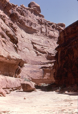


Northeast Corner:
37 30'0'' N , 108 15'7'' W ( 37.5,-108.252 )
Southwest Corner:
36 0'0'' N , 109 59'49'' W ( 36,-109.997 )
Climate:
Select Mineral List Type
Standard Detailed Gallery Strunz Chemical ElementsCommodity List
This is a list of exploitable or exploited mineral commodities recorded at this locality.Mineral List
146 valid minerals. 6 (TL) - type locality of valid minerals.
Rock Types Recorded
Note: data is currently VERY limited. Please bear with us while we work towards adding this information!
Select Rock List Type
Alphabetical List Tree DiagramLocalities within grid area
- Arizona
- Apache County
- Black Mountain Mining District (Black Mesa Mining District)
- Taasahdi Dzil
- Alkali Water Gap prospect
- Arrowhead Mine
- Arrowhead No. 2 Mine
- Begay No. 1 Mine (Thomas Begay No. 1; Begay #1)
- Black Mountain Vase Mine (Jim L. Smiley)
- Claim 14
- Claim 16
- Claim 28 Mine
- Claim 3 Mine (Denny Lee Mine)
- Claim 31 Mine (Claim No. 35)
- Claim 7 Mine (Homer Scott Mine; Dry Run Canyon)
- Claim No. 4 (Claim #4)
- Dan Taylor No. 1 Mine (LaGloria Oil and Gas claim; Yale Point)
- Dry Run Canyon prospect (Homer Scott; Claim 10)
- Etsitty No. 1 Mine (M.O. 5)
- George Belinte No. 2 (George Belinte #2)
- Kasewood Bahe No. 1 Mine
- La Gloria Oil & Gas claim
- M.O. 2 prospect
- M.O. 28 Mine
- North Tah Chee Wash prospect
- Ruin Mesa Mine (Charlie James Mine; Charlie James No. 1; Salina No. 4)
- Sam Charley No. 1 (Sam Charley #1)
- Todecheenie No. 1 Mine (Frank Todeckeenie Mine)
- Two Adits Mine
- Unnamed Ti-Zr-Th-U-REE occurrence [1] (Unnamed E)
- Unnamed Ti-Zr-Th-U-REE occurrence [2] (Unnamed F)
- Unnamed U deposit [11]
- Unnamed U deposit [21]
- West Burnt Corn Wash Mine (Claim 27)
- Taasahdi Dzil
- Cane Valley Mining District
- Yazzie Mesa
- Carrizo Range
- Black Rock Point Mining District
- Black Rock Point
- Black Rock Point Mine (Thomas Clani Mine)
- Block K Mine
- Capitan Benally No. 4a Mine (Capitan Benally No. 4a & 5 Mine)
- Carson Mine
- Cleveland No. 1 Mine (Grover Cleveland No. 1; Cleveland)
- George Simpson No. 1a Incline (Geo. Simpson No. 1a)
- Gila Mine (Plot No. 4 Mine)
- Hogan Mine (Plot 1 Mine)
- Horse Mine (Plot 10 Mine)
- Hoskie Henry Mine
- Jimmie Bileen No. 1 & 3 Mine (Jimmie Bileen claims)
- Last Chance Mine
- Martin Mine
- McKenzie No. 3 Mine
- No. 5 Mine
- No. 8 Mine
- North Martin Mine (AEC Plot #2)
- Plot No. 13 Mine
- Plot No. 2 Mine
- Plot No. 3 & 5 prospects
- Plot No. 8 claim
- Plot No. 9 Mine
- Pope No. 1 Mine
- Rattlesnake No. 5 Mine (Plot No. 7 Mine)
- Rattlesnake No. 8 Mine (Plot No. 12 Mine)
- Sah Tah Mine (Saytah Mine)
- Silentman No. 1 Mine
- Tsosie No. 1 Mine (Tsosie; Luke Tsosie)
- Red Mesa
- Toh Atin Mesa
- Barton No. 3 Mine (Barton #3; King #8)
- Brodie No. 1 Mine (Mike Brodie #1)
- George Simpson 1B
- John Lee Benally Mine
- Johnny McCoy No. 1 Mine (Johnny McCoy)
- Phillip Dee No. 1 Mine
- Rattlesnake Mine (Plot No. 6 Mine; Rattlesnake incline)
- Unidentified clay occurrence [2]
- Unnamed U deposit [1]
- Unnamed U deposit [5]
- Black Rock Point
- Chimney No. 1 Mine
- Chinle Mining District
- Cove Mesa Mining District
- Alcove Mesa prospect (Alcove-Toh Acon Mesa)
- Cove Mesa
- Kinusta Mesa
- Clani Mine (Tree Mesa Mine)
- Friday Mesa Mine
- Hanley Mine (Sheepskin Mesa Mine; Hanley No. 1 & 3 claims)
- King Tut Mine
- Mildred No. 1 Mine
- Segi-Ho-Cha Mesa Mine (Mildred Mine; Mildred No. 1 Mine)
- Sunnyside Mine
- Unnamed U deposit [13]
- Unnamed U deposit [16]
- Unnamed U deposit [18]
- Unnamed U deposit [34]
- Unnamed U deposit [37]
- Unnamed U deposit [38]
- Unnamed U deposit [43]
- Unnamed U occurrence [48] (Unnamed C)
- Unnamed U prospect [2]
- Toh-A-Con Mesa
- Northeast Carrizo Mountains Mining District
- Barton No. 4 Mine
- Boiling Over Well
- Cottonwood Butte claim (Charlie Bekis)
- Gravel Cap Mine (Oak Springs Mine; Oak Springs Gravel Cap Mine)
- Hazel Mine (Hazell)
- Mesa 4½ Mine
- Oak Springs Plot No. 10 Mine (Oak Springs Mine)
- Plot No. 11 Mine (Plot #11; White Cap lease)
- Shiprock Mine
- Syracuse Mine (Plot No. 12; Plot #12)
- Syracuse Mine (R.F. and R. Mine; Sam Harvey)
- Teec Nos Pos
- Allen Gleason claim
- Basalt claim
- Bettie No. 1 Mine
- Billie No. 1 Mine (Billie #1)
- Harvey Begay No. 3 Mine
- Jim Lee No. 1 Mine (Richard King No. 1 Mine)
- North Mesa Mine
- Rattlesnake No. 1 Mine (Rattlesnake; North Mesa; Paul Shorty No. 1; Shorty No. 1; Shorty Mine)
- Ruben No. 1 Mine
- Texaco Z-1 Navajo well (Texaco Z-1 Nav)
- Todakonzie No. 1 Mine
- Tony Tuc Mine (Toni Tuc Mine; Toni Tuc Tract No. 1)
- Unidentified clay occurrence [3]
- Unnamed U deposit [3]
- Zona No. 1 Mine
- Upper Canyon Mines
- Upper Red Canyon Mine (Pearl Buck; Red Feather #3)
- Valley View Mine (Valley View M.S. No. 3762; Valley View Extension)
- West Carrizo Mining District
- Black Rock Point Mining District
- Chuska Mountains
- Dinnehotso
- Lukachukai Mountains
- Lukachukai Mining District
- Cove
- Cove School Mine
- Frank No. 2 Mine
- Jerry Jay No. 1 Mine
- Kerr-McGee 4-1 Mine
- Lukachukai
- Mexican Cry Mesa
- Tom Joe No. 7 (Snake Point Mine)
- White Ash Peak
- 4b Mine
- Billy Topaha Mine (Topaha)
- Black No. 2 East Mine (Bare Rock Mesa Mine)
- Black No. 2 West Mine
- Cato No. 2 Mine
- Cisco Mine (Cisco No. 1 Mine)
- Flag No. 1 Mine (Flag #1)
- Flag No. 2 Mine (Black No. 1 Mine)
- Frank Jr. Mine
- Frank No. 1 Mine (709 Mine)
- Frank No. 182 Mine
- Hall Mine
- Henry Phillips Mine (Gothie; Gothe)
- Jimmie King No. 9 Mine
- Joleo Mine
- Knife Edge Mesa Mine
- Mesa 1 Mines 10-15
- Lukachukai Mining District
- Black Mountain Mining District (Black Mesa Mining District)
- Apache County
- Arizona
- Apache County
- Lukachukai Mountains
- Lukachukai Mining District
- White Ash Peak
- Mesa 1 Mines 10-15
- Mesa 1½ Mine (Mesa 1½)
- Mesa 1½ West Mine
- Mesa 1¼ Mine
- Mesa 1¾ incline (Mesa 1¾ Mine)
- Mesa 1¾ Mine No. 2; P-150
- Mesa 2 Mine 4 (Mesa II Mine 4)
- Mesa 2 Mine No. 1; P-150
- Mesa 2 Nos. 1 & 2 Mines; P-21 (Mesa II Nos. 1 & 2 Mines; P-21)
- Mesa 2 pit (Mesa 2 Mine)
- Mesa 2½; Mine 4 (Mesa II½; Mine 4)
- Mesa 2½ Mine (Mesa II½ Mine)
- Mesa 2¼ Mine (Mesa II¼ Mine)
- Mesa 3 Mine (Mesa III Mine)
- Mesa 3 Northwest and West Mines (Mesa III Northwest Mine)
- Mesa 3 Northwest Mine
- Mesa 4 Mine No. 1 (Mesa IV Mine No. 1)
- Mesa 4½ Mine
- Mesa 4¼ Mine
- Mesa 5 adit
- Mesa 5 incline
- Mesa 5 Mine
- Mesa 6 Mine
- Mesa 7 Mine (Frank Bluehorse Mine)
- Mesa No. 1 Mine
- Mine No. 1 Mesa 4
- Mine No. 2 Mesa 4 (Mesa IV Mine No. 2; Mesa 4 Mine No. 2)
- Mine No. 3 Mesa 4 (Mesa IV Mine No. 3; Mesa 4 Mine No. 3)
- Nakai Chee Begay Mine (Tom Joe #7 permits)
- North Portal Frank No. 1 Mine
- South Portal Frank No. 1 Mine
- Step Mesa Mine
- Tommy James Mines (Fall Down Mesa; T.J. #9)
- Unnamed U deposit [7]
- West Mine Mesa 4 (Mesa IV West Mine; Mesa 4 West Mine)
- White Ash Peak
- Luki Mine
- Lukachukai Mining District
- Lukachuki Creek Clay deposit
- Mexican Water
- Red Point Mesa
- Red Rock Mining District
- Rough Rock Mining District
- Round Rock
- Sanders-Defiance Plateau area (Sanders-Cheto District)
- Barnwater Wash
- Defiance Plateau
- Sawmill
- Sonsela Butte Mining District
- Unidentified clay deposit [1]
- Valley View and Yarnell group (Prieta Chinda group)
- Lukachukai Mountains
- Navajo County
- Cuesta channel (Channel No. 59)
- Red Mesa District
- Apache County
- Arizona & Utah
- Apache; Navajo and San Juan Cos.
- Colorado Plateau
- Apache; Navajo and San Juan Cos.
- Colorado
- ⭔Montezuma County
- Bear Creek Mining District
- Canon No. 7
- Dolores
- East Mancos Mining District
- La Plata Mining District (California Mining District)
- Mancos River Black Sand Deposit
- ⭔McElmo Creek (Ute Mountains) Area
- Battle Rock Mine
- Cliff House Group (Cliff House No. 4 Prospects; Cliff House No. 2)
- Coffin's Prospect
- Karla Kay Mine
- Little Maude Mine
- ⭔McElmo Creek Area (McElmo Field; Ute Mountains Area)
- Three States Natural Gas Company Prospect
- Unknown Vanadium - Coal Prospect (MRDS - 10190975)
- Ute Creek Dike Prospects
- ⭔Mesa Verde National Park
- Mesa Verde Quarry
- Paradox Basin
- San Juan Basin
- Shiprock Group
- Unknown Clay - Fire (Refractory) Occurrence (MRDS - 10017582)
- Unknown Clay - Fire (Refractory) Occurrence (MRDS - 10017583)
- Ute Mountain
- Ute Mountain Ute Reservation
- ⭔Yellowjacket Canyon Area
- San Miguel County
- ⭔Montezuma County
- ⭔Colorado Plateau
- ⭔Navajo Nation Indian Reservation
- New Mexico
- McKinley County
- Toadlena area
- ⭔San Juan County
- A.L.Cook Prospect
- Adamson Mines
- Beclavite Dome
- Bee Sho Shee Mine
- Bisti trading post
- Black Diamond Mines
- Boyd Mining District
- Carrizo Mountains Mining District
- Chimney Rock
- Chuska Mountains
- Cottonwood Butte Mine
- Farmington Mining District
- Hoskey Barton
- Kerr-Mcgee Uranium Mine
- Mitten Rock
- Narbona Pass
- ⭔Navajo Nation Reservation
- Red Rocks
- Rowland Young
- Sanostee Deposit
- Shiprock
- Shiprock District
- Chuska
- Eastside mines
- Alongo mine
- BB Mine (Lewis Barton Mine)
- BBB Mine (Barton & Begay Mine)
- Begay No. 1 mine
- Begay No. 2 mine
- Canyon No. 1 mine
- Canyon No 2
- Canyon View mine
- Carizzo No. 1 mine
- Junction mine
- King No. 2 mine
- King No. 6 mine
- King Tut Central mine
- King Tut No. 1 Mine (King Tutt No. 1 Mine)
- Lone Star mine
- Lookout Point mine
- Nelson Point mine
- Oak Springs mine
- Rattlesnake No. 6 mine
- Red Wash Point mine
- Rocky Flats mine
- Rocky Flats No. 2 mine
- Rocky No. 2 mine
- Rocky Spring
- Salt Canyon mine
- Salt Canyon No 2
- Sam Point mine
- Shadyside mine
- Tent mine
- Williams Point Mine
- Shiprock Group
- The Thumb
- Toadlena Deposit
- Unnamed mine [10150918]
- Unnamed uranium prospect [10222957]
- Unnamed uranium prospect [10223325]
- Unnamed uranium prospect [10223356]
- Unnamed uranium prospect [10223423]
- Unnamed uranium prospect [10296597]
- Unnamed uranium prospect [10296721]
- Unnamed vanadium prospect [10126346]
- Upper Canyon Mine
- Victory Exploration
- McKinley County
- Utah
- San Juan County
- Alhambra Rock Kimberlite
- Aneth 1
- Bluff - Butler Wash Mining District
- Butterfield Bentonite Mine
- Four Corners meteorite
- Limestone Quarry (MRDS - 10078645)
- Mexican Hat
- Montezuma Canyon Mining District
- Moses Rock
- Moses Rock Deposit
- Mule Ear Deposit
- Pete-Red Hot-School Section 16 Occurrence
- San Juan River
- Sandstone Quarry (MRDS - 10251899)
- Shiprock
- Utah Department of Highways pit No. 19044
- San Juan County
- ⭔Ute Mountain Ute Reservation


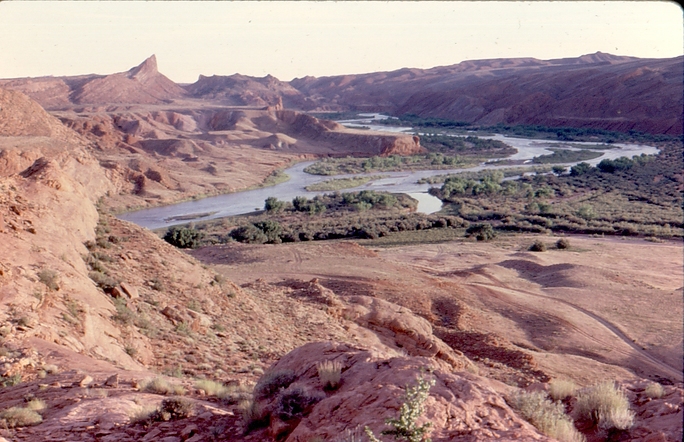
San Juan River, San Juan County, Utah, USA