Rooster Goose Mine, Beaver Mining District, Shoshone County, Idaho, USAi
| Regional Level Types | |
|---|---|
| Rooster Goose Mine | Mine |
| Beaver Mining District | Mining District |
| Shoshone County | County |
| Idaho | State |
| USA | Country |
This page is currently not sponsored. Click here to sponsor this page.


Latitude & Longitude (WGS84):
47° 36' 48'' North , 115° 57' 31'' West
Latitude & Longitude (decimal):
Locality type:
Köppen climate type:
Nearest Settlements:
| Place | Population | Distance |
|---|---|---|
| Osburn | 1,510 (2017) | 12.3km |
| Kellogg | 2,069 (2017) | 14.7km |
| Wallace | 761 (2017) | 15.7km |
| Wardner | 186 (2017) | 16.6km |
| Smelterville | 603 (2017) | 18.5km |
Other/historical names associated with this locality:
Lucky No. 12; R.G. Mine; R-G Mining Co. Group; Clear Grit and Rooster Goose Mine; Silver Bar Vein
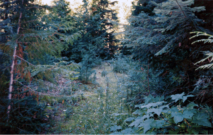
Located on the west side of Beaver Creek approximately 1.9 miles (3.1 kilometers) southeast of the confluence of Beaver Creek and the Coeur d' Alene River. The closest town is Prichard, Idaho.
A jumble of different owners, consolidation of owners, and the ensuing naming conventions lead to much confusion. This mine began life as the Rooster Goose Mine. Was later acquired by the Clear Grit Mine consortium. At that time it was renamed Clear Grit and Rooster Goose Mine (This due to the fact that the Clear Grit group also owned the Clear Grit Mine on the opposite side of the Beaver Creek Canyon. To relieve confusion between the Clear Grit Mine and the Clear Grit Rooster Goose Mine we revert back to the original name here.
Commodities (Major) - Lead, Silver; (Trace) - Zinc, Gold, Copper
Development Status: Past Producer
Host Rock Unit: Wallace Formation
Structure: Area Highly Faulted
Host Rock: Quartzite
Deposit Type: Vein
Tectonic Structure: Belt Basin
Select Mineral List Type
Standard Detailed Gallery Strunz Chemical ElementsCommodity List
This is a list of exploitable or exploited mineral commodities recorded at this locality.Mineral List
5 valid minerals.
Rock Types Recorded
Note: data is currently VERY limited. Please bear with us while we work towards adding this information!
Select Rock List Type
Alphabetical List Tree DiagramDetailed Mineral List:
| ⓘ Chalcopyrite Formula: CuFeS2 Reference: U.S. Geological Survey, 2005, Mineral Resources Data System: U.S. Geological Survey, Reston, Virginia. |
| ⓘ Galena Formula: PbS Reference: U.S. Geological Survey, 2005, Mineral Resources Data System: U.S. Geological Survey, Reston, Virginia. |
| ⓘ Pyrite Formula: FeS2 Reference: U.S. Geological Survey, 2005, Mineral Resources Data System: U.S. Geological Survey, Reston, Virginia. |
| ⓘ Quartz Formula: SiO2 Reference: U.S. Geological Survey, 2005, Mineral Resources Data System: U.S. Geological Survey, Reston, Virginia. |
| ⓘ Sphalerite Formula: ZnS Reference: U.S. Geological Survey, 2005, Mineral Resources Data System: U.S. Geological Survey, Reston, Virginia. |
Gallery:
List of minerals arranged by Strunz 10th Edition classification
| Group 2 - Sulphides and Sulfosalts | |||
|---|---|---|---|
| ⓘ | Chalcopyrite | 2.CB.10a | CuFeS2 |
| ⓘ | Galena | 2.CD.10 | PbS |
| ⓘ | Pyrite | 2.EB.05a | FeS2 |
| ⓘ | Sphalerite | 2.CB.05a | ZnS |
| Group 4 - Oxides and Hydroxides | |||
| ⓘ | Quartz | 4.DA.05 | SiO2 |
List of minerals for each chemical element
| O | Oxygen | |
|---|---|---|
| O | ⓘ Quartz | SiO2 |
| Si | Silicon | |
| Si | ⓘ Quartz | SiO2 |
| S | Sulfur | |
| S | ⓘ Sphalerite | ZnS |
| S | ⓘ Chalcopyrite | CuFeS2 |
| S | ⓘ Galena | PbS |
| S | ⓘ Pyrite | FeS2 |
| Fe | Iron | |
| Fe | ⓘ Chalcopyrite | CuFeS2 |
| Fe | ⓘ Pyrite | FeS2 |
| Cu | Copper | |
| Cu | ⓘ Chalcopyrite | CuFeS2 |
| Zn | Zinc | |
| Zn | ⓘ Sphalerite | ZnS |
| Pb | Lead | |
| Pb | ⓘ Galena | PbS |
References
Sort by
Year (asc) Year (desc) Author (A-Z) Author (Z-A)GREEN, W.R., 1966 , IDAHO BUR. MINES AND GEOLOGY OPEN-FILE REPORT, 2 P.
WESTERN MINING NEWS, 1974 - 75 DIRECTORY OF MINES IN IDAHO (COEUR D'ALENES) AND WASHINGTON, P. 110
SPOKANE CHRONICLE, APRIL 1 , 1969 ; JAN. 20 .
Hosterman J.W., Cressman E.R., 1956, Geology of the Murray area, Shoshone County, Idaho-Contributions to economic geology, 1955, USGS, Bulletin 1027.
U.S. Geological Survey, 1955, Defense Minerals Exploration Administration-3968: Rooster- Goose Mine.
Kauffman J.D., Bennett E.H., Mitchell V.E., 2003, Site Inspection Report for the Abandoned and Inactive Mines in Idaho on U.S. Forest Service Lands (Region 1), Idaho Panhandle National Forest: Volume V, Section B: Coeur d'Alene River Drainage Surrounding the Coeur d'Alene Mining District (Excluding the Prichard Creek and Eagle Creek Drainages), Secondary Properties, ISG S-03-6.
Other Databases
| Link to USGS MRDS: | 10105999 |
|---|
External Links
Other Regions, Features and Areas containing this locality
North America PlateTectonic Plate
- Belt BasinBasin
- Wallace DomainDomain
- West Canadian-Alberta basinBasin
USA
- Montana
This page contains all mineral locality references listed on mindat.org. This does not claim to be a complete list. If you know of more minerals from this site, please register so you can add to our database. This locality information is for reference purposes only. You should never attempt to
visit any sites listed in mindat.org without first ensuring that you have the permission of the land and/or mineral rights holders
for access and that you are aware of all safety precautions necessary.


Rooster Goose Mine, Beaver Mining District, Shoshone County, Idaho, USA