N'Drahamcha Quarry, Nouakchott District, Mauritania

| Latitude & Longitude (WGS84): | 18° 35' North , 15° 45' West |
|---|---|
| Latitude & Longitude (decimal): | 18.58333,-15.75000 |
| GeoHash: | G#: eekc9wgpy |
| Locality type: | Quarry |
| Köppen climate type: | BWh : Hot deserts climate |
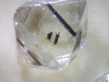
A gypsum mine located 50 km NE of Nouakchott. Closed April, 1981 and reopened November, 1984. Owned by Société Arabe des Industries Métallurgiques Mauritano-Koweitiennes (Samia). Mine has a capacity of 120,000 tons/year.
Regions containing this locality

Select Mineral List Type
Standard Detailed Strunz Dana Chemical ElementsList of minerals arranged by Strunz 10th Edition classification
| Group 7 - Sulphates, Chromates, Molybdates and Tungstates | |||
|---|---|---|---|
| ⓘ | 'Gypsum' | 7.CD.40 | CaSO4 · 2H2O |
List of minerals arranged by Dana 8th Edition classification
| Group 29 - HYDRATED ACID AND NORMAL SULFATES | |||
|---|---|---|---|
| AXO4·xH2O | |||
| ⓘ | Gypsum | 29.6.3.1 | CaSO4 · 2H2O |
List of minerals for each chemical element
| H | Hydrogen | |
|---|---|---|
| H | ⓘ Gypsum | CaSO4 · 2H2O |
| O | Oxygen | |
| O | ⓘ Gypsum | CaSO4 · 2H2O |
| S | Sulfur | |
| S | ⓘ Gypsum | CaSO4 · 2H2O |
| Ca | Calcium | |
| Ca | ⓘ Gypsum | CaSO4 · 2H2O |
Regional Geology
This geological map and associated information on rock units at or nearby to the coordinates given for this locality is based on relatively small scale geological maps provided by various national Geological Surveys. This does not necessarily represent the complete geology at this locality but it gives a background for the region in which it is found.
Click on geological units on the map for more information. Click here to view full-screen map on Macrostrat.org
| Quaternary 0 - 2.588 Ma ID: 3307343 | Age: Pleistocene (0 - 2.588 Ma) Lithology: Sedimentary Reference: Thiéblemont, D. (ed.). New edition of the 1:10,000,000 geological map of Africa. CGMW-BRGM. [190] |
| Neogene 2.588 - 23.03 Ma ID: 3185124 | Cenozoic sedimentary rocks Age: Neogene (2.588 - 23.03 Ma) Lithology: Sedimentary rocks Reference: Chorlton, L.B. Generalized geology of the world: bedrock domains and major faults in GIS format: a small-scale world geology map with an extended geological attribute database. doi: 10.4095/223767. Geological Survey of Canada, Open File 5529. [154] |
Data and map coding provided by Macrostrat.org, used under Creative Commons Attribution 4.0 License
References
Sort by
Year (asc) Year (desc) Author (A-Z) Author (Z-A)


