Penhale Sands, Perranzabuloe, Cornwall, England, UKi
| Regional Level Types | |
|---|---|
| Penhale Sands | Group of Dunes |
| Perranzabuloe | Civil Parish |
| Cornwall | County |
| England | Constituent Country |
| UK | Country |
This page is currently not sponsored. Click here to sponsor this page.


Latitude & Longitude (WGS84):
50° 22' 22'' North , 5° 8' 7'' West
Latitude & Longitude (decimal):
Type:
Group of Dunes
Köppen climate type:
Nearest Settlements:
| Place | Population | Distance |
|---|---|---|
| Cubert | 771 (2017) | 1.5km |
| Perranporth | 3,210 (2017) | 3.5km |
| Crantock | 801 (2017) | 3.7km |
| Newquay | 20,189 (2017) | 6.5km |
| Saint Agnes | 2,820 (2014) | 8.3km |
Nearest Clubs:
Local clubs are the best way to get access to collecting localities
Local clubs are the best way to get access to collecting localities
| Club | Location | Distance |
|---|---|---|
| British Micromount Society, Devon and Cornwall Branch Meetings | Liskeard, Cornwall | 48km |
Mindat Locality ID:
222405
Long-form identifier:
mindat:1:2:222405:6
GUID (UUID V4):
f67cf58a-76d3-4945-bc25-a7b543c87966
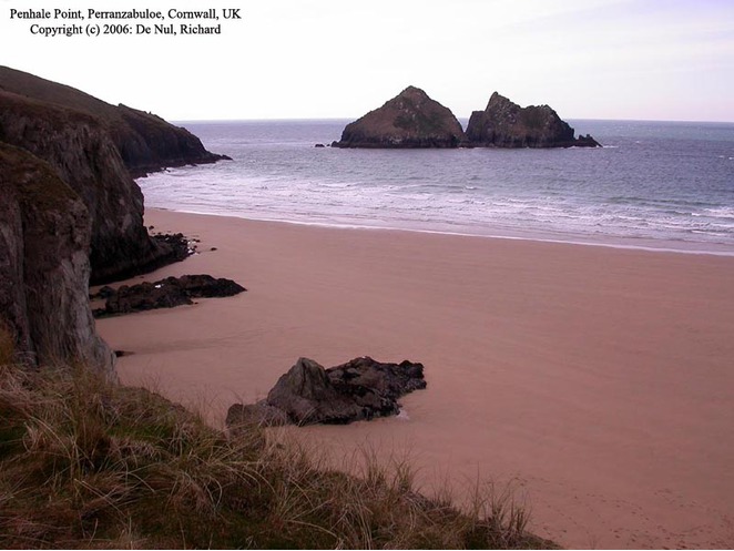
Penhale Sands (Cornish: Peran Treth, meaning St Piran's sands), or Penhale Dunes, is a complex of sand dunes and a protected area for its wildlife, on the north Cornwall coast in England, UK. It is the most extensive system of sand dunes in Cornwall and is believed to be the landing site of Saint Piran. Dating from the 6th century, St Piran's Oratory is thought to be one of the oldest Christian sites in Britain. The remains were discovered in the late 18th century, and in 2014 the covering sand was removed to reveal a building more than a thousand years old, in a reasonable state of preservation. A restricted military area dating from 1939, Penhale Camp, is found on the northern part of the dunes.
The area has been designated as a Site of Special Scientific Interest (SSSI) since 1953 and became a Special Area of Conservation (SAC) in 2004. The South West Coast Path runs through the dunes.
The sands are located 5 miles (ca. 8 km) southwest of the town of Newquay, in the civil parish of Perranzabuloe, stretching for over 2.5 miles (ca. 4 km) between Perranporth in the south and Holywell to the north, with the Atlantic Ocean and Perran Beach to the west. The Cornish sand dunes are thought to have formed over 5,000 years ago as sea levels rose to approximately their present levels. Penhale Sands are the largest dune system within Cornwall and has a maximum depth of 48 metres (ca. 157 ft) of sand. The system, of over 650 hectares (1,600 acres), extends for more than 1 mile (1.6 km) inland and includes Reen Sands, Gear Sands and Perransands.
Select Mineral List Type
Standard Detailed Gallery Strunz Chemical ElementsCommodity List
This is a list of exploitable or exploited mineral commodities recorded from this region.Mineral List
Mineral list contains entries from the region specified including sub-localities12 valid minerals.
Detailed Mineral List:
| ⓘ Cerussite Formula: PbCO3 |
| ⓘ Chalcopyrite Formula: CuFeS2 |
| ⓘ Fluorapatite Formula: Ca5(PO4)3F |
| ⓘ Fluorapatite var. Carbonate-rich Fluorapatite Formula: Ca5(PO4,CO3)3(F,O) |
| ⓘ Fluorite Formula: CaF2 |
| ⓘ Galena Formula: PbS Localities: |
| ⓘ Goethite Formula: α-Fe3+O(OH) |
| ⓘ Linarite Formula: PbCu(SO4)(OH)2 |
| ⓘ Malachite Formula: Cu2(CO3)(OH)2 |
| ⓘ Pyrite Formula: FeS2 |
| ⓘ Quartz Formula: SiO2 |
| ⓘ Quartz var. Chalcedony Formula: SiO2 |
| ⓘ Siderite Formula: FeCO3 |
| ⓘ Sphalerite Formula: ZnS |

List of minerals arranged by Strunz 10th Edition classification
| Group 2 - Sulphides and Sulfosalts | |||
|---|---|---|---|
| ⓘ | Sphalerite | 2.CB.05a | ZnS |
| ⓘ | Chalcopyrite | 2.CB.10a | CuFeS2 |
| ⓘ | Galena | 2.CD.10 | PbS |
| ⓘ | Pyrite | 2.EB.05a | FeS2 |
| Group 3 - Halides | |||
| ⓘ | Fluorite | 3.AB.25 | CaF2 |
| Group 4 - Oxides and Hydroxides | |||
| ⓘ | Goethite | 4.00. | α-Fe3+O(OH) |
| ⓘ | Quartz var. Chalcedony | 4.DA.05 | SiO2 |
| ⓘ | 4.DA.05 | SiO2 | |
| Group 5 - Nitrates and Carbonates | |||
| ⓘ | Siderite | 5.AB.05 | FeCO3 |
| ⓘ | Cerussite | 5.AB.15 | PbCO3 |
| ⓘ | Malachite | 5.BA.10 | Cu2(CO3)(OH)2 |
| Group 7 - Sulphates, Chromates, Molybdates and Tungstates | |||
| ⓘ | Linarite | 7.BC.65 | PbCu(SO4)(OH)2 |
| Group 8 - Phosphates, Arsenates and Vanadates | |||
| ⓘ | Fluorapatite var. Carbonate-rich Fluorapatite | 8.BN.05 | Ca5(PO4,CO3)3(F,O) |
| ⓘ | 8.BN.05 | Ca5(PO4)3F | |
List of minerals for each chemical element
Geochronology
| Geologic Time | Rocks, Minerals and Events | |||||||||||||||||||||
|---|---|---|---|---|---|---|---|---|---|---|---|---|---|---|---|---|---|---|---|---|---|---|
| Phanerozoic | ||||||||||||||||||||||
| Paleozoic | ||||||||||||||||||||||
| Permian | ||||||||||||||||||||||
| Guadalupian |
| |||||||||||||||||||||
| Cisuralian |
| |||||||||||||||||||||
Other Databases
| Wikipedia: | https://en.wikipedia.org/wiki/Penhale_Sands |
|---|---|
| Wikidata ID: | Q7162815 |
Localities in this Region
- England
- Cornwall
- Perranzabuloe
- Penhale Sands
- Perranzabuloe
- Cornwall
Other Regions, Features and Areas containing this locality
British and Irish IslesGroup of Islands
Eurasian PlateTectonic Plate
EuropeContinent
UK
- England
- Cornwall
- St Agnes Mining DistrictMining District
- Devon and Cornwall metalliferous mining districtMining District
- Cornwall
This page contains all mineral locality references listed on mindat.org. This does not claim to be a complete list. If you know of more minerals from this site, please register so you can add to our database. This locality information is for reference purposes only. You should never attempt to
visit any sites listed in mindat.org without first ensuring that you have the permission of the land and/or mineral rights holders
for access and that you are aware of all safety precautions necessary.


Penhale Mine, Penhale Sands, Perranzabuloe, Cornwall, England, UK