Toomey's Hill gold area, Parker Range Goldfield, Yilgarn Shire, Western Australia, Australia
This page is currently not sponsored. Click here to sponsor this page.

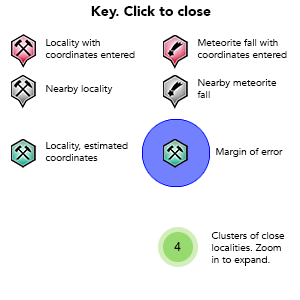
Key
Lock Map
| Latitude & Longitude (WGS84): | 31° 35' 57'' South , 119° 38' 35'' East |
|---|---|
| Latitude & Longitude (decimal): | -31.59920,119.64332 |
| GeoHash: | G#: qdmh4x997 |
| Locality type: | Area |
| Köppen climate type: | BSk : Cold semi-arid (steppe) climate |
This denotes a line of historic shafts and shallow alluvial workings directly south of the Southern Star Mine open pit, which is listed under the Marvel Loch heading. The area can be accessed from the road leading to Southern Star close to the mine. The workings extend for 500 metres west north-west to east south-east following a low ridge. It is about 8 to 10 kilometres north-east of Parker Range.
Toomey's Hill is a general name denoting several prospecting leases. The reef was discovered in September 1892 by Toomey (surname). From that time until at least World War Two it was largely the haunt of the lone prospector, with limited information available.
It is noted next in 1895, where Woods and party had taken out three leases totalling 30 acres known as the Glenmore. This was at the east end of the line, close to the salt lake. The reef dipped north, which the source states is a unique feature for reefs in the district. Lease 237 is mentioned at this time with two shafts at 22 and 55 feet deep. Glenmore Amalgamated is at the western end of the line of 30 acres, and a condenser is operating on a nearby salt lake for water.
Renewed prospector activity occurred on the field during the gold boom of the mid 1930's. In 1935, a listing of prospecting leases were: P.A. 3364 Richards & Holmwood; P.A. 3374 J. Broughton; P.A. 3775 D. Melrose; P.A. 3384 Hine & Giles; P.A. 3368 O. Hannaford; P.A. 3006 24 acres J. MCDonald, P.A. 3367 V. Hughes; P.A. 3403 24 acres Kew; P.A. 3347 A. Goodwin; P.A. 2917 24 acres Sewell; P.A. 3349 24 acres P. Zappa; P.A. 3408 F. Mant; P.A. 3348 24 acres S. McInnes; P.A. 3346 24 acres R.J. O'Neil; P.A. 3371 24 acres Winifred Sewell; P.A. 3409 24 acres J. Hughes; P.A. 3429 24 acres Turich; P.A. 3345 24 acres J.H. Canute; P.A. 3444 24 acres R. Canute; P.A. 2917 Harold Sewell, P.A. 3416 R.J. O'Neil. Four of the leases were under a 12 month option to the Goldfields Australian Development Company Limited.
One called the Lighthouse Mine reported a crushing in 1937, J. McDonald 1935, W. Sewell 1938.
J.B. Crewe GML 3871, L.R. Flower P.A. 5775, and J. McDonald P.A. 3006 crushed small tonnages in 1940.
Mineral List
1 valid mineral.
This page contains all mineral locality references listed on mindat.org. This does not claim to be a complete list. If you know of more minerals from this site, please register so you can add to our database. This locality information is for reference purposes only. You should never attempt to
visit any sites listed in mindat.org without first ensuring that you have the permission of the land and/or mineral rights holders
for access and that you are aware of all safety precautions necessary.
References
Sort by Year (asc) | by Year (desc) | by Author (A-Z) | by Author (Z-A)
Western Mail newspaper (Perth) (1895), New Find at Toomey's Hill, 27/09/1895
The Southern Cross Times newspaper (1940), Toomey's Hill, 27/07/1940
Western Mail newspaper (Perth) (1895), Yilgarn. Toomey's Hill, 01/11/1895
The Southern Cross Times newspaper (1940), Toomey's Hill, 03/02/1940
Western Mail newspaper (Perth) (1892), Notes of a Trip from Parker's Range to Dundas Hills, 15/10/1892
Western Argus newspaper (Kalgoorlie) (1935), Toomey's Hills. Near Palmer's Find, 08/01/1935


