North Star Gold Mine, Malcolm Goldfield, Leonora Shire, Western Australia, Australia


| Latitude & Longitude (WGS84): | 28° 56' 24'' South , 121° 30' 8'' East |
|---|---|
| Latitude & Longitude (decimal): | -28.94015,121.50232 |
| GeoHash: | G#: qdy7kge73 |
| Locality type: | Mine |
| Köppen climate type: | BWh : Hot deserts climate |
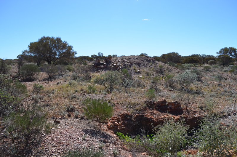
The North Star Gold Mine lies a little south-west of the former Malcolm town site, itself nothing these days than a bare area of flat ground. Bordering the former town site on the east now, is a modern railway siding. Little remains at the North Star site other than some minor remnant battery sands and a few shafts. The Richmond Gem Gold Mine is a few hundred metres south-east of the North Star, closer to the road heading south, with similar scenery.
The North Star is the site of the original gold discovery at Malcolm, said to have been before even Bayley's famous discovery at Coolgardie. Gold was found at Malcolm by Speakman and Ryan (surnames). They chipped some rich stone from the outcrop then left without pegging a lease. Birks and party pegged the first lease here in 1895, but did little with it. G.W. Hall came to own the lease around 1897, with a company called the North Star Gold Mining Company subsequently floated in London, 20 head mill and cyanide plant installed.
Active mining and crushings are found till 1900, when mining ceases, and by 1902 the cyanide plant was seized by the bailiff to cover debts.
In 1902, it was decided to use waste ore from the mine to line the roads of Malcolm. People took to digging up the streets when gold nuggets were found in the road base.
The mine had a poor safety record. Mathew Colby and Colin McInnes (or McGuiness) were killed at the mine in June 1900. Colby was being raised in the cage when the rope snapped, and the cage plummeted 400 feet to the bottom of the shaft. He was killed instantly, as was McInnes who was working at the bottom of the shaft, and was crushed by the cage. The coroner's inquest was abandoned when one of the jurors was found to be an employee at the mine. In 1910, John Nella was also killed, but the reason is not mentioned. Several miners suffered serious injuries from accidents at the mine over the years.
A Mr. Campbell applied for the abandoned lease in 1903, then left it in 1905. The town of Malcolm was heavily reliant on the North Star Mine for its survival. Local businessmen formed the Malcolm Prospecting Syndicate to re-open the mine. 3000 pounds was raised, although half of this was a government loan. The 470 foot shaft was un-watered and a 10 head battery installed.
The syndicate operated the mine until 1916, although not all in the town were happy with the investment. The mine failed to pay dividends, purchased goods from local businesses owned by the directors of the company, failed to repay the government loan, and lacked sufficient capital to develop the mine. The mine employees were two thirds Italians, favoured by many gold mines as harder workers for less pay, than their British counterparts, and this caused resentment in some quarters.
In 1946, the Maund brothers erect a 5 head battery on the foundations of the old 10 head mill from decades earlier, a cyanide plant of two cement vats, planning to treat the sands, and access any gold left behind in the old workings. The mine is said over its history to have achieved approximately 26 000 tonnes of ore for 15 000 ounces of gold at 11 dwt.
Commodity List
This is a list of exploitable or exploited mineral commodities recorded at this locality.Mineral List
1 valid mineral.
Regional Geology
This geological map and associated information on rock units at or nearby to the coordinates given for this locality is based on relatively small scale geological maps provided by various national Geological Surveys. This does not necessarily represent the complete geology at this locality but it gives a background for the region in which it is found.
Click on geological units on the map for more information. Click here to view full-screen map on Macrostrat.org
| Archean 2500 - 4000 Ma ID: 864533 | mafic intrusive rocks 74263 Age: Archean (2500 - 4000 Ma) Description: Mafic intrusive rocks, medium to coarse-grained; layered mafic to ultramafic intrusions - dolerite, gabbro, olivine gabbro, peridotite, pyroxenite, leucogabbro, quartz dolerite, quartz gabbro, gabbronorite Comments: igneous mafic intrusive; synthesis of multiple published descriptions Lithology: Igneous mafic intrusive Reference: Raymond, O.L., Liu, S., Gallagher, R., Zhang, W., Highet, L.M. Surface Geology of Australia 1:1 million scale dataset 2012 edition. Commonwealth of Australia (Geoscience Australia). [5] |
| Neoarchean - Mesoarchean 2500 - 3200 Ma ID: 3188638 | Archean volcanic and intrusive rocks Age: Archean (2500 - 3200 Ma) Comments: Yilgarn Craton Lithology: Greenstone belt; mafic-ultramafic volcanic rocks Reference: Chorlton, L.B. Generalized geology of the world: bedrock domains and major faults in GIS format: a small-scale world geology map with an extended geological attribute database. doi: 10.4095/223767. Geological Survey of Canada, Open File 5529. [154] |
Data and map coding provided by Macrostrat.org, used under Creative Commons Attribution 4.0 License
References


North Star Gold Mine, Malcolm Goldfield, Leonora Shire, Western Australia, Australia