Bürgl Alp (Bürgel Alp), Dienten am Hochkönig, Zell am See District, Salzburg, Austriai
| Regional Level Types | |
|---|---|
| Bürgl Alp (Bürgel Alp) | Mountain |
| Dienten am Hochkönig | Municipality |
| Zell am See District | District |
| Salzburg | State |
| Austria | Country |
This page is currently not sponsored. Click here to sponsor this page.


Latitude & Longitude (WGS84):
47° 22' 24'' North , 13° 1' 18'' East
Latitude & Longitude (decimal):
Locality type:
Köppen climate type:
Nearest Settlements:
| Place | Population | Distance |
|---|---|---|
| Dienten am Hochkönig | 761 (2018) | 1.8km |
| Hinterthal | 212 (2018) | 5.1km |
| Eschenau | 347 (2018) | 6.3km |
| March | 308 (2018) | 7.1km |
| Schlöglberg | 143 (2018) | 7.2km |
No description has been added for this locality. Can you add one?
Select Mineral List Type
Standard Detailed Gallery Strunz Chemical ElementsMineral List
Mineral list contains entries from the region specified including sub-localities2 valid minerals.
Detailed Mineral List:
| ⓘ Aragonite Formula: CaCO3 Reference: A. Strasser: Die Minerale Salzburgs, 1989 |
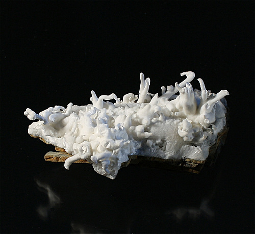
ⓘ Aragonite var. Flos Ferri Formula: CaCO3 Reference: A. Strasser: Die Minerale Salzburgs, 1989 |
| ⓘ Todorokite Formula: (Na,Ca,K,Ba,Sr)1-x(Mn,Mg,Al)6O12 · 3-4H2O Reference: A. Strasser: Die Minerale Salzburgs, 1989 |

Gallery:
List of minerals arranged by Strunz 10th Edition classification
| Group 4 - Oxides and Hydroxides | |||
|---|---|---|---|
| ⓘ | Todorokite | 4.DK.10 | (Na,Ca,K,Ba,Sr)1-x(Mn,Mg,Al)6O12 · 3-4H2O |
| Group 5 - Nitrates and Carbonates | |||
| ⓘ | Aragonite | 5.AB.15 | CaCO3 |
| ⓘ | var. Flos Ferri | 5.AB.15 | CaCO3 |
List of minerals for each chemical element
| H | Hydrogen | |
|---|---|---|
| H | ⓘ Todorokite | (Na,Ca,K,Ba,Sr)1-x(Mn,Mg,Al)6O12 · 3-4H2O |
| C | Carbon | |
| C | ⓘ Aragonite | CaCO3 |
| C | ⓘ Aragonite var. Flos Ferri | CaCO3 |
| O | Oxygen | |
| O | ⓘ Aragonite | CaCO3 |
| O | ⓘ Todorokite | (Na,Ca,K,Ba,Sr)1-x(Mn,Mg,Al)6O12 · 3-4H2O |
| O | ⓘ Aragonite var. Flos Ferri | CaCO3 |
| Na | Sodium | |
| Na | ⓘ Todorokite | (Na,Ca,K,Ba,Sr)1-x(Mn,Mg,Al)6O12 · 3-4H2O |
| Mg | Magnesium | |
| Mg | ⓘ Todorokite | (Na,Ca,K,Ba,Sr)1-x(Mn,Mg,Al)6O12 · 3-4H2O |
| Al | Aluminium | |
| Al | ⓘ Todorokite | (Na,Ca,K,Ba,Sr)1-x(Mn,Mg,Al)6O12 · 3-4H2O |
| K | Potassium | |
| K | ⓘ Todorokite | (Na,Ca,K,Ba,Sr)1-x(Mn,Mg,Al)6O12 · 3-4H2O |
| Ca | Calcium | |
| Ca | ⓘ Aragonite | CaCO3 |
| Ca | ⓘ Todorokite | (Na,Ca,K,Ba,Sr)1-x(Mn,Mg,Al)6O12 · 3-4H2O |
| Ca | ⓘ Aragonite var. Flos Ferri | CaCO3 |
| Mn | Manganese | |
| Mn | ⓘ Todorokite | (Na,Ca,K,Ba,Sr)1-x(Mn,Mg,Al)6O12 · 3-4H2O |
| Sr | Strontium | |
| Sr | ⓘ Todorokite | (Na,Ca,K,Ba,Sr)1-x(Mn,Mg,Al)6O12 · 3-4H2O |
| Ba | Barium | |
| Ba | ⓘ Todorokite | (Na,Ca,K,Ba,Sr)1-x(Mn,Mg,Al)6O12 · 3-4H2O |
Localities in this Region
- Salzburg
- Zell am See District
- Dienten am Hochkönig
- Bürgl Alp (Bürgel Alp)
- Dienten am Hochkönig
- Zell am See District
Other Regions, Features and Areas containing this locality
This page contains all mineral locality references listed on mindat.org. This does not claim to be a complete list. If you know of more minerals from this site, please register so you can add to our database. This locality information is for reference purposes only. You should never attempt to
visit any sites listed in mindat.org without first ensuring that you have the permission of the land and/or mineral rights holders
for access and that you are aware of all safety precautions necessary.


Forestry road cut, Bürgl Alp, Dienten am Hochkönig, Zell am See District, Salzburg, Austria