Log InRegister
Quick Links : The Mindat ManualThe Rock H. Currier Digital LibraryMindat Newsletter [Free Download]
Home PageAbout MindatThe Mindat ManualHistory of MindatCopyright StatusWho We AreContact UsAdvertise on Mindat
Donate to MindatCorporate SponsorshipSponsor a PageSponsored PagesMindat AdvertisersAdvertise on Mindat
Learning CenterWhat is a mineral?The most common minerals on earthInformation for EducatorsMindat ArticlesThe ElementsThe Rock H. Currier Digital LibraryGeologic Time
Minerals by PropertiesMinerals by ChemistryAdvanced Locality SearchRandom MineralRandom LocalitySearch by minIDLocalities Near MeSearch ArticlesSearch GlossaryMore Search Options
Search For:
Mineral Name:
Locality Name:
Keyword(s):
 
The Mindat ManualAdd a New PhotoRate PhotosLocality Edit ReportCoordinate Completion ReportAdd Glossary Item
Mining CompaniesStatisticsUsersMineral MuseumsClubs & OrganizationsMineral Shows & EventsThe Mindat DirectoryDevice SettingsThe Mineral Quiz
Photo SearchPhoto GalleriesSearch by ColorNew Photos TodayNew Photos YesterdayMembers' Photo GalleriesPast Photo of the Day GalleryPhotography

Bürger shaft, Zwickau, Zwickau District, Saxony, Germanyi
Regional Level Types
Bürger shaftMine
ZwickauTown
Zwickau DistrictDistrict
SaxonyState
GermanyCountry

This page is currently not sponsored. Click here to sponsor this page.
PhotosMapsSearch
04696640017085915336007.jpg
View of the Zwickau hard coal mining area, in 1911.

Bürger shaft, Zwickau, Zwickau District, Saxony, Germany
00700620017085915348692.jpg
View of the Zwickau hard coal mining area, in 1911.

Bürger shaft, Zwickau, Zwickau District, Saxony, Germany
06065320017085915345859.jpg
Zwickau underground hard coal mining scene, in 1910.

Bürger shaft, Zwickau, Zwickau District, Saxony, Germany
05736490017058373942146.jpg
View of the Zwickau hard coal mining area, in 1911.

Bürger shaft, Zwickau, Zwickau District, Saxony, Germany
03485010017058373964459.jpg
View of the Zwickau hard coal mining area, in 1911.

Bürger shaft, Zwickau, Zwickau District, Saxony, Germany
05764860017058373975040.jpg
Zwickau underground hard coal mining scene, in 1910.

Bürger shaft, Zwickau, Zwickau District, Saxony, Germany
04696640017085915336007.jpg
View of the Zwickau hard coal mining area, in 1911.

Bürger shaft, Zwickau, Zwickau District, Saxony, Germany
00700620017085915348692.jpg
View of the Zwickau hard coal mining area, in 1911.

Bürger shaft, Zwickau, Zwickau District, Saxony, Germany
Latitude & Longitude (WGS84):
50° 42' 25'' North , 12° 28' 55'' East
Latitude & Longitude (decimal):
Type:
Köppen climate type:
Nearest Settlements:
PlacePopulationDistance
Zwickau98,796 (2015)2.3km
Weißenborn2,747 (2017)3.7km
Wilkau-Haßlau11,850 (2015)4.2km
Lichtentanne7,163 (2017)4.3km
Reinsdorf8,907 (2017)5.3km
Mindat Locality ID:
298505
Long-form identifier:
mindat:1:2:298505:6
GUID (UUID V4):
ad824df1-fd47-4a8e-a170-4b492581fb23
Other Languages:
German:
Bürgerschacht, Zwickau, Landkreis Zwickau, Sachsen, Deutschland


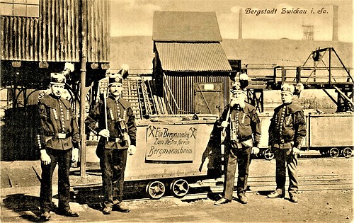
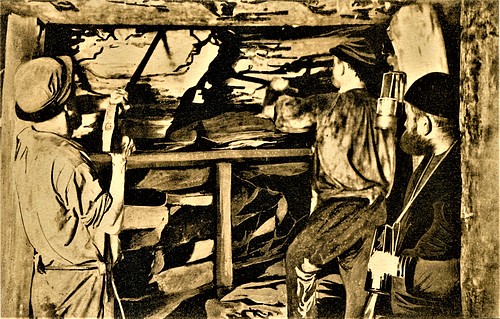
Abandonded coal mine.

Select Mineral List Type

Standard Detailed Gallery Strunz Chemical Elements

Commodity List

This is a list of exploitable or exploited mineral commodities recorded at this locality.


Mineral List


1 valid mineral.

Detailed Mineral List:

Copper
Formula: Cu

List of minerals arranged by Strunz 10th Edition classification

Group 1 - Elements
Copper1.AA.05Cu

List of minerals for each chemical element

CuCopper
Cu CopperCu

Other Regions, Features and Areas containing this locality

Eurasian PlateTectonic Plate
EuropeContinent

This page contains all mineral locality references listed on mindat.org. This does not claim to be a complete list. If you know of more minerals from this site, please register so you can add to our database. This locality information is for reference purposes only. You should never attempt to visit any sites listed in mindat.org without first ensuring that you have the permission of the land and/or mineral rights holders for access and that you are aware of all safety precautions necessary.
 
Mineral and/or Locality  
Mindat Discussions Facebook Logo Instagram Logo Discord Logo
Mindat.org is an outreach project of the Hudson Institute of Mineralogy, a 501(c)(3) not-for-profit organization.
Copyright © mindat.org and the Hudson Institute of Mineralogy 1993-2024, except where stated. Most political location boundaries are © OpenStreetMap contributors. Mindat.org relies on the contributions of thousands of members and supporters. Founded in 2000 by Jolyon Ralph.
Privacy Policy - Terms & Conditions - Contact Us / DMCA issues - Report a bug/vulnerability Current server date and time: April 19, 2024 13:44:53 Page updated: February 22, 2024 08:45:37
Go to top of page