Lüsens valley, Innsbruck-Land District, Tyrol, Austriai
| Regional Level Types | |
|---|---|
| Lüsens valley | Valley |
| Innsbruck-Land District | District |
| Tyrol | State |
| Austria | Country |
This page is currently not sponsored. Click here to sponsor this page.


Latitude & Longitude (WGS84):
47° North , 11° East (est.)
Estimate based on other nearby localities or region boundaries.
Margin of Error:
~3km
Type:
Köppen climate type:
Mindat Locality ID:
57735
Long-form identifier:
mindat:1:2:57735:6
GUID (UUID V4):
8e0379ee-d45b-41c2-9aac-9c900f814629
Other/historical names associated with this locality:
Lisens valley; Lüsens alp; Lisens alp
Other Languages:
German:
Lüsenser Tal, Bezirk Innsbruck-Land, Tirol, Österreich
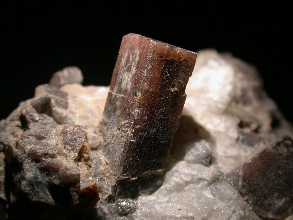
This area is well known for pseudomorphs of pinite after large andalusite crystals. Unaltered andalusite very rarely occurs here, though. According to the Book "Minerals" by George W. Robinson (Simon&Schuster, 1994, p. 156) "many of these (andalusite) specimens exhibit (X-ray) patterns indicative of kyanite".
Note: The valley, which is a side valley of the Sellrain valley, covers two municipalities.
Located 7.7 km S of Gries im Sellrain at approx. N47.12734 11.14429, elev. 1870 m.
Some discoveries also at N47.12097 E11.14546 and N 47.11459 E11.14627 around the track which leads to Grosses Horntal.
Select Mineral List Type
Standard Detailed Gallery Strunz Chemical ElementsMineral List
Mineral list contains entries from the region specified including sub-localities2 valid minerals.
Detailed Mineral List:
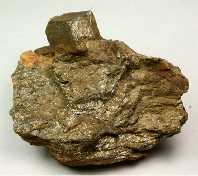
| ⓘ Andalusite Formula: Al2(SiO4)O Localities: |
| ⓘ 'Pinite' Localities: |
| ⓘ Quartz Formula: SiO2 |
| ⓘ Quartz var. Prase Formula: SiO2 |
Gallery:

List of minerals arranged by Strunz 10th Edition classification
| Group 4 - Oxides and Hydroxides | |||
|---|---|---|---|
| ⓘ | Quartz var. Prase | 4.DA.05 | SiO2 |
| ⓘ | 4.DA.05 | SiO2 | |
| Group 9 - Silicates | |||
| ⓘ | Andalusite | 9.AF.10 | Al2(SiO4)O |
| Unclassified | |||
| ⓘ | 'Pinite' | - | |
List of minerals for each chemical element
| O | Oxygen | |
|---|---|---|
| O | ⓘ Andalusite | Al2(SiO4)O |
| O | ⓘ Quartz | SiO2 |
| O | ⓘ Quartz var. Prase | SiO2 |
| Al | Aluminium | |
| Al | ⓘ Andalusite | Al2(SiO4)O |
| Si | Silicon | |
| Si | ⓘ Andalusite | Al2(SiO4)O |
| Si | ⓘ Quartz | SiO2 |
| Si | ⓘ Quartz var. Prase | SiO2 |
Other Databases
| Wikipedia: | https://de.wikipedia.org/wiki/L%C3%BCsenstal |
|---|---|
| Wikidata ID: | Q21869032 |
Localities in this Region
- Tyrol
- Innsbruck-Land District
- Gries im Sellrain
- Sellrain
- Innsbruck-Land District
Other Regions, Features and Areas that Intersect
This page contains all mineral locality references listed on mindat.org. This does not claim to be a complete list. If you know of more minerals from this site, please register so you can add to our database. This locality information is for reference purposes only. You should never attempt to
visit any sites listed in mindat.org without first ensuring that you have the permission of the land and/or mineral rights holders
for access and that you are aware of all safety precautions necessary.
References


Lüsens valley, Innsbruck-Land District, Tyrol, Austria