Wheal Zion, Calstock, Cornwall, England, UKi
| Regional Level Types | |
|---|---|
| Wheal Zion | Mine (Abandoned) |
| Calstock | Civil Parish |
| Cornwall | County |
| England | Constituent Country |
| UK | Country |
This page is currently not sponsored. Click here to sponsor this page.


Latitude & Longitude (WGS84):
50° 30' 19'' North , 4° 12' 46'' West
Latitude & Longitude (decimal):
UK National Grid Reference:
SX431696
Type:
Mine (Abandoned) - last checked 2024
Köppen climate type:
Nearest Settlements:
| Place | Population | Distance |
|---|---|---|
| Calstock | 790 (2017) | 1.1km |
| Gunnislake | 4,044 (2017) | 2.1km |
| Bere Alston | 2,164 (2018) | 3.0km |
| Buckland Monachorum | 779 (2018) | 5.9km |
| Tavistock | 12,280 (2018) | 6.9km |
Nearest Clubs:
Local clubs are the best way to get access to collecting localities
Local clubs are the best way to get access to collecting localities
| Club | Location | Distance |
|---|---|---|
| British Micromount Society, Devon and Cornwall Branch Meetings | Liskeard, Cornwall | 19km |
Mindat Locality ID:
892
Long-form identifier:
mindat:1:2:892:6
GUID (UUID V4):
b7f3759c-9bc0-4392-9e7a-ea7eca815590
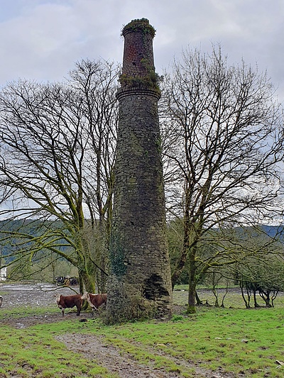
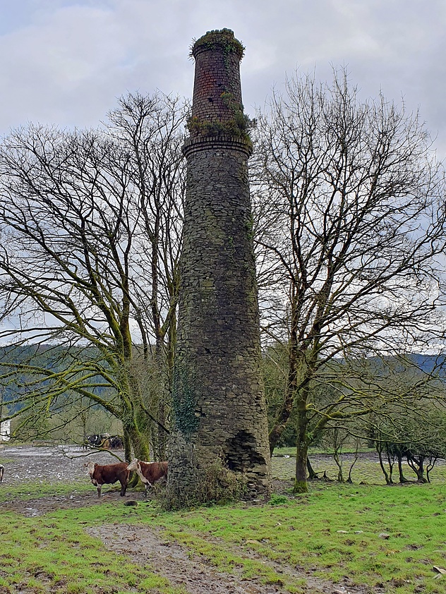
Wh Zion was abandoned in 1858 although some further work was carried out in the Wh Morshead adit in the 1880s.
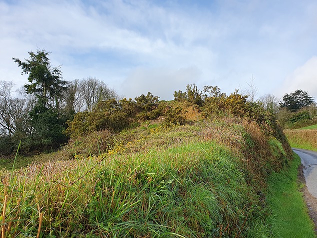
The site is marked in the present day (March, 2024) by 2 chimneys standing about 50m apart amongst trees, and a shaft collar with associated tip bedside the east-west side road.
The tip is a mix of crushed sand and slimes and ochre stained and cemented rock. There is little evidence of metal mineralisation but specks of pyrite in a quartz matrix were found.
Select Mineral List Type
Standard Detailed Gallery Strunz Chemical ElementsCommodity List
This is a list of exploitable or exploited mineral commodities recorded from this region.Mineral List
Mineral list contains entries from the region specified including sub-localities4 valid minerals.
Detailed Mineral List:
| ⓘ Anatase Formula: TiO2 |
| ⓘ Arsenopyrite Formula: FeAsS Description: Heated in a closed tube a faint silver mirror forms on the glass References: Virginia Maine collectionIdentified by Virginia Maine: Wet Chemical |
| ⓘ Chalcopyrite Formula: CuFeS2 |
| ⓘ Pyrite Formula: FeS2 |
Gallery:
List of minerals arranged by Strunz 10th Edition classification
| Group 2 - Sulphides and Sulfosalts | |||
|---|---|---|---|
| ⓘ | Chalcopyrite | 2.CB.10a | CuFeS2 |
| ⓘ | Pyrite | 2.EB.05a | FeS2 |
| ⓘ | Arsenopyrite | 2.EB.20 | FeAsS |
| Group 4 - Oxides and Hydroxides | |||
| ⓘ | Anatase | 4.DD.05 | TiO2 |
List of minerals for each chemical element
| O | Oxygen | |
|---|---|---|
| O | ⓘ Anatase | TiO2 |
| S | Sulfur | |
| S | ⓘ Arsenopyrite | FeAsS |
| S | ⓘ Chalcopyrite | CuFeS2 |
| S | ⓘ Pyrite | FeS2 |
| Ti | Titanium | |
| Ti | ⓘ Anatase | TiO2 |
| Fe | Iron | |
| Fe | ⓘ Arsenopyrite | FeAsS |
| Fe | ⓘ Chalcopyrite | CuFeS2 |
| Fe | ⓘ Pyrite | FeS2 |
| Cu | Copper | |
| Cu | ⓘ Chalcopyrite | CuFeS2 |
| As | Arsenic | |
| As | ⓘ Arsenopyrite | FeAsS |
Geochronology
| Geologic Time | Rocks, Minerals and Events | |||||||||||||||||||||
|---|---|---|---|---|---|---|---|---|---|---|---|---|---|---|---|---|---|---|---|---|---|---|
| Phanerozoic | ||||||||||||||||||||||
| Paleozoic | ||||||||||||||||||||||
| Permian | ||||||||||||||||||||||
| Guadalupian |
| |||||||||||||||||||||
| Cisuralian |
| |||||||||||||||||||||
Localities in this Region
- England
- Cornwall
- Calstock
- Wheal Zion
- Calstock
- Cornwall
Other Regions, Features and Areas containing this locality
British and Irish IslesGroup of Islands
Eurasian PlateTectonic Plate
EuropeContinent
UK
- England
- Callington and Tavistock Mining DistrictMining District
- Devon and Cornwall metalliferous mining districtMining District
This page contains all mineral locality references listed on mindat.org. This does not claim to be a complete list. If you know of more minerals from this site, please register so you can add to our database. This locality information is for reference purposes only. You should never attempt to
visit any sites listed in mindat.org without first ensuring that you have the permission of the land and/or mineral rights holders
for access and that you are aware of all safety precautions necessary.


Wheal Zion, Calstock, Cornwall, England, UK