| Locality type: | Mine |
| Classification |
|---|
|
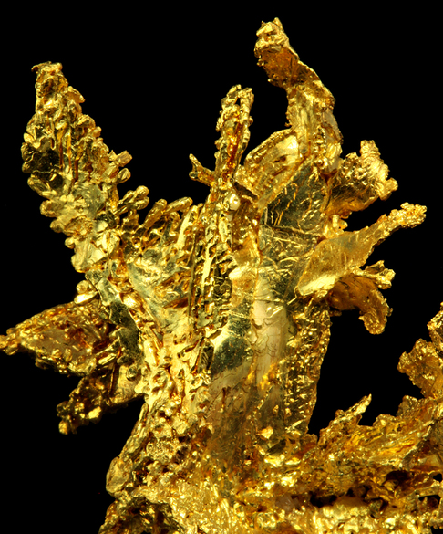
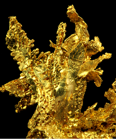
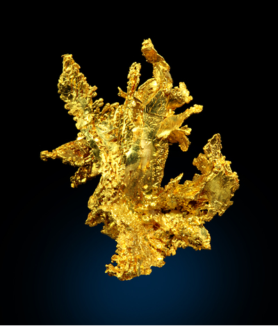
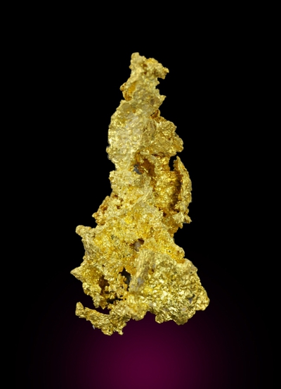
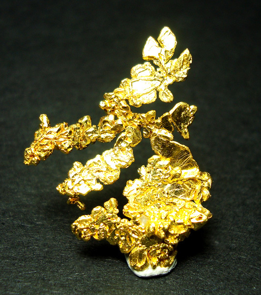
| Species: | Gold |
| Formula: | Au |
| Comments: | Extremely rich specimens of well crystallized gold in Quartz |
| Habit: | Small sharp octos to a cm, dendritic, wires and plates to many cm. |
| Colour: | gold |
| Luminescent properties: | none |
| Quality for species: | Excellent - world class for species or very significant. (!!) |
| Confirmation |
|---|
|
| Validity: | Believed Valid |
| Data |
|---|
|
| Mineral Data: | Click here to view Gold data |
| Locality Data: | Click here to view De Maria Mine (Garbe Mine), Sage Hill, Michigan Bluff Mining District (Michigan Bluff Mining deposit), Placer County, California, USA |
| Photo Gallery | View Gallery (6 photos) |
| Data Identifiers |
|---|
|
| Mindat Occurrence Record ID: | 68870 |
| Long-form Identifier: | 1:3:68870:1 |
| GUID (UUID V4): | 8f485be0-cecf-424c-91d6-4c985132a42f |
| Nearest other occurrences of Gold |
|---|
|
|
| 0.0km (0.0 miles) | ⓘEagle's Nest Mine (Mystery Wind Mine), Sage Hill, Michigan Bluff Mining District (Michigan Bluff Mining deposit), Placer County, California, USA |
| 0.6km (0.3 miles) | ⓘFerrier Diggings Mine (Johnny Rafael Mine), Foresthill, Forest Hill Mining District, Placer County, California, USA |
| 0.6km (0.4 miles) | ⓘUnnamed Au mine [38], Sage Hill, Michigan Bluff Mining District (Michigan Bluff Mining deposit), Placer County, California, USA |
| 0.8km (0.5 miles) | ⓘBunker and Nihill Mine (Bunker & Nihill; Bunker Hill [?]), Sage Hill, Michigan Bluff Mining District (Michigan Bluff Mining deposit), Placer County, California, USA |
| 1.1km (0.7 miles) | ⓘBlanche Placer Mine, Sage Hill, Michigan Bluff Mining District (Michigan Bluff Mining deposit), Placer County, California, USA |
| 1.1km (0.7 miles) | ⓘWashington Mine, Foresthill, Forest Hill Mining District, Placer County, California, USA |
| 1.3km (0.8 miles) | ⓘMarigold Placer Mine, Foresthill, Forest Hill Mining District, Placer County, California, USA |
| 1.3km (0.8 miles) | ⓘRed Ink Maid Mine, Sage Hill, Michigan Bluff Mining District (Michigan Bluff Mining deposit), Placer County, California, USA |
| 1.3km (0.8 miles) | ⓘDewey and Stocker Mine (Dewey & Stocker; Burt Mine), Foresthill, Forest Hill Mining District, Placer County, California, USA |
| 1.4km (0.9 miles) | ⓘBreece & Wheeler Placer Mine (Paragon Mine; Paragon prospect), Bath, Forest Hill Mining District, Placer County, California, USA |
| References |
|---|
|
|
| Reference Search (possible matching items) |
|---|
 | | Report (issue) | | IgtmmtSlTY OF CALIFORNIA DAVIS Digitized by the Internet Archive in 2012 with funding from University...University of California, Davis Libraries http://archive.org/details/reportofstatemin15cali CALIFORNIA STATE...STATE MINING BUREAU FERRY BUILDING, SAN FRANCISCO ^LETCHER HAMILTON State Mineralogist [December, 1917...PORTIONS OF CALIFORNIA Chapters of State Mineralogist's Report Biennial Period 1915-1916 CALIFORNIA STATE...OFFICE SACRAMENTO 19 19 LIBRARY UNIVERSITY Cr CALIFORNIA Da v I S CONTENTS. Page Administrative |
|


De Maria Mine, Sage Hill, Michigan Bluff Mining District, Placer County, California, USA