| Locality type: | Municipality |
| Classification |
|---|
|
| Species: | Cassiterite |
| Formula: | SnO2 |
| Confirmation |
|---|
|
| Validity: | Believed Valid |
| Data |
|---|
|
| Mineral Data: | Click here to view Cassiterite data |
| Locality Data: | Click here to view Vyšná Boca, Liptovský Mikuláš District, Žilina Region, Slovakia |
| Data Identifiers |
|---|
|
| Mindat Occurrence Record ID: | 397249 |
| Long-form Identifier: | 1:3:397249:6 |
| GUID (UUID V4): | 02ed48ff-008d-4d59-ac67-a0e5bf345ae2 |
| Nearest other occurrences of Cassiterite |
|---|
|
|
| 7.0km (4.4 miles) | ⓘBacúch magnetite deposit, Bacúch, Brezno District, Banská Bystrica Region, Slovakia |
| 8.5km (5.3 miles) | ⓘHlboká Valley, Braväcovo, Brezno District, Banská Bystrica Region, Slovakia |
| 22.3km (13.9 miles) | ⓘKyslá, Jasenie, Brezno District, Banská Bystrica Region, Slovakia |
| 33.3km (20.7 miles) | ⓘPodlipa deposit, Ľubietová, Banská Bystrica District, Banská Bystrica Region, Slovakia |
| 47.5km (29.5 miles) | ⓘMalá Vlčia Valley pegmatite vein, Dobšiná mining district, Dobšiná, Rožňava District, Košice Region, Slovakia |
| 48.3km (30.0 miles) | ⓘOchtiná-Rochovce Mo-W deposit, Ochtiná, Rožňava District, Košice Region, Slovakia |
| 55.3km (34.4 miles) | ⓘMedvedí potok, Hnilec, Spišská Nová Ves District, Košice Region, Slovakia |
| 58.0km (36.1 miles) | ⓘElisabeth Mine, Gemerská Poloma, Rožňava District, Košice Region, Slovakia |
| 60.1km (37.3 miles) | ⓘGreisen outcrop, Dlhá Valley, Gemerská Poloma, Rožňava District, Košice Region, Slovakia |
| 61.4km (38.2 miles) | ⓘSurovec granite body, Henclová, Gelnica District, Košice Region, Slovakia |
| References |
|---|
|
|
| Reference Search (possible matching items) |
|---|
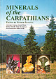 | | Book | | outside of Romania. Rudolf Duda (1944, Vojany, Slovakia) Head of the Department of Natural History, Eastern...Poland (Ewa Kos/.owska) Romania (Gheorghe Udubasa) Slovakia (Rudolf Duda) Ukraine (Orest Matkovs'ky) 31 31...(Ewa Kos/.owska). Romania (Gheorghe Udubasa), Slovakia (Rudolf Duda). Ukraine (Victor Kvasnytsya) 127...Czech Republic (Moravia) Hungary Poland Romania Slovakia Ukraine 397 397 399 409 412 419 425 References...through several countries, (i.e. the Czech Republic. Slovakia, Poland. Hungary, Ukraine, and Romania). From | 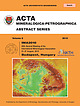 | | Journal (volume) | | of Szeged On the cover: Map of the Carpathian region with type localities of new mineral species, rocks...Mineralogical Society of Romania Geological Society of Slovakia, Mineralogical-Geochemical Branch Eötvös Loránd...(Romania) (Romania) (Austria) (Croatia) (Hungary) (Slovakia) (Greece) (Hungary) (USA) (Hungary) (Egypt) (Austria)...(Hungary) (Hungary) (Hungary) (Croatia) (Hungary) (Slovakia) (Serbia) (South Africa) (Austria) (France) (Hungary)...(Hungary) (Hungary) (Croatia) (UK) (Slovakia) (USA) (Austria) (Romania) (Slovakia) (China) (Germany) (Poland) |
|


