| Locality type: | Mine |
| Classification |
|---|
|
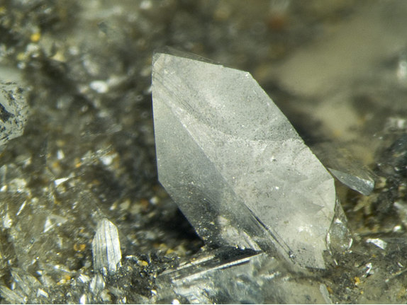
| Species: | Anglesite |
| Formula: | PbSO4 |
| Abundance at site: | Common |
| Confirmation |
|---|
|
| Validity: | Believed Valid |
| Associated Minerals Based on Photo Data: |
|---|
|
| Quartz | ⓘ4 photos of Anglesite associated with Quartz at this locality. |
| Linarite | ⓘ1 photo of Anglesite associated with Linarite at this locality. |
| Covellite | ⓘ1 photo of Anglesite associated with Covellite at this locality. |
| Cerussite | ⓘ1 photo of Anglesite associated with Cerussite at this locality. |
| Data |
|---|
|
| Mineral Data: | Click here to view Anglesite data |
| Locality Data: | Click here to view Loudville Lead Mines (Manhan Lead-Silver Mine; Southampton Lead Mine; Northampton Lead Mine), Easthampton, Hampshire County, Massachusetts, USA |
| Photo Gallery | View Gallery (6 photos) |
| Data Identifiers |
|---|
|
| Mindat Occurrence Record ID: | 29768 |
| Long-form Identifier: | 1:3:29768:8 |
| GUID (UUID V4): | e7d557be-bab3-4f6a-bbfc-93427b2801fb |
| Nearest other occurrences of Anglesite |
|---|
|
|
| 46.0km (28.6 miles) | ⓘDavis Pyrite Mine, Rowe, Franklin County, Massachusetts, USA |
| 48.5km (30.2 miles) | ⓘQuabbin Aqueduct shaft No. 10 locality, Hardwick, Worcester County, Massachusetts, USA |
| 51.7km (32.1 miles) | ⓘCanton Lead Mines (Cherry Brook lead mine; Dyer Farm zinc mine), Rattlesnake Hill, Canton, Hartford County, Connecticut, USA |
| 69.6km (43.3 miles) | ⓘState Route 9 - Ellis Street and State Route 72 interchanges (State Route 72 roadcut), New Britain, Hartford County, Connecticut, USA |
| 70.6km (43.9 miles) | ⓘThomaston Dam railroad cut, Thomaston Dam, Thomaston, Litchfield County, Connecticut, USA |
| 77.5km (48.1 miles) | ⓘStrickland Quarry, Strickland pegmatite, Collins Hill, Portland, Middlesex County, Connecticut, USA |
| 80.9km (50.3 miles) | ⓘMiddletown lead mines (Middletown Mine), Middletown, Middlesex County, Connecticut, USA |
| 93.8km (58.3 miles) | ⓘRoxbury Iron Mine (Shepaug Iron Company Mine; Shepaug Spathic Iron and Steel Company Mine), Mine Hill (Ore Hill), Roxbury, Litchfield County, Connecticut, USA |
| References |
|---|
|
|


Loudville Lead Mines, Easthampton, Hampshire County, Massachusetts, USA