| Locality type: | Mine |
| Classification |
|---|
|
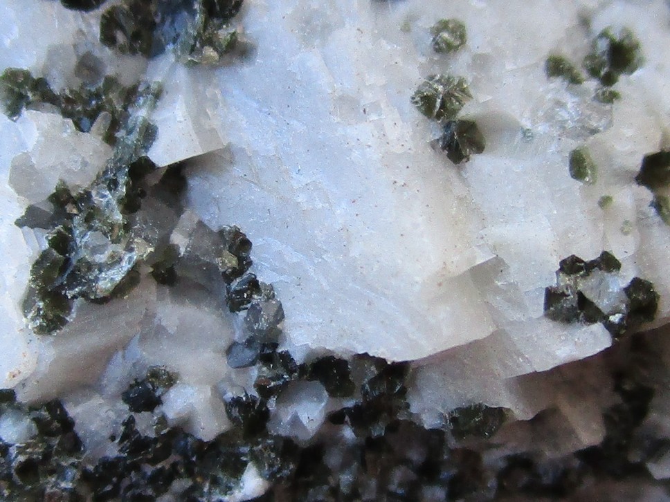
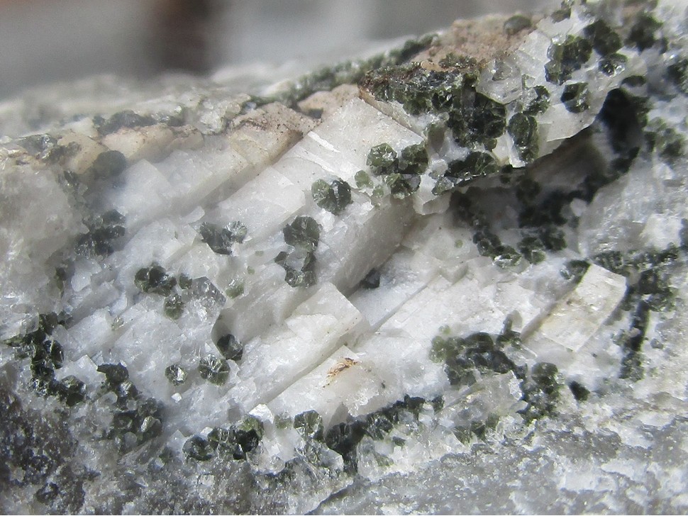
| Species: | Clinochlore |
| Formula: | Mg5Al(AlSi3O10)(OH)8 |
| Confirmation |
|---|
|
| Validity: | Confirmed |
| Confirmation Methods: | Visually Identified |
| Associated Minerals Based on Photo Data: |
|---|
|
| Calcite | ⓘ2 photos of Clinochlore associated with Calcite at this locality. |
| Data |
|---|
|
| Mineral Data: | Click here to view Clinochlore data |
| Locality Data: | Click here to view Evelinensglück mine, Czarnów, Gmina Kamienna Góra, Kamienna Góra County, Lower Silesian Voivodeship, Poland |
| Data Identifiers |
|---|
|
| Mindat Occurrence Record ID: | 1342350 |
| Long-form Identifier: | 1:3:1342350:2 |
| GUID (UUID V4): | 20639038-7924-456c-abfb-d3d686780beb |
| Nearest other occurrences of Clinochlore |
|---|
|
|
| 11.4km (7.1 miles) | ⓘKrucze Skały, Karpacz, Karkonosze County, Lower Silesian Voivodeship, Poland |
| 12.8km (8.0 miles) | ⓘMount Kopina, Niedamirów, Gmina Lubawka, Kamienna Góra County, Lower Silesian Voivodeship, Poland |
| 18.2km (11.3 miles) | ⓘBolków, Gmina Bolków, Jawor County, Lower Silesian Voivodeship, Poland |
| 27.0km (16.8 miles) | ⓘStara Kamienica skarn occurrence, Stara Kamienica, Gmina Stara Kamienica, Karkonosze County, Lower Silesian Voivodeship, Poland |
| 29.9km (18.5 miles) | ⓘPaszowice quarry, Gmina Paszowice, Jawor County, Lower Silesian Voivodeship, Poland |
| 30.0km (18.6 miles) | ⓘSzklarska Poręba Huta granite quarry, Szklarska Poręba, Karkonosze County, Lower Silesian Voivodeship, Poland |
| 31.0km (19.2 miles) | ⓘSkalna Brama pegmatite, Szklarska Poręba, Karkonosze County, Lower Silesian Voivodeship, Poland |
| 32.6km (20.3 miles) | ⓘPtasie Gniazda Rocks, Szklarska Poręba, Karkonosze County, Lower Silesian Voivodeship, Poland |
| 33.3km (20.7 miles) | ⓘGrabina, Strzegom, Gmina Strzegom, Świdnica County, Lower Silesian Voivodeship, Poland |
| 33.3km (20.7 miles) | ⓘAndrzej I quarry, Żółkiewka, Gmina Strzegom, Świdnica County, Lower Silesian Voivodeship, Poland |
| References |
|---|
|
|


Evelinensglück mine, Czarnów, Gmina Kamienna Góra, Kamienna Góra County, Lower Silesian Voivodeship, Poland