| Locality type: | Mine |
| Classification |
|---|
|
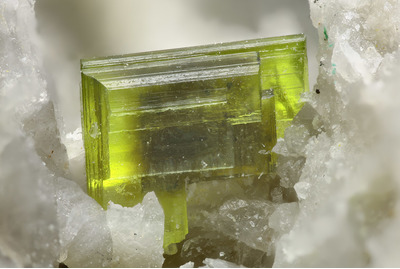
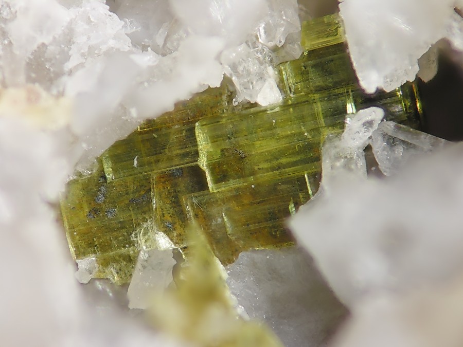
| Species: | Saléeite |
| Formula: | Mg(UO2)2(PO4)2 · 10H2O |
| Confirmation |
|---|
|
| Validity: | Believed Valid |
| Associated Minerals Based on Photo Data: |
|---|
|
| Phosphuranylite | ⓘ1 photo of Saléeite associated with Phosphuranylite at this locality. |
| Quartz | ⓘ1 photo of Saléeite associated with Quartz at this locality. |
| Data |
|---|
|
| Mineral Data: | Click here to view Saléeite data |
| Locality Data: | Click here to view Christa Mine, Großschloppen, Kirchenlamitz, Wunsiedel im Fichtelgebirge, Upper Franconia, Bavaria, Germany |
| Photo Gallery | View Gallery (15 photos) |
| Data Identifiers |
|---|
|
| Mindat Occurrence Record ID: | 90911 |
| Long-form Identifier: | 1:3:90911:8 |
| GUID (UUID V4): | 98c05f2d-ee56-4cea-9aa9-65bb0949b10e |
| Nearest other occurrences of Saléeite |
|---|
|
|
| 52.8km (32.8 miles) | ⓘKladská, Mariánské Lázně, Cheb District, Karlovy Vary Region, Czech Republic |
| 64.0km (39.7 miles) | ⓘSchaar Shaft, Johanngeorgenstadt, Erzgebirgskreis, Saxony, Germany |
| 70.4km (43.8 miles) | ⓘWeißer Hirsch Mine (shaft 3), Neustädtel, Schneeberg, Erzgebirgskreis, Saxony, Germany |
| 70.5km (43.8 miles) | ⓘWalpurgis Flacher vein, Weißer Hirsch Mine (shaft 3), Neustädtel, Schneeberg, Erzgebirgskreis, Saxony, Germany |
| 79.9km (49.7 miles) | ⓘLichtenberg Absetzer dump, Kauern, Greiz District, Thuringia, Germany |
| References |
|---|
|
|


Christa Mine, Großschloppen, Kirchenlamitz, Wunsiedel im Fichtelgebirge, Upper Franconia, Bavaria, Germany