 | | Journal (article/letter/editorial) |
| SomeCopperSulfideDeposits Near Mount Bohemia,KeweenawCounty, Michigan JAMESM. ROBERTSON Abstract Coppersulfides...interestingamounts,have recentlybeendiscoveredin the Keweenaw Peninsulaof northernMichigan, a district long...sulfidesoccurextensivelyin the vicinity of Mount Bohemia,chieflyas open-space fillingsand replacements...sulfurhavebeenaddedto dikes and flow topsin the Mount Bohemiaarea,probablyby hydrothermal solutionsmoving...pre-existingflows. The chronologic sequence developedin the Mount Bohemiaarea is: dike emplacement and alteration |
 | | Journal (article/letter/editorial) |
| Michigan Mineralogy: A LOCALITY INDEX TOM MORRIS, JR. 4553 Shenandoah Allen Park, Michigan 48101 Tom...occurrences. These localities have been listed by county; and, strictly for convenience, the list has been...compiling this information was The Mineralogy of Michigan (Heinrich, 1976), which should be consulted by...locality labeling of Michigan specimens. It should be pointed out that the list of Michigan mineral localities...None theless, with the aid of a good state or county map, plus local inquiries, the list could be helpful |
 | | Journal (issue) |
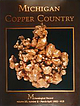
| large mass of native copper in the Quincy mine ca. 1918. (Michigan Technological University Archives, Houghton)...Donald Pearce (1941-1989) The “Copper King” The MICHIGAN COPPER COUNTRY L. W i l s o n New Mexico Bureau...t a n l e y J. D y l II Seaman Mineral Museum Michigan Technological University % 1992 T h e M in e...crystal group, 13.6 cm, from an unknown mine in the Michigan Copper Country. Richard A. Kosnar collection;...wrote the classic work on the copper deposits of Michigan in 1929. Photo by Wendell E. Wilson. TENT . |
 | | Report (volume) |
| Mathews, Johns Hopkins University, Baltimore. Michigan..........Mr. R. A. Smith, Lansing. Dr. A. C. Lane...See Bauxite and Hallpysite. Asbestos. Tallapoosa County, with corundum deposits near Dudleyville; not found...commercial quantity or quality. Asphalt. Colbert County, small quantity has been shipped from near Leighton;...following localities: Bibb County, Pratts Ferry; Calhoun County, near Tampa; Clay County, T. 20, Pv. 7 E.; Jefferson...Jefferson County, at Elyton; Lee County, at Chewacla lime works; St. Clair County, at Gfeensport; Shelby |
 | | Book |
| Mineralogy of Michigan by E. W. Heinrich updated and revised • by George W. Robinson M By E W~ Hellnr]ch...Museum Michigan Technological University Houghton, Michigan 49931 2004 © MINERALOGY OF MICHIGAN 3 FOREWORD...FOREWORD Michigan has a long and varied geologic history that includes repeated episodes of volcanism...before the first Europeans set foot here. When Michigan became a state in 1837, one of the first actions...and we continue to learn more about them today. Michigan minerals helped to build the state and nation |
 | | Report (volume) |
| :............................................. Michigan.................................................See Bauxite and Halloysite. Asbestos. Tallapoosa County, with corundum deposits near Dudleyville; not found...commercial quantity or quality. Asphalt. Colbert County, small quantity has been shipped from near Leighton;...following localities : Bibb County, Pratts Ferry; Calhoun County, near Tampa; Clay County, T. 20 S., R. 7 E.;...; Jefferson County, at Ely ton; Lee County, at Chewacla lime works"; St. Clair County, at Greensport; |
 | | Report (issue) |
| (CaBSiO4OH) vesicle filling from a basaltic Houghton County lava flow. Small specks of native copper occur...the surface and between the nodular masses. The Michigan Bicentennial symbol (back cover) incorporates...Survey Division BULLETIN 6 THE MINERALOGY OF MICHIGAN by E. Wm. Heinrich Professor of Mineralogy and...University of Michigan Ann Arhor, Michigan Lansing, Michigan 1976 STATE OF MICHIGAN WILLIAM G. Mrr...State of Michigan CL '48 s.321.6. Printed by Speaker-Hines and Thomas, Inc., Lansing, Michigan. Available |
 | | Book (edition) |
| mmed at Broken Arrow aud Trout creek, in Sc. Clair county. The strata in this field are more faulted und...prong of Canoe creek, in St. Clair county, to Ha\sop creek, in Bibb county, a distance of 60 miles. Down to...to Helena, in Shelby county, the field has an average width of 5 or 6 miles. Below that point the width...miles being in the latitud" of Blocton, in Bibb county. The south ern end of this field has a greater...Jefferson county; Helena, Montevallo, and Brierfield, Shelby county; and at Blocion. Bibb county. The Warrior |
 | | Report (issue) |
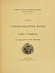
| Extent and General Nature of the Keweenaw Series Lithology of the Keweenaw Series Section I. Basic Original...III. Summary View of the Original Rocks of the Keweenaw Series Section IV. Detrital Rocks Chapter IV....Features of the Three Classes of Rocks of the Keweenaw Chapter Chapter II. 24 III. 34 '. 35 91... General Stratigraphy of the Keweenaw Series Chapter VI.— The Keweenaw an Rocks op the South Shore of...of Lake Superior Introductory 152 Section I.— Keweenaw Point Section II.— The Region between Portage |
 | | Book |
| variety, etc. T Tsumeb (vol. 8, no. 3) M y Michigan Copper Country (vol. 23, no. 2) Co. Company...five book-format issues (8/#3, Tsumeb; 23/#2, Michigan Copper Country; 23/#4, Yukon Phosphates; 24/#2...On a spectacular find of crocoite in the Adelaide mine, Dundas, Tasmania (by A. H. Chapman) 3:111-113 ADOLFSSON...Iaria from the Howard-Montgomery quarry, Howard County, Maryland (by J. S. White) 25:53-54 AFGHANISTAN...AJO Famous mineral localities: the New Cornelia mine, Ajo, Arizona (by W. J. Thomas & R. B. Gibbs) 14:283-298 |
 | | Journal (issue) |
| Prairie Creek j ust 10uth of Murfree• boro, Pike County, Arkansas. The near-oval shaped area is an enclosed...diatreme (volcanic pipe) near Murfreesboro, Pike County, Arkansas (The Crater of Diamonds State Park)....origin and derivation of mineral names. SO ROCKS AND MINE~ Natural Diamonds and Their Imperfections When...barite, magnesite, calcite, pyrite, pyrrhotite, chalcopyrite and pentlandite. Olivine appears to be first...Treasures of the Earth : The World of Rocks and Mine rals, published in 1975, has beco,ne a standard |
 | | Journal (issue) |
| Dayvault 214 Turquoise from Virginia's Kelly Bank Mine Richard S. Mitchell Howard R . Freeland 219 A...35 c jasper 50 c moss quartz 1 r citrine 2 r chalcopyrite August 8, 1968 30 h Ardspach rocks and Arnmonite...collecting rocks FUI July 15, 1978 4 sh Emperor gold mine and gold ore BRAZIL June 8 1974 40 c sandstone...sandstone cliffs January 13, 1969 40 c Emperor gold mine and gold ore FRANCE July 8, 1975 September 27, 1969...2.50 e arsenopyrite 3.50 e beryllium 6.50 e chalcopyrite October 5, 1973 4 k a crystal NAURU RHODESIA |
 | | Journal (article/letter/editorial) |
| was still a territory awaiting statehood, Wysses Grant was serving his second term as president, and Benjamin...This article deals with that portion of San Miguel County extending from north of Telluride beginning at...origins in the establishment of county lines when San Miguel County was created in 1883. Geologically...mining district of Ouray County and the Silverton caldera of San Juan County. It should be noted that...that before the creation of San Miguel County, the Telluride district was called the Upper San Miguel district |
 | | Report (issue) |
| Boulder County.............. . . . . . . . . . . . ......... . ....... . 103 Ores in Gilpin County ........................... . 103 Orcs in Clear Creek County ............................ . 103 Ores from the.... .. .. . .. . . . .. . . .. 114 ll4 Ores of the La Plata quadrangle ............. - .. - . Ores of the............................................ . 125 Mine waters ............................................ . . . . . . 144 144 Persistence of veins of Mendota type in depth........ . . . . . . . . . . . . |
 | | Journal (issue) |
| Famous mineral localities: the Home Sweet Home mine ..................................................333 by R. A. Kosnar Famous mineral localities: Mount A n tero ............................ 339 by M....quartz, 10 cm tall, from the Yucca Hill claim, Park County, Colorado. Richard A. Kosnar specimen; photo by...6 1 3 - 4 7 3 - 4 3 2 5 ) Fra n k & W e n d y M e la n s o n Fine Minerals from Worldwide Sources Cabinet...significant mineral localities in C o l o r a d o ,by county. In addition, there is a complete listing o f all |
 | | Journal (article/letter/editorial) |
| APRIL 30, 1935 DIFFERENTIATION IN LAVAS OF THE MICHIGAN KEWEENAWAN * B Y T . M . BBO DEBICK (Bead before...thousand square miles, and in one section on Keweenaw Point, Michigan, form a series with a minimum thickness...evidence for the correlation of individual flows from Keweenaw Point on the south limb of the syncline to Isle...deposits which occur in the series on Keweenaw Point, Michigan. The thousands of feet of diamond drilling...the occurrence of the flows. Lane, while on the Michigan Geological Survey, carried on these studies with |
 | | Report (volume) |
| Revista de la Union Geofisica Mexicana, auspiciada par el Instituto de Geofisica de la Universidad Nacional...Organa del Instituto de Geologia y Metalurgia de la Universidad Aut6noma Potosina. San Luis Potosf, S...dell'Universita di Roma (e del Centro di Studio per la Geologia dell'Italia Centrale) del Consiglio N azionale...Assoc. Geol. Socs. Trans. Transactions. New Orleans, La. Harvard Univ. Bot. Mus. Leaflets Cambridge, Mass...Ky. Kentucky Geol. Survey County Rept. - Kentucky Geological Survey County Report. University of Kentucky |
 | | Book (edition) |
| Survey, Tom Rosemeyer, Chief Engineer, Camp Bird Mine and Miss Margaret B. Allen, M.A. of Orange, New........................................ 8 9 Chalcopyrite...................................................................... Ouray and the Camp Bird Mine; Past, Present. Future The Windham Report of Mining...Ouray in 1880 . . The Mineralogy at the Camp Bird Mine................... Glossary' Including Notes On...Rosemeyer, Chief Engineer, all of the Camp Bird Mine, Ouray; Mrs. Mildred Magee, Kenneth Childers, Bruno |
 | | Book (volume) |
| Silver Nevada Peak, Nevada 3. 6. Drinkwater mine, Silver Peak. Vertical cross-section Forking of...Lake, Manitoba 11. Great Gulch mine. Silver Peak, Nevada 12. Great Gulch mine, Silver Peak, Nevada Surface...13. Mandy mine, Manitoba. Vertical cross-section 14-A. Mandy mine, Manitoba. 14-B. Mandy mine, Manitoba...Mandy mine. 9. 10. 17. Mandy Mandy 18. Pelican vein, Georgetown, Colorado. 19. Mendota vein, Georgetown...sulphides by replacement Mendota vein. Granite inclusions in blende Mendota vein. Gneiss inclusions in |
 | | Report (issue) |
| Copper Country Ellis W. Courter Contribution to Michigan Geology 92 01 Table of Contents Preface ............................................... 2 The Keweenaw Peninsula ......................................geology and history of the copper deposits of Michigan. Every effort has been made to present accurate...necessarily reflect the policies or practices of the Michigan Department of Natural Resources, Geological Survey...Nonetheless, he was very well known by hobbyists in Michigan and surrounding areas. The National Rockhound |
 | | Journal (issue) |
| Eastern Michigan E. Reed Wicander R. V. Dietrich COVER STORY : Fairfieldite from the Foote mine in Kin...Foote Mineral Company spodumene mine at Kings Mountain , Cleveland County, North Carolina consisted of six...28012 GENERAL DESCRIPTION The geology of the Foote Mine was described by Kesler ( 196 1). It is part of...time, interfering with mine operations and conflicting with established mine regulations. The result...case, has been at least temporary closure of the mine to collectors. That is the status of collecting |
 | | Report (issue) |
| INTERIOR GEOLOGICAL SURVEY MINERAL RESOURCES OF ELKO COUNTY, NEVADA By Roscoe M. Smith Prepared in cooperation...Cave Creek district ----Charleston district_--Coal Mine district~ Contact district Cornucopia district -...Illustrations . Plate 1. Mineral resources map of Elko County. Figure 1. Index-map of mining districts 2. Exploratory...petroleum, through 1973 9 Temperatures of some Elko County hot springs- -- 12 Distribution of mineral deposits...ELKO COUNTY, NEVADA By Roscoe M. Smith ABSTRACT Of the 66 named mining districts in Elko County, 56 have |
 | | Report (volume) |
| examples: Ontario Economic geology Beatty Township Garrison Township Gold, Konoeivmi Lake area Porcupine...Institution of Oceanography, Submarine Geology Report. La Jolla, Calif. Calif. Univ. Seismog. Sta. Bull. California...11 Los Angeles County Mus. Quart.; Science Ser. [Paleontology Pub.] Los Angeles County Museum Quarterly;... Rec. Miner. Bol. Mexico Institute Nacional para la Investigaci6n de los Recursos Minerales de Mexico...Boletln. Mexico City. Mich. Acad. Sci. Papers Michigan Academy of Science, Arts and Letters Papers. Ann |
 | | Report (issue) |
| Pre-Cambrian deposits _________________________ _ Mine descriptions __________________________ _ 39 39...disseminations_ Cotopaxi mine _____________________ _ Copper deposits in Jefferson County __ _ F. M.D. property...property _____________ _ Malachite mine ________________ _ Empire mine __________________ _ Hypothermal replacement...replacement veins _________ _ Isabel mine _______________________ _ 68 68 68 68 Lone Chimney, Mill...Nisley mine _______________________ _ Hosa Lodge mine __________________ _ Copper King nickel mine ___________ |


