| Locality type: | Occurrence |
| Classification |
|---|
|
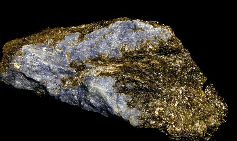
| Species: | Sodalite |
| Formula: | Na4(Si3Al3)O12Cl |
| Confirmation |
|---|
|
| Validity: | Believed Valid |
| Associated Minerals Based on Photo Data: |
|---|
|
| Biotite | ⓘ1 photo of Sodalite associated with Biotite at this locality. |
| Hackmanite | 1 photo of Sodalite associated with Hackmanite at this locality. |
| Sunstone | ⓘ1 photo of Sodalite associated with Sunstone at this locality. |
| Pyrophanite | ⓘ1 photo of Sodalite associated with Pyrophanite at this locality. |
| Data |
|---|
|
| Mineral Data: | Click here to view Sodalite data |
| Locality Data: | Click here to view Symmes Pond Syenite, Straw Hill occurrence, Newfield, York County, Maine, USA |
| Photo Gallery | View Gallery (3 photos) |
| Data Identifiers |
|---|
|
| Mindat Occurrence Record ID: | 558289 |
| Long-form Identifier: | 1:3:558289:1 |
| GUID (UUID V4): | e7130aec-df7b-4510-89ec-55fddcbb8812 |
| Nearest other occurrences of Sodalite |
|---|
|
|
| 48.9km (30.4 miles) | ⓘRed Hill, Moultonborough, Carroll County, New Hampshire, USA |
| 49.0km (30.5 miles) | ⓘHorne Quarry, Red Hill, Moultonborough, Carroll County, New Hampshire, USA |
| 97.2km (60.4 miles) | ⓘDennis Hill locality (Litchfield sodalite locality), Litchfield, Kennebec County, Maine, USA |
| 97.9km (60.8 miles) | ⓘDevil's Den (Devil's Den lime pit), Newbury, Essex County, Massachusetts, USA |
| 99.1km (61.6 miles) | ⓘSpears Corner Locality, West Gardiner, Kennebec County, Maine, USA |
| References |
|---|
|
|
| Reference Search (possible matching items) |
|---|
 | | Book (volume) | | Mineralogy by Vandall T. King and Eugene E. Foord Maine Geological Survey DEPARTMENT OF CONSERVATION Walter...Descriptive Mineralogy Vandall T. King Rochester, New York 14609 , Eugene E. Foord U S. Geological Survey...Resources Information, Maine Geological Survey Walter A. Anderson, State Geologist Maine Geological Survey...DEPARTMENT OF CONSERVATION 1994 Copyright ©1994 by the Maine Geological Survey, Department of Conservation. All...photograph: Fluorapatite, Pulsifer quarry, Auburn, Maine (2.2 cm specimen), Harvard Mineralogical Museum |
|


Symmes Pond Syenite, Straw Hill occurrence, Newfield, York County, Maine, USA