 | | Report (issue) | | MINERALS OF INDIANA by RICHARD C. ERD AND SEYMOUR S. GREENBERG Indiana Department of Conservation GEOLOGICAL...GEOLOGICAL SURVEY Bulletin No. 18 1960 STATE OF INDIANA HAROLD W. HANDLEY, GOVERNOR DEPARTMENT OF CONSERVATION...________________________________ MINERALS OF INDIANA BY RICHARD C. ERD AND SEYMOUR S. GREENBERG PRINTED...PRINTED BY AUTHORITY OF THE STATE OF INDIANA BLOOMINGTON, INDIANA September 1060 _____________________...______________ For sale by Geological Survey, Indiana Department of Conservation, Bloomington, Ind. Price |  | | Report (issue) | | of the Caseyville elastics are quartz pebbles, siderite, minable coals, conspicuous mica, and siltier...Pennsylvanian unit is the Caseyville Formation. In Indiana the Mansfield Sandstone at the base of the Pennsylvanian...at higher levels in the Pennsylvanian. In the Indiana, Kentucky, and southernmost Illinois parts of the...where the formations are unusually thick. Visible siderite also is nearly certain to indicate Pennsylvanian...abundant in the Pennsylvanian, rare in the Chester. Siderite was observed, disseminated between the larger |  | | Report (volume) | | overgrowth in Lower Pennsylvanian sandstone in Indiana. Quartz overgrowths occlude much of the pore space...Pennsylvanian Sandstones of the Illinois Basin, Illinois, Indiana, and Kentucky By Paula L. Hansley EVOLUTION OF...Pennyslvanian sandstones of the Illinois Basin, Illinois, Indiana, and Kentucky / by Paula L. Hansley. p. cm. (Evolution................................................ Siderite..................................................... 13 Photomicrographs of: 10. "Wheat seed" siderite.............................................. |  | | Report (chapter) | | Breathitt Group (Pennsylvanian), eastern Kentucky, USA J O H N F. A I T K E N 1 & S T E P H E N S. F L...deposits of the Breathitt Group, eastern Kentucky, USA, illustrating the variable nature of such surfaces...the Blackhawk Formation of the Book Cliffs, Utah, USA, are characterized by thin coals and carbonaceous...mottling. Thin sections indicate that the mottles are siderite spherules that are superimposed onto translocated...interfluvial sequence boundaries have been described from County Clare, Western Ireland, by Davies & Elliott (1996) |  | | Report (issue) | | covers much of Illinois and adjacent parts of Indiana and Kentucky. In this area Chester stratigraphy...Distribution of upper Chester sandstone samples (Indiana samples not shown) SEDIMENTARY PETROGRAPHY Some...collected in southeastern Illinois and in Perry County, Indiana. The other samples come from two continuous...total quartz except in the samples coming from the Indiana outcrop section, where these varieties constitute...14 .5 R. 3 E., Williamson County, 111. Depth R ,3 E. Williamson County, 111. Depth 1802' 31. Madison |  | | Report (issue) | | CatlinMansfield Area, Parke and Putnam Counties, Indiana BULLETIN 54 SCIENTIFIC AND TECHNICAL STAFF OF...entrance. Pictured here by Artist Robert E. Judah, Indiana Geological Survey, is a candid illustration of...Catlin-Mansfield Area Parke and Putnam Counties Indiana By HAROLD C. HUTCHISON DEPARTMENT OF NATURAL RESOURCES...AUTHORITY OF THE STATE OF INDIANA BLOOMINGTON , INDIANA : 1976 STATE OF INDIANA Otis R. Bowen, Governor...Geological Survey and the Bulletin series of the Indiana Geological Survey / 3 2 Schematic stratigraphic |  | | Book (edition) | | mmed at Broken Arrow aud Trout creek, in Sc. Clair county. The strata in this field are more faulted und...prong of Canoe creek, in St. Clair county, to Ha\sop creek, in Bibb county, a distance of 60 miles. Down to...to Helena, in Shelby county, the field has an average width of 5 or 6 miles. Below that point the width...miles being in the latitud" of Blocton, in Bibb county. The south ern end of this field has a greater...Jefferson county; Helena, Montevallo, and Brierfield, Shelby county; and at Blocion. Bibb county. The Warrior |  | | Report (issue) | | AND ROCKS IN INDIANA SEYMOUR S. GREENBERG WAYNE M. BUNDY DUNCAN J. McGREGOR Indiana Department of...SURVEY Circular No. 4 1958 ' . ' STATE OF INDIANA Harold W. Handley, Governor DEPARTMENT OF CONSERVATION...ular No. 4 GUIDE TO SOME MINERALS AND ROCKS IN INDIANA by Seymour S. Greenberg Wayne M. Bundy Dunc an...Printed by authority of the State of Indiana BLOOMINGTON, INDIANA Mar c h 1958 For sal e by Geo logi...Robert H. Shaver, Paleontologist and Head T. G. Perry, Research Associate Petroleum Section T. A. Dawson |  | | Journal (article/letter/editorial) | | Kansas a N.Okla Basin Missouri a Iowa Basin fer Indiana 1 *" " Kentucky Appallichian 3asin Ohio a Kentucky...sandstone at the base of the underclay Vermillion County, Indiana (outcrop 28), a contains about the same proportion...underclay materials. However, For example, in Crawford County, Kansas the assumption that the sandstones have...of an outcrop of the Ravenscroft Coal in White County, Tennessee (zone 2, outcrop 21). The edge of a...illustrated by Figure 13c is in a clay pit in Holmes County, Ohio (zone 8, outcrop 5). Samples a and b are |  | Gray, Henry H., Dawson, Thomas A., McGregor, Duncan, Jr., Perry, Thomas G., Wayne, William J (1957) Rocks Associated with the Mississippian-Pennsylvanian Unconformity in Southwestern Indiana. Guidebook 9. Indiana Geological Survey | Report (issue) | | MISSISSIPPIAN-PENNSYLVANIAN UNCONFORMITY IN SOUTHWESTERN INDIANA Indiana Department of Conservation GEOLOGICAL SURVEY...Field Conference Guidebook No. 9 1957 STATE OF INDIANA Harold W. Handley, Governor DEPARTMENT OF CONSERVATION...UNCONFORMITY IN SOUTHWESTERN INDIANA CONFERENCE SPONSORED BY Geological Survey, Indiana Department of Conservation...Conservation and Department of Geology, Indiana University, October 4, 5, and 6, 1957 CONFERENCE COMMITTEE...G. Perry; and William J. Wayne Printed by authority of the State of Indiana BLOOMINGTON, INDIANA October |  | | Book | | Fossil and Mineral Trails Lakes States Wisconsin, Indiana, Illinois, Michigan, by June Culp Zeitner $5...species of fossils have been collected in Illinois, Indiana, and Michigan. Dow Chemical has reported finding...and Huron virtually surrounding it. Illinois and Indiana are bordered in part by Lake Michigan, and Ohio...peninsula of Michigan. Southern Illinois, southern Indiana and southern Ohio have milder winters than the...through Itasca and St. Louis Counties into Lake County. Hibbing is about the center of this historic area |  | | Report (volume) | | Illinois...........Mr. F. W. DeWolf, Urbana. Indiana...........Mr. Edward Barrett, Indianapolis. Iowa...See Bauxite and Hallpysite. Asbestos. Tallapoosa County, with corundum deposits near Dudleyville; not found...commercial quantity or quality. Asphalt. Colbert County, small quantity has been shipped from near Leighton;...following localities: Bibb County, Pratts Ferry; Calhoun County, near Tampa; Clay County, T. 20, Pv. 7 E.; Jefferson...Jefferson County, at Elyton; Lee County, at Chewacla lime works; St. Clair County, at Gfeensport; Shelby |  | | Report (issue) | | Clay and Shale Resources of Indiana BULLETIN 42-L STATE OF INDIANA DEPARTMENT OF NATURAL RESOURCES ... Paleontologist Clay and Shale Resources of Indiana By GEORGE S. AUSTIN DEPARTMENT OF NATURAL RESOURCES...PRINTED BY AUTHORITY OF THE STATE OF INDIANA BLOOMINGTON, INDIANA : 1975 ST ATE OF INDIAN A Otis R....Introduction I History of the clay industry of Indiana 2 Clay minerals 7 Factors controlling the properties...bibliography 38 Illustrations Plate Map of Indiana showing bedrock geology, Kankakee and Cincinnati |  | | Journal (article/letter/editorial) | | array of other minerals, as evidenced by this county-by-county description of localities. A R K A N S A...Arkansas. index in volume 60, number 4; and the Indiana index in volume 61, number 3. March/April 1988...counties where minerals have been found. Baxter County Michigan Mine, 1 mile east of Buffalo River; fractured...W U L F E N I T E (Stroud et al., 1969). Benton County Rogers Limestone Quarry, near Rogers; calcite veins...Rhodes-Man chester and other mines; eastern edge of county around Zinc; mineralized Everton Dolomite and St |  | | Report (volume) | | ......................................... 122 Indiana...........................'......................See Bauxite and Halloysite. Asbestos. Tallapoosa County, with corundum deposits near Dudleyville; not found...commercial quantity or quality. Asphalt. Colbert County, small quantity has been shipped from near Leighton;...following localities : Bibb County, Pratts Ferry; Calhoun County, near Tampa; Clay County, T. 20 S., R. 7 E.;...; Jefferson County, at Ely ton; Lee County, at Chewacla lime works"; St. Clair County, at Greensport; |  | | Book (volume) | | Dahlonega Co. and Rabum Co., and the McDuffie County Belt extending through portions of McDuffie, Warren...Sphalerite. BALDWIN COUNTY MILLEDGEVILLE, at state farmjasper. BANKS COUNTY COMMERCE, along Hwy. 59...along adjoining Co. linerock crystal. BARROW COUNTY WINDER, along rd. to Jefferson and 1½ mi. inside...Guide for Rock Hounds in the United States BARTOW COUNTY AREA, Saltpeter Cave, as floatjasper. CARTERSVILLE:...agate, (banded, various colors), jasper. BIBB COUNTY MACON: at Holton Quarry, 7½ mi. NWagate; N |  | | Journal (article/letter/editorial) | | Development Co.; and Dr. John Patton and Tom Dawson, Indiana Geological Survey. Dr. Louis Briggs, University...Ostrom, Wisconsin Geological Survey, John Droste, Indiana University, and T. W. Smoot, of Harbison-Walker...consist of both detrital matrix and carbonate. Siderite serves as a minor cementing agent in many sandstones...lateral equivalents, parts of the Mansfield in Indiana and possibly the Parma in Michigan, are orthoquartzites...Illinois, Indiana, Pennsylvanian and Michigan West Kentucky, Illinois, and Upper Mississippian Indiana Early |  | | Book (edition) | | 28 29 30 31 ....16, 28 .... 18, 28 Shelocta Siderite Concretions..... New Paris Fluorite.............Road (PA) EH] Forest Road (PA) | 626 | Spur 563 County Route (NJ) PHI Interchange I___ jQ Town or Park...23 24 25 26 27 28 29 30 31 32 33 34 Shelocta Siderite Concretions New Paris Fluorite New Enterprise...covers all of Pennsylvania west of Bedford and Blair County, except for a band of lowland on the shores of...then hooks northwest through Wyoming County and down into Carbon County. The eastern edge of the province |  | | Report (issue) | | Compendium of Rock-Unit Stratigraphy in Indiana BULLETIN 43 ember tone ember Dean dsburg d Dolo mo...Formation all Coal Member ne: Mattoo Mi STATE OF INDIANA DEPARTMENT OF NATURAL RESOURCES GEOLOGICAL SURVEY...Clerk Compendium of Rock-Unit Stratigraphy in Indiana By ROBERT H. SHAVER, ANN M. BURGER, GARY R. GATES..., and CHARLES E. WIER And dedicated to EARLY INDIANA STRATIGRAPHERS DEPARTMENT OF NATURAL RESOURCES...AUTHORITY OF THE STATE OF INDIANA BLOOMINGTON, INDIANA: 1970 STATE OF INDIANA Edgar D. Whitcomb, Governor | 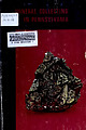 | | Report (edition) | | particular site, remember it is possible to visit the county courthouse in which the site is located, and trace...23 23 28 Adams County Native copper localities Teeter quarry zeolite Allegheny County Wittmer wurtzite...wurtzite Bedford County New locality 31 31 locality Paris fluorite locality Sherman Valley cryptomelane...locality Berks County Dyer quarry zeolite locality Frystown fetid barite locality Blair County Altoona barite...Butler County East Unity Church Sedwicks Mill 54 54 54 57 57 63 63 65 65 nodule locality siderite nodule |  | | Journal (article/letter/editorial) | | at mouth of Silver Creek near Edinburg, Portage County. Figure 1 (left). Rosanna Carlson sitting in dolostone...septarium, Copperas Mountain near Spargursville, Ross County. Ernest Carlson photo. Figure 3. Map showing mineral...amounts of calcite, quartz, illite, and pyrite; siderite is absent. The bodies of many smaller concretions...Devonian black shales (Huron Shale) irnnMune siderite. i Díte, quartz, calcite, bitumen barite. sphalerite...sediment of the matrix is composed chiefly of siderite, with lesser amounts of illite, calcite, quartz |  | | Report (issue) | | Paleozoic Rock-Unit Stratigraphy in Indiana-A Revision State of Indiana Department of Natural Resources... Compendium of Paleozoic Rock-Unit Stratigraphy in Indiana - A Revision By ROBERT H. SHAVER, CURTIS H. AULT...and CHARLES E. WIER And rededicated to EARLY INDIANA STRATIGRAPHERS DEPARTMENT OF NATURAL RESOURCES...AUTHORITY OF THE STATE OF INDIANA BLOOMINGTON, INDIANA: 1986 STATE OF INDIANA Robert D. Orr, Governor...Plate Page 1 2 3 4 170 197 Page 1 Map of Indiana showing locations of type sections, localities |  | | Journal (article/letter/editorial) | | left). Calcite, 5.5 cm high, Elmwood mine, Smith County. Terry Huizing specimen, Jeff Scovil photo. Figure...(above). Fluorite, 13.1 cm wide, Elmwood mine, Smith County. Francis Benjamin specimen, Jeff Scovil photo....Smith County. Terry Huizing specimen and photo. Figure 4 (right). Cumberland mine, Smith County. Travis...earths to make saltpeter, at Nicojack Cave in Marion County, then nitromagnesite at the same location (Shepard...Sevier County (Coskren and Lauf 2000). The following index is arranged alphabetically by county. It is |  | | Book (volume) | | 600 to 800 feet thick in the north. ALEXANDER COUNTY FAYVILLE, area stream gravels⎯agate, jasper, rare...⎯agate, jasper; d RR siding of Clay⎯agate. CALHOUN COUNTY AREA, shores of the Mississippi R., in the Warsaw...crystals). CRAWFORD COUNTY PALESTINE, area deposits⎯Siderite. EDWARDS COUNTY AREA, T. 1 S, R. 10 E...E, regional deposits⎯Siderite. FULTON COUNTY FARMINGTON, W 6 mi. on Rte. 116 to the Rapatee No. 5 strip...mine⎯pyritized gastropods (Pennsylvanian age). GRUNDY COUNTY AREA: c Regional rd. and RR cuts and banks of Mason |  | | Book (volume) | | 600 to 800 feet thick in the north. ALEXANDER COUNTY FAYVILLE, area stream gravels⎯agate, jasper, rare...⎯agate, jasper; d RR siding of Clay⎯agate. CALHOUN COUNTY AREA, shores of the Mississippi R., in the Warsaw...crystals). CRAWFORD COUNTY PALESTINE, area deposits⎯Siderite. EDWARDS COUNTY AREA, T. 1 S, R. 10 E...E, regional deposits⎯Siderite. FULTON COUNTY FARMINGTON, W 6 mi. on Rte. 116 to the Rapatee No. 5 strip...mine⎯pyritized gastropods (Pennsylvanian age). GRUNDY COUNTY AREA: c Regional rd. and RR cuts and banks of Mason |
|


