| Locality type: | Quarry |
| Classification |
|---|
|
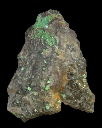
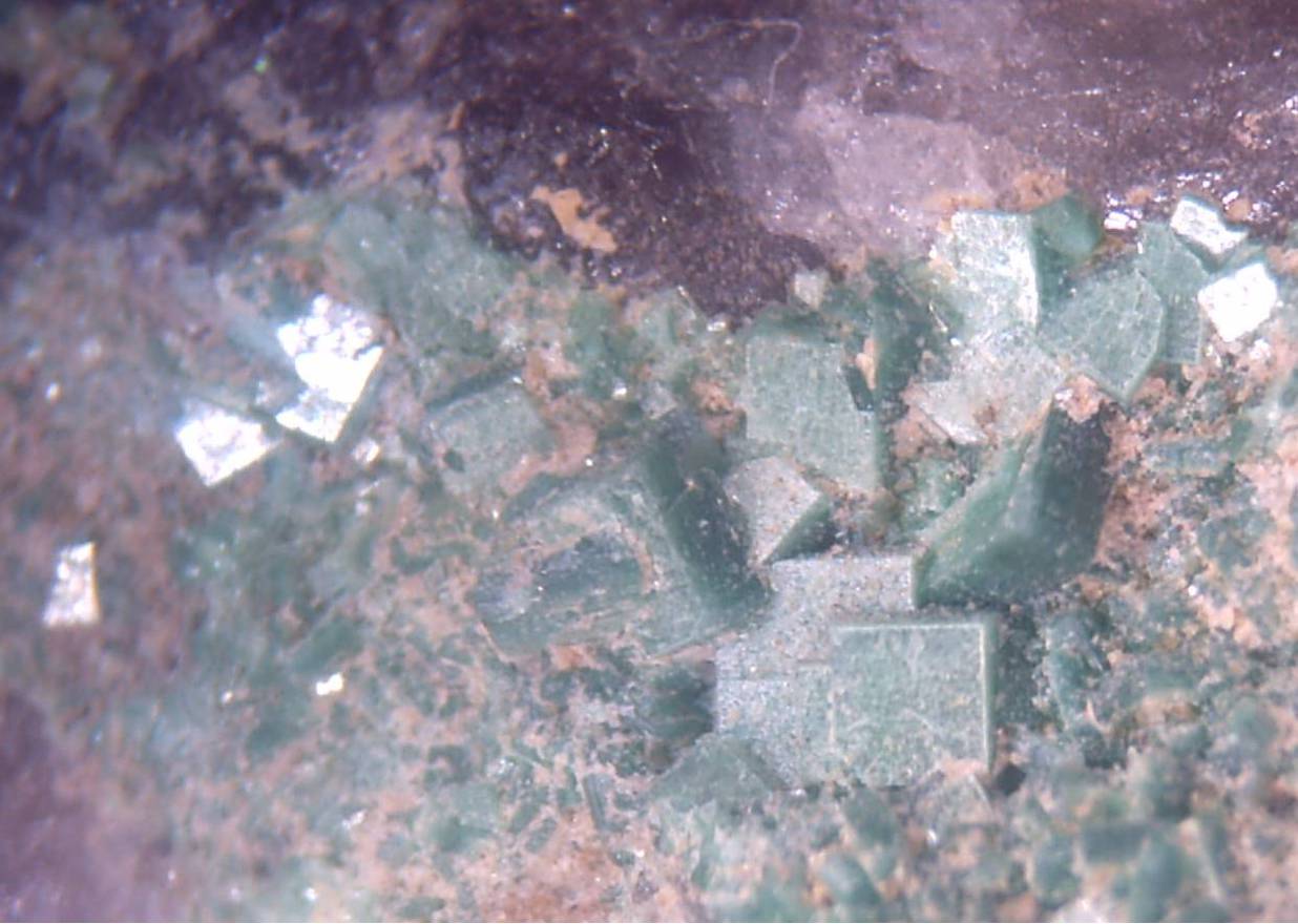
| Species: | Torbernite |
| Formula: | Cu(UO2)2(PO4)2 · 12H2O |
| Comments: | On smokey quartz. |
| Confirmation |
|---|
|
| Validity: | Believed Valid |
| Data |
|---|
|
| Mineral Data: | Click here to view Torbernite data |
| Locality Data: | Click here to view Chabanne quarry, Compreignac, Bellac, Haute-Vienne, Nouvelle-Aquitaine, France |
| Photo Gallery | View Gallery (3 photos) |
| Data Identifiers |
|---|
|
| Mindat Occurrence Record ID: | 112499 |
| Long-form Identifier: | 1:3:112499:6 |
| GUID (UUID V4): | f169aafe-47af-4720-8b8d-8984e76ea264 |
| Nearest other occurrences of Torbernite |
|---|
|
|
| 4.2km (2.6 miles) | ⓘLa Vielle Crouzille, Saint-Sylvestre, Limoges, Haute-Vienne, Nouvelle-Aquitaine, France |
| 4.4km (2.8 miles) | ⓘFanay Mine, Saint-Sylvestre, Limoges, Haute-Vienne, Nouvelle-Aquitaine, France |
| 6.8km (4.2 miles) | ⓘVilatte-Haute Quarry (Alluaud Quarry), Vilatte Quarries (La Vilate), Chanteloube, Razès, Bellac, Haute-Vienne, Nouvelle-Aquitaine, France |
| 7.8km (4.9 miles) | ⓘAvent quarry, Bessines-sur-Gartempe, Bellac, Haute-Vienne, Nouvelle-Aquitaine, France |
| 9.6km (5.9 miles) | ⓘMas-Barbu Quarry, Bessines-sur-Gartempe, Bellac, Haute-Vienne, Nouvelle-Aquitaine, France |
| 17.0km (10.5 miles) | ⓘVarnat, Saint-Amand-Magnazeix, Bellac, Haute-Vienne, Nouvelle-Aquitaine, France |
| 83.5km (51.9 miles) | ⓘLavaufranche quarry, Soumans, Aubusson, Creuse, Nouvelle-Aquitaine, France |
| 83.6km (52.0 miles) | ⓘLes Roches quarry, Montebras, Soumans, Aubusson, Creuse, Nouvelle-Aquitaine, France |
| 84.0km (52.2 miles) | ⓘMontebras Mines, Montebras, Soumans, Aubusson, Creuse, Nouvelle-Aquitaine, France |
| 85.1km (52.9 miles) | ⓘLe Boucheron, Davignac, Ussel, Corrèze, Nouvelle-Aquitaine, France |
| References |
|---|
|
|
| Reference Search (possible matching items) |
|---|
 | | Book (volume) | | l’Institut Muséum d’histoire naturelle DE LA FRANCE ET SES COLONIES DK description physique et chimique...strüvérite et la inonazite. MINÉHALÜGIE DE IA FRANCE 4 lima paru dès le premier abord vraisemblable...0;09 1120 10,90 : ana- MlNKliALOGIK DK (i FRANCE ],A (>nOUPE DE L’APATÏTE APATITE Anjou. (T...0,3930 : 1 : 0,4339] 8 MINÉKALOGIE DE LA FRANCE Ces nouvelles données permettent de simplifier...Central. mesurés. (T. IV, p. 543). — TTaute-Vienne. Des lamelles d’autunite ont été rencontrées |  | | Book (volume) | | Emberger and the following national chapters: France and Luxembourg by J. Bouladon Spain by F. Vazquez...Romania and Yugoslavia; and Southwest Europe embraces France, Spain, Portugal and Italy. Each volume has an...of large sedimentary basins Conclusions 30 31 France and Luxembourg by J. Bouladon Introduction 37...Basin (including Lorraine and Luxembourg) and Aquitaine Basin (zone E) Iron. Sulphur Gypsum and anhydrite...this introduction, comprises the territories of France, Luxembourg, Italy, Spain and Portugal. It covers |
|


Chabanne quarry, Compreignac, Bellac, Haute-Vienne, Nouvelle-Aquitaine, France