| Locality type: | Shaft |
| Classification |
|---|
|
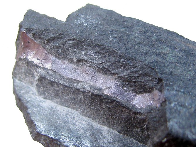
| Species: | Bornite |
| Formula: | Cu5FeS4 |
| Confirmation |
|---|
|
| Validity: | Believed Valid |
| Associated Minerals Based on Photo Data: |
|---|
|
| Chalcopyrite | ⓘ1 photo of Bornite associated with Chalcopyrite at this locality. |
| Data |
|---|
|
| Mineral Data: | Click here to view Bornite data |
| Locality Data: | Click here to view RZ shaft (Rudna mine), Polkowice, Gmina Polkowice, Polkowice County, Lower Silesian Voivodeship, Poland |
| Photo Gallery | View Gallery (3 photos) |
| Data Identifiers |
|---|
|
| Mindat Occurrence Record ID: | 119529 |
| Long-form Identifier: | 1:3:119529:3 |
| GUID (UUID V4): | 12acdb64-b023-4d90-a507-e4f5bc8892fd |
| Nearest other occurrences of Bornite |
|---|
|
|
| 3.1km (1.9 miles) | ⓘKaźmierzów borehole, Gmina Polkowice, Polkowice County, Lower Silesian Voivodeship, Poland |
| 3.5km (2.2 miles) | ⓘPG shafts - Polkowice Główne (Polkowice-Sieroszowice mine), Polkowice, Gmina Polkowice, Polkowice County, Lower Silesian Voivodeship, Poland |
| 3.7km (2.3 miles) | ⓘPZ shaft - Polkowice Zachodnie (Polkowice Sieroszowice mine), Polkowice, Gmina Polkowice, Polkowice County, Lower Silesian Voivodeship, Poland |
| 4.7km (2.9 miles) | ⓘSW-1'Jan Wyżykowski' shaft, Bądzów, Gmina Jerzmanowa, Głogów County, Lower Silesian Voivodeship, Poland |
| 8.7km (5.4 miles) | ⓘSieroszowice S-1 borehole, Sieroszowice, Gmina Radwanice, Polkowice County, Lower Silesian Voivodeship, Poland |
| 9.7km (6.0 miles) | ⓘŻelazny Most, Gmina Polkowice, Polkowice County, Lower Silesian Voivodeship, Poland |
| 11.1km (6.9 miles) | ⓘLubin Główny shafts (Lubin mine), Lubin, Lubin County, Lower Silesian Voivodeship, Poland |
| 13.7km (8.5 miles) | ⓘLW 'Bolesław' shaft (Lubin mine), Lubin, Lubin County, Lower Silesian Voivodeship, Poland |
| 17.3km (10.7 miles) | ⓘLubin S28 borehole, Lubin, Lubin County, Lower Silesian Voivodeship, Poland |
| 41.0km (25.5 miles) | ⓘKonrad Cu-mine, Iwiny, Gmina Warta Bolesławiecka, Bolesławiec County, Lower Silesian Voivodeship, Poland |
| References |
|---|
|
|


RZ shaft, Polkowice, Gmina Polkowice, Polkowice County, Lower Silesian Voivodeship, Poland