| Locality type: | Village |
| Classification |
|---|
|
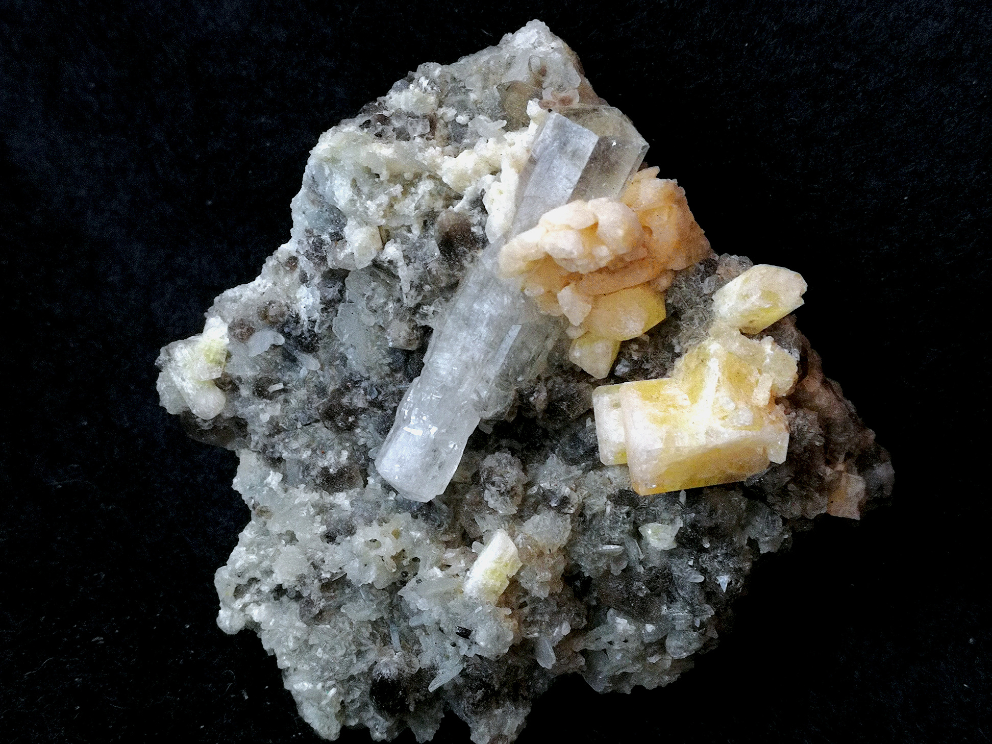
| Species: | Danburite |
| Formula: | CaB2Si2O8 |
| Confirmation |
|---|
|
| Validity: | Confirmed |
| Confirmation Methods: | Visually Identified |
| Associated Minerals Based on Photo Data: |
|---|
|
| Phenakite | ⓘ2 photos of Danburite associated with Phenakite at this locality. |
| Data |
|---|
|
| Mineral Data: | Click here to view Danburite data |
| Locality Data: | Click here to view Khetchel village (Cache village; Khat Che village), Molo quarter, Momeik Township, Kyaukme District, Shan State, Myanmar |
| Data Identifiers |
|---|
|
| Mindat Occurrence Record ID: | 929913 |
| Long-form Identifier: | 1:3:929913:9 |
| GUID (UUID V4): | e0b5f989-5d8c-4f26-aafa-29a1c7e6c006 |
| Nearest other occurrences of Danburite |
|---|
|
|
| 31.2km (19.4 miles) | ⓘShwe-twin-war Mine, Lelgyi, Momeik Township, Kyaukme District, Shan State, Myanmar |
| 45.3km (28.2 miles) | ⓘYesekan Mine, Pein-Pyit (Painpyit; Pyan Pyit), Mogok Township, Pyin-Oo-Lwin District, Mandalay Region, Myanmar |
| 47.5km (29.5 miles) | ⓘPyant Gyi mine (Pyan Gyi), Pein-Pyit (Painpyit; Pyan Pyit), Mogok Township, Pyin-Oo-Lwin District, Mandalay Region, Myanmar |
| 48.7km (30.3 miles) | ⓘHtan-yan-sho, Pein-Pyit (Painpyit; Pyan Pyit), Mogok Township, Pyin-Oo-Lwin District, Mandalay Region, Myanmar |
| 51.0km (31.7 miles) | ⓘDattaw-mid, Dattaw-taung (Dattaw hill), Mogok Valley, Mogok Township, Pyin-Oo-Lwin District, Mandalay Region, Myanmar |
| 51.0km (31.7 miles) | ⓘOhn-bin-ywe-htwet (Coconut Tree mine), Mogok Valley, Mogok Township, Pyin-Oo-Lwin District, Mandalay Region, Myanmar |
| 51.6km (32.1 miles) | ⓘLe-U-thet-kachan, Mogok Valley, Mogok Township, Pyin-Oo-Lwin District, Mandalay Region, Myanmar |
| 51.8km (32.2 miles) | ⓘLe-U-le-taw, Mogok Valley, Mogok Township, Pyin-Oo-Lwin District, Mandalay Region, Myanmar |
| 51.8km (32.2 miles) | ⓘDattaw-pyant & Dattaw-chaung, Dattaw-taung (Dattaw hill), Mogok Valley, Mogok Township, Pyin-Oo-Lwin District, Mandalay Region, Myanmar |
| 54.4km (33.8 miles) | ⓘOhngaing, Mogok Valley, Mogok Township, Pyin-Oo-Lwin District, Mandalay Region, Myanmar |
| References |
|---|
|
|


Khetchel village, Molo quarter, Momeik Township, Kyaukme District, Shan State, Myanmar