| Locality type: | Mine |
| Classification |
|---|
|
| Species: | Cerussite |
| Formula: | PbCO3 |
| Confirmation |
|---|
|
| Validity: | Believed Valid |
| Associated Minerals Based on Photo Data: |
|---|
|
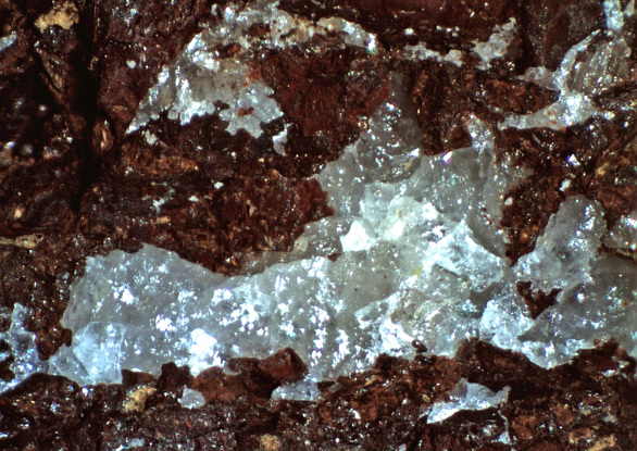
| Hematite | 1 photo of Cerussite associated with Hematite at this locality. |
| Data |
|---|
|
| Mineral Data: | Click here to view Cerussite data |
| Locality Data: | Click here to view Chief Mine (Chief claim), Prince Mine group, Hilton Mines, Copper Camp, Hilton (Lead Mountain), Empire Mining District, Empire Mountains, Pima County, Arizona, USA |
| Data Identifiers |
|---|
|
| Mindat Occurrence Record ID: | 177972 |
| Long-form Identifier: | 1:3:177972:1 |
| GUID (UUID V4): | d433124e-fb55-4a50-8f65-1ed8398589f2 |
| Nearest other occurrences of Cerussite |
|---|
|
|
| 0.0km (0.0 miles) | ⓘRed Cloud Mine, Hilton Mines, Copper Camp, Hilton (Lead Mountain), Empire Mining District, Empire Mountains, Pima County, Arizona, USA |
| 0.1km (0.0 miles) | ⓘForty-nine Mine (Forty Nine Mine; 49 Mine), Prince Mine group, Hilton Mines, Copper Camp, Hilton (Lead Mountain), Empire Mining District, Empire Mountains, Pima County, Arizona, USA |
| 0.3km (0.2 miles) | ⓘGopher Mine (Go Pher Mine), Prince Mine group, Hilton Mines, Copper Camp, Hilton (Lead Mountain), Empire Mining District, Empire Mountains, Pima County, Arizona, USA |
| 0.3km (0.2 miles) | ⓘLead Carbonate Mine, Empire Mining District, Empire Mountains, Pima County, Arizona, USA |
| 0.5km (0.3 miles) | ⓘPrince Mine group, Hilton Mines, Copper Camp, Hilton (Lead Mountain), Empire Mining District, Empire Mountains, Pima County, Arizona, USA |
| 1.8km (1.1 miles) | ⓘHilton Mines, Copper Camp, Hilton (Lead Mountain), Empire Mining District, Empire Mountains, Pima County, Arizona, USA |
| 5.3km (3.3 miles) | ⓘTotal Wreck Mine, Cienega Creek, The Narrows, Empire Mining District, Empire Mountains, Pima County, Arizona, USA |
| 12.3km (7.7 miles) | ⓘOmega Mine, Monument Mountain, Helvetia, Helvetia-Rosemont Mining District, Pima County, Arizona, USA |
| 13.8km (8.6 miles) | ⓘDeering Spring, Pima County, Arizona, USA |
| 13.8km (8.6 miles) | ⓘGolden Gate Mine group, Rosemont (Rosemont Camp), Helvetia-Rosemont Mining District, Pima County, Arizona, USA |
| References |
|---|
|
|


Chief Mine, Prince Mine group, Hilton Mines, Copper Camp, Hilton, Empire Mining District, Empire Mountains, Pima County, Arizona, USA