 | | Report (issue) |
| serpentine 4 Lava, limestone, dolomite, niarbli Sandstone Quurtzite, slate Uses 7 Building stone ~...Delaware County.. 9 .-.. Triassic sandstone in Court House. Lancaster 0. Sandstone in Court House, rniontown...County 10. Mahoning sandstone near Apollo. Armstrong County 17. Hoinewood sandstone quarry, Koppel, Beaver...quarries near Tyrone. Blair County 20. Medina sandstone quarry, near Altoona. Blair County •»7 Court House...(piarry. Quakertown. Bucks County J/> 33 Butler sandstone in Hobaugh (piarry. Butler J-> 24. St. Johns |
 | | Book |
| ONE GENERAL STRATIGRAPHY THE PRE-CAMBRIAN rr THE LOWER PALAEOZOIC(?): INFRA-CAMBRIAN The Stromatolite Sea...(Dwyka Formations). 2. Lower Permian: Ecca Formations. 3. Upper Permian-Lower Trias: Beaufort Formations... 2 . Marine Cretaceous. 40 THE PALAEOGENE 1. Lower and Middle Eocene. 53 2. 47 Upper Eocene-Oligocene...associated metamorphic rocks is of Pre-Cambrian age. It outcrops mainly in Mauritania, the Haggar, Sudan, West...into four cycles, should provisionally be adopted. Lower Pre-Cambrian (Pr I) (3,000 m.y. +): this includes |
 | | Book |
| GENERAL THE ONE STRATIGRAPHY PRE-CAMBRIAN THE LOWER PALAEOZOIC The Stromatolite Sea. (?): INFRA-CAMBRIAN...(Dwyka Formations). 2. Lower Permian: Ecca Formations. 3. Upper Permian-Lower Trias: Beaufort Formations...Continental Infra-Cretaceous. THE PALAEOGENE 1. Lower and Middle Eocene. 2. Marine Cretaceous. 2. Upper...Pre-Cambrian. 2. Pre-Karroo Palaeozoic (Cambrian— Lower Carboniferous). 3. The Karroo. 4. “Continental Intercalaire”...associated metamorphic rocks is of Pre-Cambrian age. It outcrops mainly in Mauritania, the Hoggar, Sudan, West |
 | | Journal (volume) |
| Third Floor, Ferry Building, San Francisco 11 District Offices State Building, 217 West First Street...are also sold at the Los Angeles and Sacramento district offices. ; ; ; In addition to oral conferences...maximum depth of 5 8 fathoms, probably formed by the lower sea level of the last glacial epoch (Wisconsin)...as rich in phosphate as the commercially worked land deposits. The high fluorine content shows that the...considerably Table Composition of phosphorite. 1. Land Sea Floor California Agulhas 1 (6)* Bank 2 |
 | | Report (issue) |
| section 171 Well sections in the Akron-Barberton district Barberton Well No. 11 _ _ CHAPTER 172 ___ __...Counties Concluded. Outcrops on Chardon-Concord and State roads Sections on Big Creek Outcrops near Painesville...Painesville PAGE 241 245 254 255 257 : Chardon outcrops Griswold Hollow Hambden Township 262 Bates Creek...showing top of the massive stratum, top of Euclid sandstone and super- I. Plate II. Plate III. bluish shale...Plate V. 42 48 black shale and concretionary sandstone of Bedford formation ( ?) on Skinner's Run Disconformity |
 | | Book |
| South America References Chapter 1 Lay of the Land-Climates and Physical Geography Some General Aspects...1988a. Studies in neotropical paleobotany. V The lower Tvfiocene com111unities of Panama- the Culebra Fonnation...1989. Studies in neotropical paleobotany. VII. The lower i\fiocene con1n1tu1ities of Pana1na-the La Boca...Latin Arncrica presented in Chapter 2 focL1ses on land-sea relat.ionships, mounra.in uplift, the n1ovement...• Geology • Vegetation Chapter 1 LAY OF THE LAND Climates and Physical Geography "•••for a transitory |


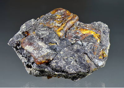
Sandstone outcrops, Gablitz, Sankt Pölten-Land District, Lower Austria, Austria