| Locality type: | Mine |
| Classification |
|---|
|
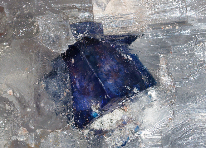
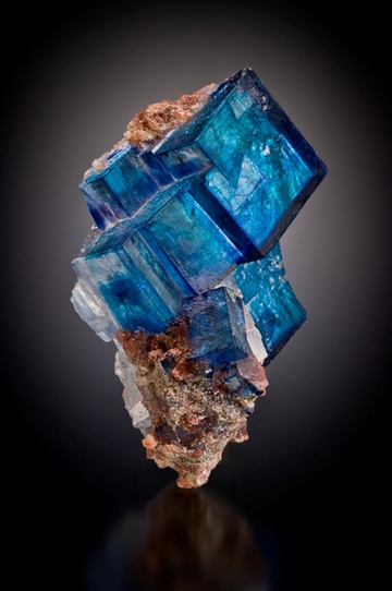
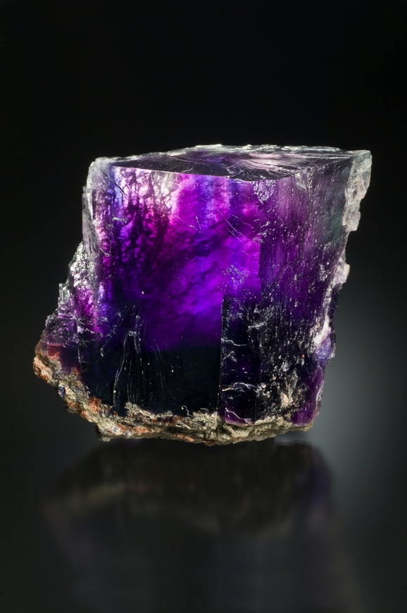
| Species: | Halite |
| Formula: | NaCl |
| Comments: | Colorless to deep blue and (rarely) violet. |
| Confirmation |
|---|
|
| Validity: | Confirmed |
| Confirmation Methods: | Visually Identified |
| Associated Minerals Based on Photo Data: |
|---|
|
| Sylvite | ⓘ30 photos of Halite associated with Sylvite at this locality. |
| Leonite | ⓘ1 photo of Halite associated with Leonite at this locality. |
| Data |
|---|
|
| Mineral Data: | Click here to view Halite data |
| Locality Data: | Click here to view Kerr McGee Mine (Kermac Mine; Kerr McGee Mine; Vertac Mine; Fermetia Mine; New Mexico Potash Mine; Mississippi Potash East Mine; Intrepid Potash East Mine; Hobbs Potash facility), Carlsbad Potash Mining District, Eddy County, New Mexico, USA |
| Photo Gallery | View Gallery (34 photos) |
| Data Identifiers |
|---|
|
| Mindat Occurrence Record ID: | 707733 |
| Long-form Identifier: | 1:3:707733:3 |
| GUID (UUID V4): | f63f8194-c03a-4080-b126-e4a2be853f5d |
| Nearest other occurrences of Halite |
|---|
|
|
| 10.4km (6.5 miles) | ⓘU. S. Potash Co. Mine (U.S. Potash Mine; U.S. Borax & Chemical Co. Mine; U.S. Potash and Chemical Mine; Continental American Mine; Teledyne Mine; Mississippi Potash West Mine; Intrepid Potash West Mine), Carlsbad Potash Mining District, Eddy County, New Mexico, USA |
| 17.8km (11.0 miles) | ⓘMosaic mine (Union Potash & Chemical Co. mine; International Agriculture mine; International Minerals & Chemical Corp. mine; Mosaic Potash mine), Carlsbad Potash Mining District, Eddy County, New Mexico, USA |
| 19.1km (11.9 miles) | ⓘNash Draw mine (Duval Sulphur & Potash Co. - Nash Draw mine; Potash Producers - Nash Draw; Western Ag - Nash Draw; IMC Potash - Nash Draw; Mosaic Potash - Nash Draw), Carlsbad Potash Mining District, Eddy County, New Mexico, USA |
| 21.0km (13.1 miles) | ⓘPCA Mine (Potash Company of America mine; Lundberg Industries mine; Eddy Potash mine; HB Potash mine; Intrepid Potash - HB Project), Carlsbad Potash Mining District, Eddy County, New Mexico, USA |
| 22.8km (14.2 miles) | ⓘLea Mine, Lea County, New Mexico, USA |
| 23.9km (14.8 miles) | ⓘPermian Potash Lease, Carlsbad Potash Mining District, Eddy County, New Mexico, USA |
| 25.5km (15.8 miles) | ⓘAmax mine (Southwest Potash mine; Horizon Potash mine), Carlsbad Potash Mining District, Eddy County, New Mexico, USA |
| 26.2km (16.3 miles) | ⓘGovernment test well #22, Carlsbad Potash Mining District, Eddy County, New Mexico, USA |
| 26.8km (16.7 miles) | ⓘHodges Potash Property, Carlsbad Potash Mining District, Eddy County, New Mexico, USA |
| 93.0km (57.8 miles) | ⓘWhite well no. 3-1, Chaves County, New Mexico, USA |
| References |
|---|
|
|


Kerr McGee Mine, Carlsbad Potash Mining District, Eddy County, New Mexico, USA