| Locality type: | Vein |
| Classification |
|---|
|
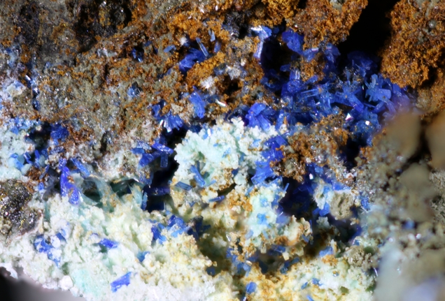
| Species: | Linarite |
| Formula: | PbCu(SO4)(OH)2 |
| Confirmation |
|---|
|
| Validity: | Confirmed |
| Confirmation Methods: | SEM-EDS |
| Associated Minerals Based on Photo Data: |
|---|
|
| Serpierite | ⓘ2 photos of Linarite associated with Serpierite at this locality. |
| Schulenbergite | ⓘ2 photos of Linarite associated with Schulenbergite at this locality. |
| Brochantite | ⓘ2 photos of Linarite associated with Brochantite at this locality. |
| Data |
|---|
|
| Mineral Data: | Click here to view Linarite data |
| Locality Data: | Click here to view Les Turcs vein, Orpierre mines, Orpierre, Gap, Hautes-Alpes, Provence-Alpes-Côte d'Azur, France |
| Photo Gallery | View Gallery (3 photos) |
| Data Identifiers |
|---|
|
| Mindat Occurrence Record ID: | 984093 |
| Long-form Identifier: | 1:3:984093:5 |
| GUID (UUID V4): | a24781d0-5211-41eb-acbd-5ed51a271285 |
| Nearest other occurrences of Linarite |
|---|
|
|
| 62.1km (38.6 miles) | ⓘLe Roux mine, Saint-Maurice-en-Valgodemard, Gap, Hautes-Alpes, Provence-Alpes-Côte d'Azur, France |
| 65.0km (40.4 miles) | ⓘLe Pendillon mine, La Chapelle-en-Valgaudemar, Gap, Hautes-Alpes, Provence-Alpes-Côte d'Azur, France |
| 83.3km (51.8 miles) | ⓘPierre Plate mine, Vizille, Grenoble, Isère, Auvergne-Rhône-Alpes, France |
| References |
|---|
|
|


Les Turcs vein, Orpierre mines, Orpierre, Gap, Hautes-Alpes, Provence-Alpes-Côte d'Azur, France